
Public Nowcast Field Watch
Public-safe nowcast watch locations for the latest forecast run. Contact roster fields are omitted; this remains a model-evidence preparedness watchlist, not an official public warning bulletin.


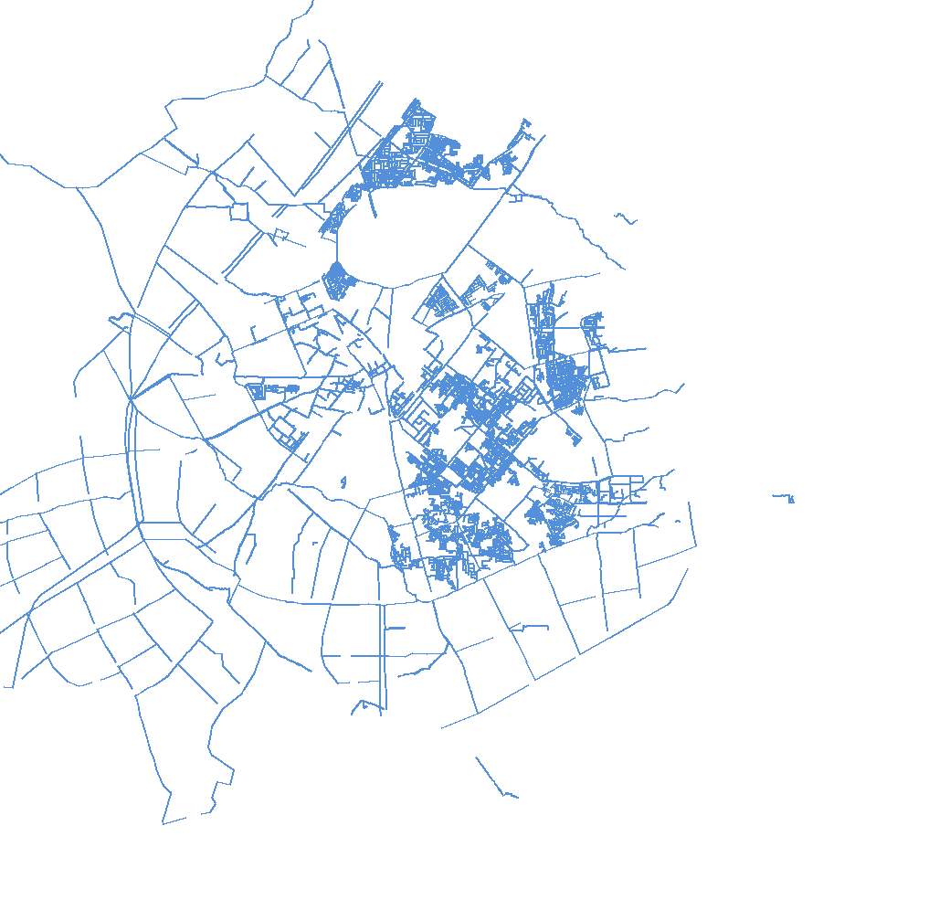
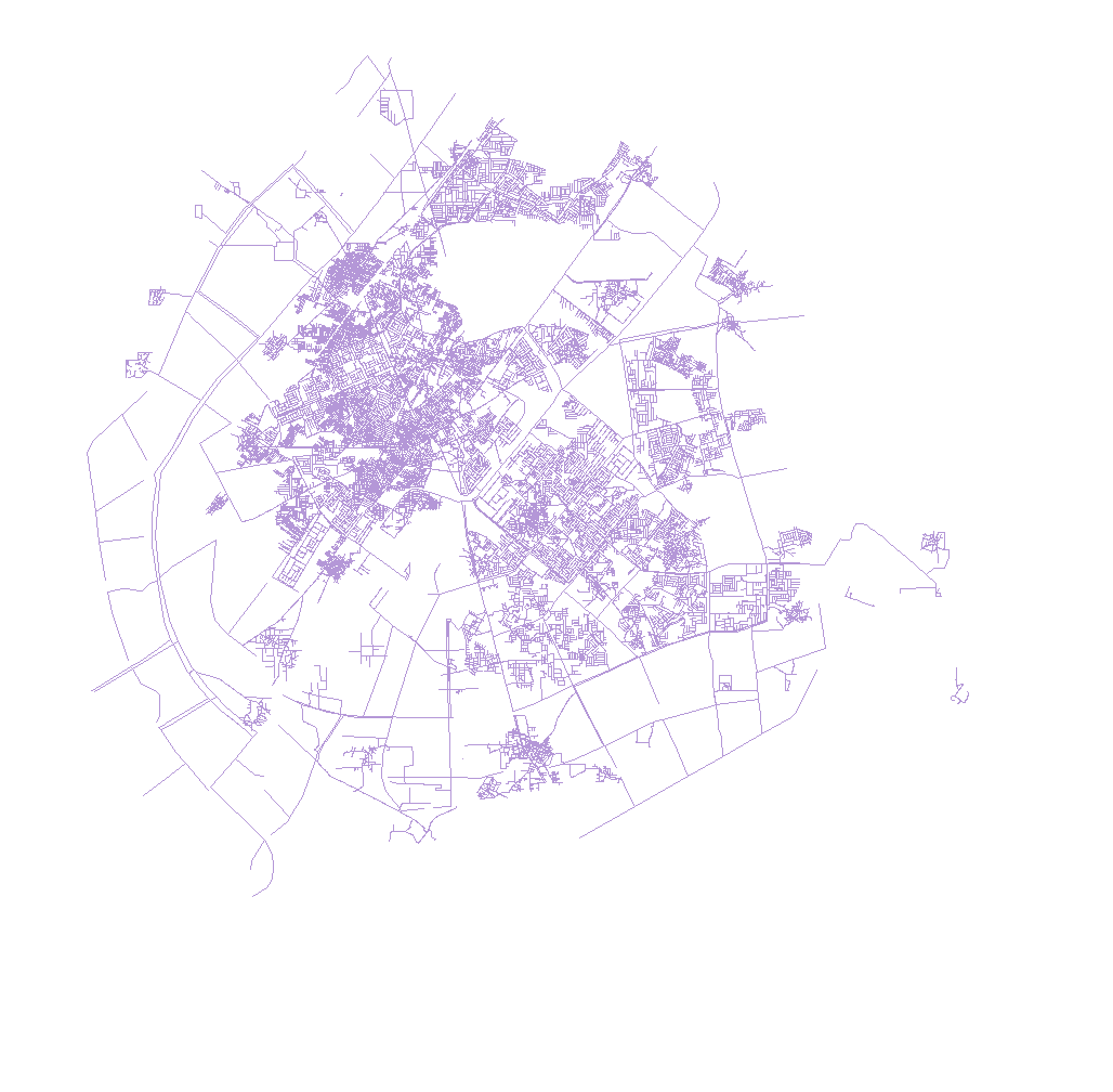
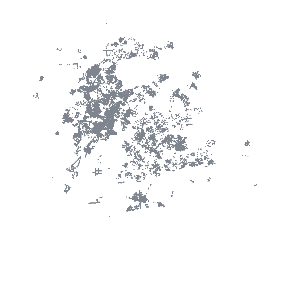

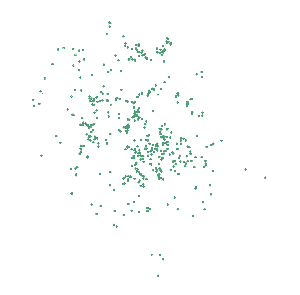
Ask plain-language questions and get responses tied to the selected scenario, the latest June 5 hydraulics, approved DSS outputs and cited model tables. Grounded answers, not unsupported AI claims.
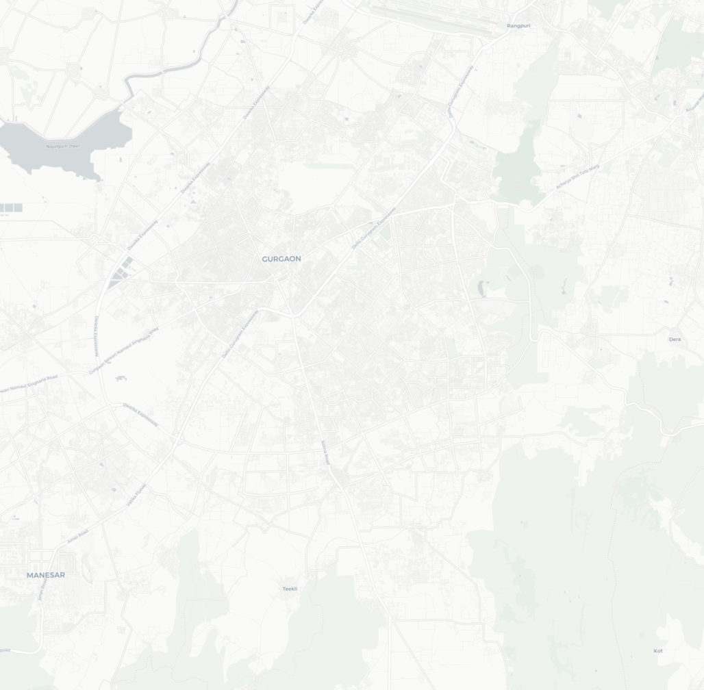
Review mapped MCG parks, terrain, soil-texture support and regional groundwater context before choosing locations for field verification. This is a preliminary screening tool, not a construction approval or site-specific recharge estimate.
Explore the 3D works, replay the modelled storm and compare the proposed intervention. Proposed works; modelled results through 3 h 15 min.
Choose a proposed work and compare it with the matching current-network result. FloodAstra reuses that baseline when rainfall, wet starting state, assets and physics are unchanged.
The map shows locations where the baseline model reaches at least 15 cm. Select one to see whether intervention is appropriate; tools activate only after the hydraulic check passes or field impact is confirmed.
Add a complete new layer or a measured set of changes to the current network.
The current network and proposed work receive the same 3-hour rainfall, the same 3-hour dry recovery window, and the same latest wet model state.
Open this only when a layer needs correction. Adding selected assets keeps the rest of the current network; replacing a layer is only for a complete city layer.
| No work file loaded. |
Read the decision first, then review the supporting flood measures and map.
Both lines use the same rainfall and wet starting state. A fall in both lines is natural recession; the gap between the lines at the same time is the effect of the proposed work.
Small numerical changes are excluded. A result must cross at least one threshold, must not worsen another known flood location, and must not materially increase downstream drain overflow.
Each row uses the same rainfall, wet starting state, assets and physics before and after the proposed work.
Paste or upload a rainfall hyetograph. FloodAstra validates it, prepares rainfall-specific external inflow, and can launch the current-condition D5 model when the DSS server is in operator-enabled mode.
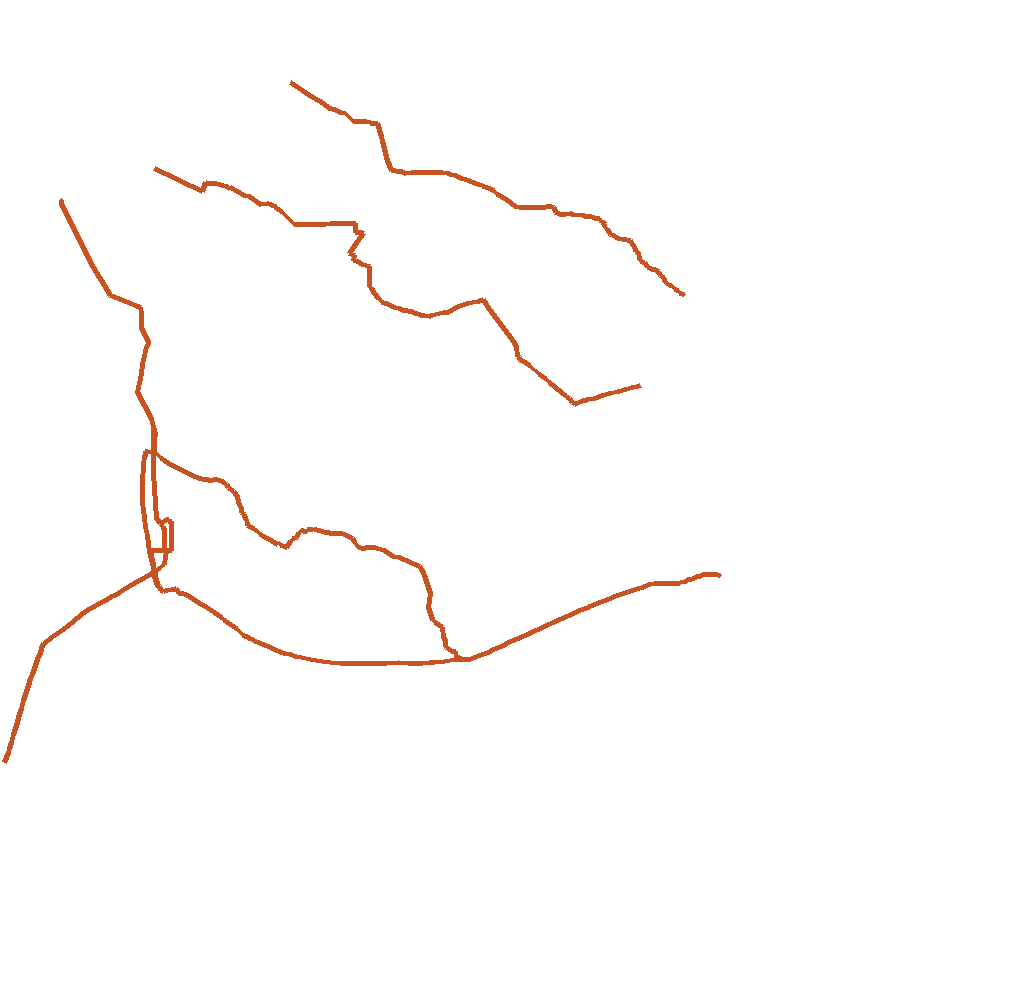
--allow-operational-runs.See the rainfall used, when the model ran, where water may become deepest or remain longest, and what field teams should check first. Every map, table and report below comes from the same selected run.
The rainfall timeline loads from the selected run.
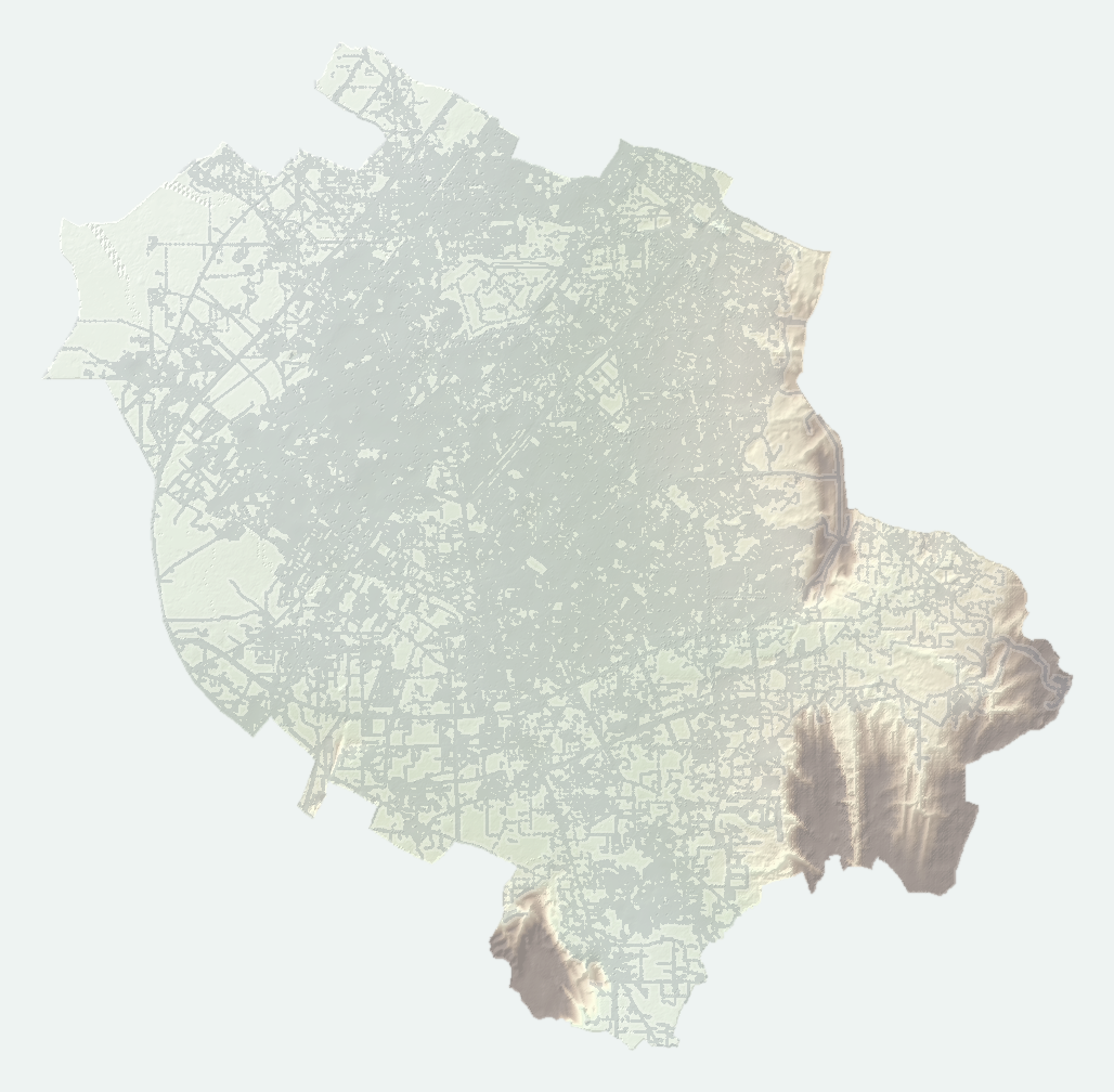
Roads and neighbourhoods remain visible beneath the flood layer. Expected depth below 5 cm is shown very lightly.
One place for the files a stakeholder or field team is most likely to need: action reports, ward packets, sensor siting, and ArcGIS/QGIS layers. The detailed tabs remain available for deeper review.
Public-safe nowcast watch locations for the latest forecast run. Contact roster fields are omitted; this remains a model-evidence preparedness watchlist, not an official public warning bulletin.
Citywide field-priority report with location, ward, nearest landmark, flood signal, exposure, egress/check cue, and recommended first action.
Approved MCG-format ward packets for every MCG ward. Each packet includes maps, key flooding numbers, local evidence, and first field actions.
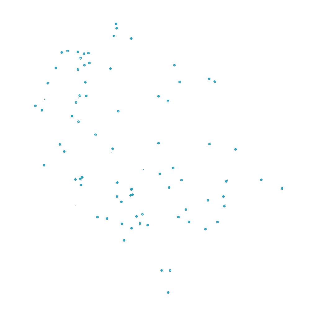
Forty recommended monitoring locations selected with spacing, flood signal, exposure, access, and preparedness logic.
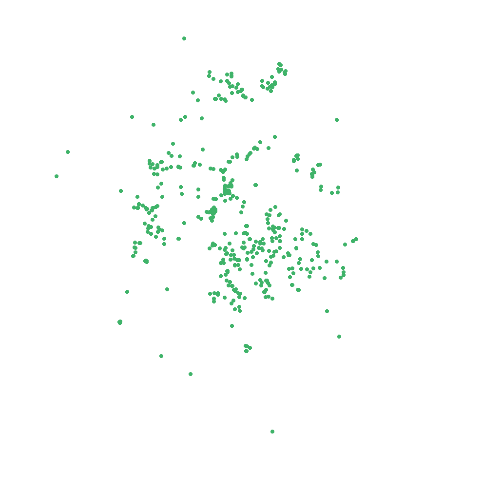
Combined current-condition point layer containing exact backflow nodes, model-watch points, reported points, and impact hotspots.
Before/after screening report for the Rajendra Park upgraded sewer-work context and constrained downstream outflow case.
Stakeholder-oriented action summary for preparedness review, field checks, and communication planning.
Water remaining on the modelled overland surface at the end of the run.
Model-estimated water leaving the city boundary.
Rainfall removed through the soil/LULC-adjusted Horton infiltration term.
Water exported through the dynamic drainage outfall links.
Final drainage-node storage minus initial 20% filled drainage storage; negative means drains ended slightly below the initial fill.
| Component | Volume | Rainfall share | Class | Interpretation |
|---|---|---|---|---|
| Rainfall input | 39,464,940 m³ | 100.0% | input | Total rainfall volume over the modelled city area. |
| External boundary inflow | 0 m³ | 0.0% | input | Upstream or outside-domain inflow where supplied. |
| Horton infiltration loss | 3,011,635 m³ | 7.6% | loss | Water removed by soil/LULC infiltration. |
| Final 2D surface storage | 31,782,382 m³ | 80.5% | storage | Water still ponded on the overland surface. |
| Drain outfall export | 203,608 m³ | 0.5% | export | Water leaving through drainage outfalls. |
| Drainage storage change | 257,331 m³ | 0.7% | storage | Final drainage storage minus initial drainage fill. |
| Final sump storage | 0 m³ | 0.0% | storage | Water retained in sump nodes. |
| Final park/detention storage | 0 m³ | 0.0% | storage | Water retained in pump-discharge receptor areas. |
| Explicit boundary outflow | 5,169,064 m³ | 13.1% | export | Estimated boundary outflow where available; otherwise the water-accounting remainder. |
| Water-balance residual | -959,080 m³ | -2.4% | review | Should remain small relative to rainfall for a stable run. |
Rows use the same rainfall and report selected condition minus the current approved baseline. Storage, 15 cm area and persistence are the decision metrics; unusual maximum-depth spikes are retained only to flag drainage-exchange locations needing review.
| No same-rainfall difference diagnostics are available for this page. |
Priority drainage assets are sorted to show main legs, MCG-provided dimensions, field-review candidates, uncertain slopes and high-capacity links first.
| Asset | Class | Source | Dimension | Provider | Capacity | Slope | Slope basis | Drain connection and capacity review | Orientation note |
|---|---|---|---|---|---|---|---|---|---|
| TRUNK-LEG-3 | main drain leg | Drain_Legs3 | not specified | AIReSQ_inferred | 80.000 m³/s | capacity placeholder; use design cross-section and tailwater when available | not_applicable | terrain high-to-low direction moves toward or roughly along main-leg proximity | |
| TRUNK-LEG-2 | main drain leg | Drain_Legs3 | not specified | AIReSQ_inferred | 45.000 m³/s | capacity placeholder; use design cross-section and tailwater when available | not_applicable | terrain high-to-low direction moves toward or roughly along main-leg proximity | |
| TRUNK-LEG-1 | main drain leg | Drain_Legs3 | not specified | AIReSQ_inferred | 35.000 m³/s | capacity placeholder; use design cross-section and tailwater when available | not_applicable | terrain high-to-low direction moves toward or roughly along main-leg proximity | |
| MASTER-SWD-157 | master storm drain | mastwer_swd | 0.90 m x 0.90 m | MCG | 1.411 m³/s | 0.00 | surface slope proxy; replace with surveyed invert slope | Field review needed: drain size/connectivity | terrain high-to-low direction moves toward or roughly along main-leg proximity |
| MASTER-SWD-4 | master storm drain | mastwer_swd | 0.90 m x 0.90 m | MCG | 1.709 m³/s | 0.01 | surface slope proxy; replace with surveyed invert slope | Field review needed: drain size/connectivity | terrain high-to-low endpoint is farther from main legs; do not force reversal without surveyed invert evidence |
| MASTER-SWD-88 | master storm drain | mastwer_swd | dia 0.60 m | MCG | 0.268 m³/s | 0.00 | surface slope proxy; replace with surveyed invert slope | Field review needed: drain size/connectivity | terrain high-to-low endpoint is farther from main legs; do not force reversal without surveyed invert evidence |
| MASTER-SWD-179 | master storm drain | mastwer_swd | dia 0.60 m | MCG | 0.389 m³/s | 0.00 | surface slope proxy; replace with surveyed invert slope | Field review needed: drain size/connectivity | terrain high-to-low direction moves toward or roughly along main-leg proximity |
| SWD-LINE-976 | local storm drain | STORM_WATER_DRAIN | dia 1.00 m | MCG | 0.929 m³/s | 0.00 | default slope; surface slope unsuitable for pipe invert | not_applicable | terrain high-to-low direction moves toward or roughly along main-leg proximity |
| SWD-LINE-2215 | local storm drain | STORM_WATER_DRAIN | dia 0.70 m | MCG | 0.359 m³/s | 0.00 | default slope; surface slope unsuitable for pipe invert | not_applicable | terrain high-to-low endpoint is farther from main legs; do not force reversal without surveyed invert evidence |
| SWD-LINE-899 | local storm drain | STORM_WATER_DRAIN | dia 0.60 m | MCG | 0.238 m³/s | 0.00 | default slope; surface slope unsuitable for pipe invert | not_applicable | terrain high-to-low direction moves toward or roughly along main-leg proximity |
| SWD-LINE-1651 | local storm drain | STORM_WATER_DRAIN | dia 0.60 m | MCG | 0.238 m³/s | 0.00 | default slope; surface slope unsuitable for pipe invert | not_applicable | terrain high-to-low direction moves toward or roughly along main-leg proximity |
| SWD-LINE-678 | local storm drain | STORM_WATER_DRAIN | dia 0.60 m | MCG | 0.238 m³/s | 0.00 | default slope; surface slope unsuitable for pipe invert | not_applicable | terrain high-to-low endpoint is farther from main legs; do not force reversal without surveyed invert evidence |
| SWD-LINE-2289 | local storm drain | STORM_WATER_DRAIN | dia 0.60 m | MCG | 0.238 m³/s | 0.00 | default slope; surface slope unsuitable for pipe invert | not_applicable | terrain high-to-low endpoint is farther from main legs; do not force reversal without surveyed invert evidence |
| SWD-LINE-2234 | local storm drain | STORM_WATER_DRAIN | dia 0.60 m | MCG | 0.238 m³/s | 0.00 | default slope; surface slope unsuitable for pipe invert | not_applicable | terrain high-to-low direction moves toward or roughly along main-leg proximity |
| SWD-LINE-1081 | local storm drain | STORM_WATER_DRAIN | dia 0.60 m | MCG | 0.238 m³/s | 0.00 | default slope; surface slope unsuitable for pipe invert | not_applicable | terrain high-to-low endpoint is farther from main legs; do not force reversal without surveyed invert evidence |
| SWD-LINE-166 | local storm drain | STORM_WATER_DRAIN | dia 0.60 m | MCG | 0.238 m³/s | 0.00 | default slope; surface slope unsuitable for pipe invert | not_applicable | terrain high-to-low endpoint is farther from main legs; do not force reversal without surveyed invert evidence |
| SWD-LINE-168 | local storm drain | STORM_WATER_DRAIN | dia 0.60 m | MCG | 0.238 m³/s | 0.00 | default slope; surface slope unsuitable for pipe invert | not_applicable | terrain high-to-low endpoint is farther from main legs; do not force reversal without surveyed invert evidence |
| SWD-LINE-164 | local storm drain | STORM_WATER_DRAIN | dia 0.60 m | MCG | 0.238 m³/s | 0.00 | default slope; surface slope unsuitable for pipe invert | not_applicable | terrain high-to-low direction moves toward or roughly along main-leg proximity |
| SWD-LINE-753 | local storm drain | STORM_WATER_DRAIN | dia 0.45 m | MCG | 0.110 m³/s | 0.00 | default slope; surface slope unsuitable for pipe invert | not_applicable | terrain high-to-low direction moves toward or roughly along main-leg proximity |
| SWD-LINE-754 | local storm drain | STORM_WATER_DRAIN | dia 0.45 m | MCG | 0.110 m³/s | 0.00 | default slope; surface slope unsuitable for pipe invert | not_applicable | terrain high-to-low endpoint is farther from main legs; do not force reversal without surveyed invert evidence |
| SWD-LINE-518 | local storm drain | STORM_WATER_DRAIN | dia 0.45 m | MCG | 0.110 m³/s | 0.00 | default slope; surface slope unsuitable for pipe invert | not_applicable | terrain high-to-low direction moves toward or roughly along main-leg proximity |
| SWD-LINE-520 | local storm drain | STORM_WATER_DRAIN | dia 0.45 m | MCG | 0.110 m³/s | 0.00 | default slope; surface slope unsuitable for pipe invert | not_applicable | terrain high-to-low direction moves toward or roughly along main-leg proximity |
| SWD-LINE-508 | local storm drain | STORM_WATER_DRAIN | dia 0.45 m | MCG | 0.110 m³/s | 0.00 | default slope; surface slope unsuitable for pipe invert | not_applicable | terrain high-to-low direction moves toward or roughly along main-leg proximity |
| SWD-LINE-535 | local storm drain | STORM_WATER_DRAIN | dia 0.45 m | MCG | 0.110 m³/s | 0.00 | default slope; surface slope unsuitable for pipe invert | not_applicable | terrain high-to-low direction moves toward or roughly along main-leg proximity |
| SWD-LINE-505 | local storm drain | STORM_WATER_DRAIN | dia 0.45 m | MCG | 0.110 m³/s | 0.00 | default slope; surface slope unsuitable for pipe invert | not_applicable | terrain high-to-low direction moves toward or roughly along main-leg proximity |
| SWD-LINE-514 | local storm drain | STORM_WATER_DRAIN | dia 0.45 m | MCG | 0.110 m³/s | 0.00 | default slope; surface slope unsuitable for pipe invert | not_applicable | terrain high-to-low direction moves toward or roughly along main-leg proximity |
| SWD-LINE-517 | local storm drain | STORM_WATER_DRAIN | dia 0.45 m | MCG | 0.110 m³/s | 0.00 | default slope; surface slope unsuitable for pipe invert | not_applicable | terrain high-to-low direction moves toward or roughly along main-leg proximity |
| SWD-LINE-519 | local storm drain | STORM_WATER_DRAIN | dia 0.45 m | MCG | 0.110 m³/s | 0.00 | default slope; surface slope unsuitable for pipe invert | not_applicable | terrain high-to-low direction moves toward or roughly along main-leg proximity |
| SWD-LINE-541 | local storm drain | STORM_WATER_DRAIN | dia 0.45 m | MCG | 0.110 m³/s | 0.00 | default slope; surface slope unsuitable for pipe invert | not_applicable | terrain high-to-low direction moves toward or roughly along main-leg proximity |
| SWD-LINE-525 | local storm drain | STORM_WATER_DRAIN | dia 0.45 m | MCG | 0.110 m³/s | 0.00 | default slope; surface slope unsuitable for pipe invert | not_applicable | terrain high-to-low direction moves toward or roughly along main-leg proximity |
| SWD-LINE-151 | local storm drain | STORM_WATER_DRAIN | dia 0.45 m | MCG | 0.110 m³/s | 0.00 | default slope; surface slope unsuitable for pipe invert | not_applicable | terrain high-to-low endpoint is farther from main legs; do not force reversal without surveyed invert evidence |
| SWD-LINE-1049 | local storm drain | STORM_WATER_DRAIN | dia 0.45 m | MCG | 0.110 m³/s | 0.00 | default slope; surface slope unsuitable for pipe invert | not_applicable | terrain high-to-low endpoint is farther from main legs; do not force reversal without surveyed invert evidence |
| SWD-LINE-513 | local storm drain | STORM_WATER_DRAIN | dia 0.45 m | MCG | 0.110 m³/s | 0.00 | default slope; surface slope unsuitable for pipe invert | not_applicable | terrain high-to-low direction moves toward or roughly along main-leg proximity |
| SWD-LINE-148 | local storm drain | STORM_WATER_DRAIN | dia 0.45 m | MCG | 0.110 m³/s | 0.00 | default slope; surface slope unsuitable for pipe invert | not_applicable | terrain high-to-low direction moves toward or roughly along main-leg proximity |
| SWD-LINE-1046 | local storm drain | STORM_WATER_DRAIN | dia 0.45 m | MCG | 0.110 m³/s | 0.00 | default slope; surface slope unsuitable for pipe invert | not_applicable | terrain high-to-low direction moves toward or roughly along main-leg proximity |
| SWD-LINE-512 | local storm drain | STORM_WATER_DRAIN | dia 0.45 m | MCG | 0.110 m³/s | 0.00 | default slope; surface slope unsuitable for pipe invert | not_applicable | terrain high-to-low direction moves toward or roughly along main-leg proximity |
| SWD-LINE-543 | local storm drain | STORM_WATER_DRAIN | dia 0.45 m | MCG | 0.110 m³/s | 0.00 | default slope; surface slope unsuitable for pipe invert | not_applicable | terrain high-to-low direction moves toward or roughly along main-leg proximity |
| SWD-LINE-1047 | local storm drain | STORM_WATER_DRAIN | dia 0.45 m | MCG | 0.110 m³/s | 0.00 | default slope; surface slope unsuitable for pipe invert | not_applicable | terrain high-to-low direction moves toward or roughly along main-leg proximity |
| SWD-LINE-149 | local storm drain | STORM_WATER_DRAIN | dia 0.45 m | MCG | 0.110 m³/s | 0.00 | default slope; surface slope unsuitable for pipe invert | not_applicable | terrain high-to-low direction moves toward or roughly along main-leg proximity |
| SWD-LINE-1042 | local storm drain | STORM_WATER_DRAIN | dia 0.45 m | MCG | 0.110 m³/s | 0.00 | default slope; surface slope unsuitable for pipe invert | not_applicable | terrain high-to-low endpoint is farther from main legs; do not force reversal without surveyed invert evidence |
| SWD-LINE-144 | local storm drain | STORM_WATER_DRAIN | dia 0.45 m | MCG | 0.110 m³/s | 0.00 | default slope; surface slope unsuitable for pipe invert | not_applicable | terrain high-to-low endpoint is farther from main legs; do not force reversal without surveyed invert evidence |
| SWD-LINE-509 | local storm drain | STORM_WATER_DRAIN | dia 0.45 m | MCG | 0.110 m³/s | 0.00 | default slope; surface slope unsuitable for pipe invert | not_applicable | terrain high-to-low direction moves toward or roughly along main-leg proximity |
| SWD-LINE-539 | local storm drain | STORM_WATER_DRAIN | dia 0.45 m | MCG | 0.110 m³/s | 0.00 | default slope; surface slope unsuitable for pipe invert | not_applicable | terrain high-to-low direction moves toward or roughly along main-leg proximity |
| SWD-LINE-489 | local storm drain | STORM_WATER_DRAIN | dia 0.45 m | MCG | 0.110 m³/s | 0.00 | default slope; surface slope unsuitable for pipe invert | not_applicable | terrain high-to-low direction moves toward or roughly along main-leg proximity |
| SWD-LINE-530 | local storm drain | STORM_WATER_DRAIN | dia 0.45 m | MCG | 0.110 m³/s | 0.00 | default slope; surface slope unsuitable for pipe invert | not_applicable | terrain high-to-low direction moves toward or roughly along main-leg proximity |
| SWD-LINE-1048 | local storm drain | STORM_WATER_DRAIN | dia 0.45 m | MCG | 0.110 m³/s | 0.00 | default slope; surface slope unsuitable for pipe invert | not_applicable | terrain high-to-low direction moves toward or roughly along main-leg proximity |
| SWD-LINE-150 | local storm drain | STORM_WATER_DRAIN | dia 0.45 m | MCG | 0.110 m³/s | 0.00 | default slope; surface slope unsuitable for pipe invert | not_applicable | terrain high-to-low direction moves toward or roughly along main-leg proximity |
| SWD-LINE-533 | local storm drain | STORM_WATER_DRAIN | dia 0.45 m | MCG | 0.110 m³/s | 0.00 | default slope; surface slope unsuitable for pipe invert | not_applicable | terrain high-to-low direction moves toward or roughly along main-leg proximity |
| SWD-LINE-542 | local storm drain | STORM_WATER_DRAIN | dia 0.45 m | MCG | 0.110 m³/s | 0.00 | default slope; surface slope unsuitable for pipe invert | not_applicable | terrain high-to-low direction moves toward or roughly along main-leg proximity |
| SWD-LINE-524 | local storm drain | STORM_WATER_DRAIN | dia 0.45 m | MCG | 0.110 m³/s | 0.00 | default slope; surface slope unsuitable for pipe invert | not_applicable | terrain high-to-low direction moves toward or roughly along main-leg proximity |
| SWD-LINE-1041 | local storm drain | STORM_WATER_DRAIN | dia 0.45 m | MCG | 0.110 m³/s | 0.00 | default slope; surface slope unsuitable for pipe invert | not_applicable | terrain high-to-low direction moves toward or roughly along main-leg proximity |
| SWD-LINE-143 | local storm drain | STORM_WATER_DRAIN | dia 0.45 m | MCG | 0.110 m³/s | 0.00 | default slope; surface slope unsuitable for pipe invert | not_applicable | terrain high-to-low direction moves toward or roughly along main-leg proximity |
| SWD-LINE-140 | local storm drain | STORM_WATER_DRAIN | dia 0.45 m | MCG | 0.110 m³/s | 0.00 | default slope; surface slope unsuitable for pipe invert | not_applicable | terrain high-to-low endpoint is farther from main legs; do not force reversal without surveyed invert evidence |
| SWD-LINE-1038 | local storm drain | STORM_WATER_DRAIN | dia 0.45 m | MCG | 0.110 m³/s | 0.00 | default slope; surface slope unsuitable for pipe invert | not_applicable | terrain high-to-low endpoint is farther from main legs; do not force reversal without surveyed invert evidence |
| SWD-LINE-496 | local storm drain | STORM_WATER_DRAIN | dia 0.45 m | MCG | 0.110 m³/s | 0.00 | default slope; surface slope unsuitable for pipe invert | not_applicable | terrain high-to-low direction moves toward or roughly along main-leg proximity |
| SWD-LINE-2721 | local storm drain | STORM_WATER_DRAIN | dia 0.45 m | MCG | 0.110 m³/s | 0.00 | default slope; surface slope unsuitable for pipe invert | not_applicable | terrain high-to-low direction moves toward or roughly along main-leg proximity |
| SWD-LINE-2428 | local storm drain | STORM_WATER_DRAIN | dia 0.40 m | MCG | 0.081 m³/s | 0.00 | default slope; surface slope unsuitable for pipe invert | not_applicable | terrain high-to-low direction moves toward or roughly along main-leg proximity |
| SWD-LINE-750 | local storm drain | STORM_WATER_DRAIN | dia 0.40 m | MCG | 0.081 m³/s | 0.00 | default slope; surface slope unsuitable for pipe invert | not_applicable | terrain high-to-low direction moves toward or roughly along main-leg proximity |
| SWD-LINE-1108 | local storm drain | STORM_WATER_DRAIN | dia 0.40 m | MCG | 0.081 m³/s | 0.00 | default slope; surface slope unsuitable for pipe invert | not_applicable | terrain high-to-low direction moves toward or roughly along main-leg proximity |
| SWD-LINE-1816 | local storm drain | STORM_WATER_DRAIN | dia 0.40 m | MCG | 0.081 m³/s | 0.00 | default slope; surface slope unsuitable for pipe invert | not_applicable | terrain high-to-low direction moves toward or roughly along main-leg proximity |
| SWD-LINE-2263 | local storm drain | STORM_WATER_DRAIN | dia 0.40 m | MCG | 0.081 m³/s | 0.00 | default slope; surface slope unsuitable for pipe invert | not_applicable | terrain high-to-low endpoint is farther from main legs; do not force reversal without surveyed invert evidence |
| SWD-LINE-1158 | local storm drain | STORM_WATER_DRAIN | dia 0.40 m | MCG | 0.081 m³/s | 0.00 | default slope; surface slope unsuitable for pipe invert | not_applicable | terrain high-to-low endpoint is farther from main legs; do not force reversal without surveyed invert evidence |
| SWD-LINE-2334 | local storm drain | STORM_WATER_DRAIN | dia 0.40 m | MCG | 0.081 m³/s | 0.00 | default slope; surface slope unsuitable for pipe invert | not_applicable | terrain high-to-low direction moves toward or roughly along main-leg proximity |
| SWD-LINE-1797 | local storm drain | STORM_WATER_DRAIN | dia 0.40 m | MCG | 0.081 m³/s | 0.00 | default slope; surface slope unsuitable for pipe invert | not_applicable | terrain high-to-low direction moves toward or roughly along main-leg proximity |
| SWD-LINE-1872 | local storm drain | STORM_WATER_DRAIN | dia 0.40 m | MCG | 0.081 m³/s | 0.00 | default slope; surface slope unsuitable for pipe invert | not_applicable | terrain high-to-low endpoint is farther from main legs; do not force reversal without surveyed invert evidence |
| SWD-LINE-916 | local storm drain | STORM_WATER_DRAIN | dia 0.40 m | MCG | 0.081 m³/s | 0.00 | default slope; surface slope unsuitable for pipe invert | not_applicable | terrain high-to-low endpoint is farther from main legs; do not force reversal without surveyed invert evidence |
| SWD-LINE-2336 | local storm drain | STORM_WATER_DRAIN | dia 0.40 m | MCG | 0.081 m³/s | 0.00 | default slope; surface slope unsuitable for pipe invert | not_applicable | terrain high-to-low direction moves toward or roughly along main-leg proximity |
| SWD-LINE-1791 | local storm drain | STORM_WATER_DRAIN | dia 0.40 m | MCG | 0.081 m³/s | 0.00 | default slope; surface slope unsuitable for pipe invert | not_applicable | terrain high-to-low endpoint is farther from main legs; do not force reversal without surveyed invert evidence |
| SWD-LINE-1765 | local storm drain | STORM_WATER_DRAIN | dia 0.40 m | MCG | 0.081 m³/s | 0.00 | default slope; surface slope unsuitable for pipe invert | not_applicable | terrain high-to-low endpoint is farther from main legs; do not force reversal without surveyed invert evidence |
| SWD-LINE-1773 | local storm drain | STORM_WATER_DRAIN | dia 0.40 m | MCG | 0.081 m³/s | 0.00 | default slope; surface slope unsuitable for pipe invert | not_applicable | terrain high-to-low direction moves toward or roughly along main-leg proximity |
| SWD-LINE-2277 | local storm drain | STORM_WATER_DRAIN | dia 0.40 m | MCG | 0.081 m³/s | 0.00 | default slope; surface slope unsuitable for pipe invert | not_applicable | terrain high-to-low endpoint is farther from main legs; do not force reversal without surveyed invert evidence |
| SWD-LINE-969 | local storm drain | STORM_WATER_DRAIN | dia 0.40 m | MCG | 0.081 m³/s | 0.00 | default slope; surface slope unsuitable for pipe invert | not_applicable | terrain high-to-low endpoint is farther from main legs; do not force reversal without surveyed invert evidence |
| SWD-LINE-44 | local storm drain | STORM_WATER_DRAIN | dia 0.40 m | MCG | 0.081 m³/s | 0.00 | default slope; surface slope unsuitable for pipe invert | not_applicable | terrain high-to-low direction moves toward or roughly along main-leg proximity |
| SWD-LINE-354 | local storm drain | STORM_WATER_DRAIN | dia 0.40 m | MCG | 0.081 m³/s | 0.00 | default slope; surface slope unsuitable for pipe invert | not_applicable | terrain high-to-low endpoint is farther from main legs; do not force reversal without surveyed invert evidence |
| SWD-LINE-1678 | local storm drain | STORM_WATER_DRAIN | dia 0.40 m | MCG | 0.081 m³/s | 0.00 | default slope; surface slope unsuitable for pipe invert | not_applicable | terrain high-to-low direction moves toward or roughly along main-leg proximity |
| SWD-LINE-832 | local storm drain | STORM_WATER_DRAIN | dia 0.40 m | MCG | 0.081 m³/s | 0.00 | default slope; surface slope unsuitable for pipe invert | not_applicable | terrain high-to-low direction moves toward or roughly along main-leg proximity |
| SWD-LINE-815 | local storm drain | STORM_WATER_DRAIN | dia 0.40 m | MCG | 0.081 m³/s | 0.00 | default slope; surface slope unsuitable for pipe invert | not_applicable | terrain high-to-low endpoint is farther from main legs; do not force reversal without surveyed invert evidence |
| SWD-LINE-1095 | local storm drain | STORM_WATER_DRAIN | dia 0.40 m | MCG | 0.081 m³/s | 0.00 | default slope; surface slope unsuitable for pipe invert | not_applicable | terrain high-to-low endpoint is farther from main legs; do not force reversal without surveyed invert evidence |
| SWD-LINE-1860 | local storm drain | STORM_WATER_DRAIN | dia 0.40 m | MCG | 0.081 m³/s | 0.00 | default slope; surface slope unsuitable for pipe invert | not_applicable | terrain high-to-low endpoint is farther from main legs; do not force reversal without surveyed invert evidence |
| SWD-LINE-819 | local storm drain | STORM_WATER_DRAIN | dia 0.40 m | MCG | 0.081 m³/s | 0.00 | default slope; surface slope unsuitable for pipe invert | not_applicable | terrain high-to-low direction moves toward or roughly along main-leg proximity |
| SWD-LINE-876 | local storm drain | STORM_WATER_DRAIN | dia 0.40 m | MCG | 0.081 m³/s | 0.00 | default slope; surface slope unsuitable for pipe invert | not_applicable | terrain high-to-low direction moves toward or roughly along main-leg proximity |
| SWD-LINE-964 | local storm drain | STORM_WATER_DRAIN | dia 0.40 m | MCG | 0.081 m³/s | 0.00 | default slope; surface slope unsuitable for pipe invert | not_applicable | terrain high-to-low endpoint is farther from main legs; do not force reversal without surveyed invert evidence |
| SWD-LINE-2287 | local storm drain | STORM_WATER_DRAIN | dia 0.40 m | MCG | 0.081 m³/s | 0.00 | default slope; surface slope unsuitable for pipe invert | not_applicable | terrain high-to-low direction moves toward or roughly along main-leg proximity |
| SWD-LINE-803 | local storm drain | STORM_WATER_DRAIN | dia 0.40 m | MCG | 0.081 m³/s | 0.00 | default slope; surface slope unsuitable for pipe invert | not_applicable | terrain high-to-low endpoint is farther from main legs; do not force reversal without surveyed invert evidence |
| SWD-LINE-1788 | local storm drain | STORM_WATER_DRAIN | dia 0.40 m | MCG | 0.081 m³/s | 0.00 | default slope; surface slope unsuitable for pipe invert | not_applicable | terrain high-to-low endpoint is farther from main legs; do not force reversal without surveyed invert evidence |
| SWD-LINE-50 | local storm drain | STORM_WATER_DRAIN | dia 0.40 m | MCG | 0.081 m³/s | 0.00 | default slope; surface slope unsuitable for pipe invert | not_applicable | terrain high-to-low direction moves toward or roughly along main-leg proximity |
| SWD-LINE-2283 | local storm drain | STORM_WATER_DRAIN | dia 0.40 m | MCG | 0.081 m³/s | 0.00 | default slope; surface slope unsuitable for pipe invert | not_applicable | terrain high-to-low endpoint is farther from main legs; do not force reversal without surveyed invert evidence |
| SWD-LINE-1707 | local storm drain | STORM_WATER_DRAIN | dia 0.40 m | MCG | 0.081 m³/s | 0.00 | default slope; surface slope unsuitable for pipe invert | not_applicable | terrain high-to-low endpoint is farther from main legs; do not force reversal without surveyed invert evidence |
| SWD-LINE-2335 | local storm drain | STORM_WATER_DRAIN | dia 0.40 m | MCG | 0.081 m³/s | 0.00 | default slope; surface slope unsuitable for pipe invert | not_applicable | terrain high-to-low direction moves toward or roughly along main-leg proximity |
| SWD-LINE-1909 | local storm drain | STORM_WATER_DRAIN | dia 0.40 m | MCG | 0.081 m³/s | 0.00 | default slope; surface slope unsuitable for pipe invert | not_applicable | terrain high-to-low endpoint is farther from main legs; do not force reversal without surveyed invert evidence |
| SWD-LINE-2276 | local storm drain | STORM_WATER_DRAIN | dia 0.40 m | MCG | 0.081 m³/s | 0.00 | default slope; surface slope unsuitable for pipe invert | not_applicable | terrain high-to-low endpoint is farther from main legs; do not force reversal without surveyed invert evidence |
| SWD-LINE-2214 | local storm drain | STORM_WATER_DRAIN | dia 0.40 m | MCG | 0.081 m³/s | 0.00 | default slope; surface slope unsuitable for pipe invert | not_applicable | terrain high-to-low direction moves toward or roughly along main-leg proximity |
| SWD-LINE-875 | local storm drain | STORM_WATER_DRAIN | dia 0.40 m | MCG | 0.081 m³/s | 0.00 | default slope; surface slope unsuitable for pipe invert | not_applicable | terrain high-to-low direction moves toward or roughly along main-leg proximity |
| SWD-LINE-1717 | local storm drain | STORM_WATER_DRAIN | dia 0.40 m | MCG | 0.081 m³/s | 0.00 | default slope; surface slope unsuitable for pipe invert | not_applicable | terrain high-to-low direction moves toward or roughly along main-leg proximity |
| SWD-LINE-2250 | local storm drain | STORM_WATER_DRAIN | dia 0.40 m | MCG | 0.081 m³/s | 0.00 | default slope; surface slope unsuitable for pipe invert | not_applicable | terrain high-to-low endpoint is farther from main legs; do not force reversal without surveyed invert evidence |
| SWD-LINE-1856 | local storm drain | STORM_WATER_DRAIN | dia 0.40 m | MCG | 0.081 m³/s | 0.00 | default slope; surface slope unsuitable for pipe invert | not_applicable | terrain high-to-low direction moves toward or roughly along main-leg proximity |
| SWD-LINE-1688 | local storm drain | STORM_WATER_DRAIN | dia 0.40 m | MCG | 0.081 m³/s | 0.00 | default slope; surface slope unsuitable for pipe invert | not_applicable | terrain high-to-low endpoint is farther from main legs; do not force reversal without surveyed invert evidence |
| SWD-LINE-1686 | local storm drain | STORM_WATER_DRAIN | dia 0.40 m | MCG | 0.081 m³/s | 0.00 | default slope; surface slope unsuitable for pipe invert | not_applicable | terrain high-to-low endpoint is farther from main legs; do not force reversal without surveyed invert evidence |
| SWD-LINE-2022 | local storm drain | STORM_WATER_DRAIN | dia 0.40 m | MCG | 0.081 m³/s | 0.00 | default slope; surface slope unsuitable for pipe invert | not_applicable | terrain high-to-low direction moves toward or roughly along main-leg proximity |
| SWD-LINE-927 | local storm drain | STORM_WATER_DRAIN | dia 0.40 m | MCG | 0.081 m³/s | 0.00 | default slope; surface slope unsuitable for pipe invert | not_applicable | terrain high-to-low endpoint is farther from main legs; do not force reversal without surveyed invert evidence |
| SWD-LINE-2243 | local storm drain | STORM_WATER_DRAIN | dia 0.40 m | MCG | 0.081 m³/s | 0.00 | default slope; surface slope unsuitable for pipe invert | not_applicable | terrain high-to-low direction moves toward or roughly along main-leg proximity |
| SWD-LINE-1982 | local storm drain | STORM_WATER_DRAIN | dia 0.40 m | MCG | 0.081 m³/s | 0.00 | default slope; surface slope unsuitable for pipe invert | not_applicable | terrain high-to-low direction moves toward or roughly along main-leg proximity |
| SWD-LINE-882 | local storm drain | STORM_WATER_DRAIN | dia 0.40 m | MCG | 0.081 m³/s | 0.00 | default slope; surface slope unsuitable for pipe invert | not_applicable | terrain high-to-low direction moves toward or roughly along main-leg proximity |
| SWD-LINE-1859 | local storm drain | STORM_WATER_DRAIN | dia 0.40 m | MCG | 0.081 m³/s | 0.00 | default slope; surface slope unsuitable for pipe invert | not_applicable | terrain high-to-low direction moves toward or roughly along main-leg proximity |
| SWD-LINE-837 | local storm drain | STORM_WATER_DRAIN | dia 0.40 m | MCG | 0.081 m³/s | 0.00 | default slope; surface slope unsuitable for pipe invert | not_applicable | terrain high-to-low direction moves toward or roughly along main-leg proximity |
| SWD-LINE-2225 | local storm drain | STORM_WATER_DRAIN | dia 0.40 m | MCG | 0.081 m³/s | 0.00 | default slope; surface slope unsuitable for pipe invert | not_applicable | terrain high-to-low endpoint is farther from main legs; do not force reversal without surveyed invert evidence |
| SWD-LINE-1739 | local storm drain | STORM_WATER_DRAIN | dia 0.40 m | MCG | 0.081 m³/s | 0.00 | default slope; surface slope unsuitable for pipe invert | not_applicable | terrain high-to-low endpoint is farther from main legs; do not force reversal without surveyed invert evidence |
| SWD-LINE-1685 | local storm drain | STORM_WATER_DRAIN | dia 0.40 m | MCG | 0.081 m³/s | 0.00 | default slope; surface slope unsuitable for pipe invert | not_applicable | terrain high-to-low direction moves toward or roughly along main-leg proximity |
| SWD-LINE-813 | local storm drain | STORM_WATER_DRAIN | dia 0.40 m | MCG | 0.081 m³/s | 0.00 | default slope; surface slope unsuitable for pipe invert | not_applicable | terrain high-to-low endpoint is farther from main legs; do not force reversal without surveyed invert evidence |
| SWD-LINE-1857 | local storm drain | STORM_WATER_DRAIN | dia 0.40 m | MCG | 0.081 m³/s | 0.00 | default slope; surface slope unsuitable for pipe invert | not_applicable | terrain high-to-low direction moves toward or roughly along main-leg proximity |
| SWD-LINE-938 | local storm drain | STORM_WATER_DRAIN | dia 0.40 m | MCG | 0.081 m³/s | 0.00 | default slope; surface slope unsuitable for pipe invert | not_applicable | terrain high-to-low direction moves toward or roughly along main-leg proximity |
| SWD-LINE-28 | local storm drain | STORM_WATER_DRAIN | dia 0.40 m | MCG | 0.081 m³/s | 0.00 | default slope; surface slope unsuitable for pipe invert | not_applicable | terrain high-to-low endpoint is farther from main legs; do not force reversal without surveyed invert evidence |
| SWD-LINE-1819 | local storm drain | STORM_WATER_DRAIN | dia 0.40 m | MCG | 0.081 m³/s | 0.00 | default slope; surface slope unsuitable for pipe invert | not_applicable | terrain high-to-low endpoint is farther from main legs; do not force reversal without surveyed invert evidence |
| SWD-LINE-866 | local storm drain | STORM_WATER_DRAIN | dia 0.40 m | MCG | 0.081 m³/s | 0.00 | default slope; surface slope unsuitable for pipe invert | not_applicable | terrain high-to-low direction moves toward or roughly along main-leg proximity |
| SWD-LINE-1772 | local storm drain | STORM_WATER_DRAIN | dia 0.40 m | MCG | 0.081 m³/s | 0.00 | default slope; surface slope unsuitable for pipe invert | not_applicable | terrain high-to-low endpoint is farther from main legs; do not force reversal without surveyed invert evidence |
| SWD-LINE-29 | local storm drain | STORM_WATER_DRAIN | dia 0.40 m | MCG | 0.081 m³/s | 0.00 | default slope; surface slope unsuitable for pipe invert | not_applicable | terrain high-to-low endpoint is farther from main legs; do not force reversal without surveyed invert evidence |
| SWD-LINE-1858 | local storm drain | STORM_WATER_DRAIN | dia 0.40 m | MCG | 0.081 m³/s | 0.00 | default slope; surface slope unsuitable for pipe invert | not_applicable | terrain high-to-low direction moves toward or roughly along main-leg proximity |
| SWD-LINE-272 | local storm drain | STORM_WATER_DRAIN | dia 0.40 m | MCG | 0.081 m³/s | 0.00 | default slope; surface slope unsuitable for pipe invert | not_applicable | terrain high-to-low direction moves toward or roughly along main-leg proximity |
| SWD-LINE-2342 | local storm drain | STORM_WATER_DRAIN | dia 0.40 m | MCG | 0.081 m³/s | 0.00 | default slope; surface slope unsuitable for pipe invert | not_applicable | terrain high-to-low endpoint is farther from main legs; do not force reversal without surveyed invert evidence |
| SWD-LINE-1704 | local storm drain | STORM_WATER_DRAIN | dia 0.40 m | MCG | 0.081 m³/s | 0.00 | default slope; surface slope unsuitable for pipe invert | not_applicable | terrain high-to-low direction moves toward or roughly along main-leg proximity |
| SWD-LINE-1716 | local storm drain | STORM_WATER_DRAIN | dia 0.40 m | MCG | 0.081 m³/s | 0.00 | default slope; surface slope unsuitable for pipe invert | not_applicable | terrain high-to-low direction moves toward or roughly along main-leg proximity |
| SWD-LINE-1675 | local storm drain | STORM_WATER_DRAIN | dia 0.40 m | MCG | 0.081 m³/s | 0.00 | default slope; surface slope unsuitable for pipe invert | not_applicable | terrain high-to-low direction moves toward or roughly along main-leg proximity |
| SWD-LINE-17 | local storm drain | STORM_WATER_DRAIN | dia 0.40 m | MCG | 0.081 m³/s | 0.00 | default slope; surface slope unsuitable for pipe invert | not_applicable | terrain high-to-low direction moves toward or roughly along main-leg proximity |
| SWD-LINE-1946 | local storm drain | STORM_WATER_DRAIN | dia 0.40 m | MCG | 0.081 m³/s | 0.00 | default slope; surface slope unsuitable for pipe invert | not_applicable | terrain high-to-low endpoint is farther from main legs; do not force reversal without surveyed invert evidence |
| SWD-LINE-1854 | local storm drain | STORM_WATER_DRAIN | dia 0.40 m | MCG | 0.081 m³/s | 0.00 | default slope; surface slope unsuitable for pipe invert | not_applicable | terrain high-to-low direction moves toward or roughly along main-leg proximity |
| SWD-LINE-360 | local storm drain | STORM_WATER_DRAIN | dia 0.40 m | MCG | 0.081 m³/s | 0.00 | default slope; surface slope unsuitable for pipe invert | not_applicable | terrain high-to-low direction moves toward or roughly along main-leg proximity |
| SWD-LINE-1844 | local storm drain | STORM_WATER_DRAIN | dia 0.40 m | MCG | 0.081 m³/s | 0.00 | default slope; surface slope unsuitable for pipe invert | not_applicable | terrain high-to-low direction moves toward or roughly along main-leg proximity |
| SWD-LINE-1914 | local storm drain | STORM_WATER_DRAIN | dia 0.40 m | MCG | 0.081 m³/s | 0.00 | default slope; surface slope unsuitable for pipe invert | not_applicable | terrain high-to-low endpoint is farther from main legs; do not force reversal without surveyed invert evidence |
| SWD-LINE-1069 | local storm drain | STORM_WATER_DRAIN | dia 0.40 m | MCG | 0.081 m³/s | 0.00 | default slope; surface slope unsuitable for pipe invert | not_applicable | terrain high-to-low endpoint is farther from main legs; do not force reversal without surveyed invert evidence |
| SWD-LINE-1077 | local storm drain | STORM_WATER_DRAIN | dia 0.40 m | MCG | 0.081 m³/s | 0.00 | default slope; surface slope unsuitable for pipe invert | not_applicable | terrain high-to-low endpoint is farther from main legs; do not force reversal without surveyed invert evidence |
| SWD-LINE-2013 | local storm drain | STORM_WATER_DRAIN | dia 0.40 m | MCG | 0.081 m³/s | 0.00 | default slope; surface slope unsuitable for pipe invert | not_applicable | terrain high-to-low direction moves toward or roughly along main-leg proximity |
| SWD-LINE-2309 | local storm drain | STORM_WATER_DRAIN | dia 0.40 m | MCG | 0.081 m³/s | 0.00 | default slope; surface slope unsuitable for pipe invert | not_applicable | terrain high-to-low endpoint is farther from main legs; do not force reversal without surveyed invert evidence |
| SWD-LINE-54 | local storm drain | STORM_WATER_DRAIN | dia 0.40 m | MCG | 0.081 m³/s | 0.00 | default slope; surface slope unsuitable for pipe invert | not_applicable | terrain high-to-low direction moves toward or roughly along main-leg proximity |
| SWD-LINE-1689 | local storm drain | STORM_WATER_DRAIN | dia 0.40 m | MCG | 0.081 m³/s | 0.00 | default slope; surface slope unsuitable for pipe invert | not_applicable | terrain high-to-low endpoint is farther from main legs; do not force reversal without surveyed invert evidence |
| SWD-LINE-55 | local storm drain | STORM_WATER_DRAIN | dia 0.40 m | MCG | 0.081 m³/s | 0.00 | default slope; surface slope unsuitable for pipe invert | not_applicable | terrain high-to-low endpoint is farther from main legs; do not force reversal without surveyed invert evidence |
| SWD-LINE-2014 | local storm drain | STORM_WATER_DRAIN | dia 0.40 m | MCG | 0.081 m³/s | 0.00 | default slope; surface slope unsuitable for pipe invert | not_applicable | terrain high-to-low endpoint is farther from main legs; do not force reversal without surveyed invert evidence |
| SWD-LINE-1944 | local storm drain | STORM_WATER_DRAIN | dia 0.40 m | MCG | 0.081 m³/s | 0.00 | default slope; surface slope unsuitable for pipe invert | not_applicable | terrain high-to-low endpoint is farther from main legs; do not force reversal without surveyed invert evidence |
| SWD-LINE-2295 | local storm drain | STORM_WATER_DRAIN | dia 0.40 m | MCG | 0.081 m³/s | 0.00 | default slope; surface slope unsuitable for pipe invert | not_applicable | terrain high-to-low direction moves toward or roughly along main-leg proximity |
| SWD-LINE-2333 | local storm drain | STORM_WATER_DRAIN | dia 0.40 m | MCG | 0.081 m³/s | 0.00 | default slope; surface slope unsuitable for pipe invert | not_applicable | terrain high-to-low direction moves toward or roughly along main-leg proximity |
| SWD-LINE-1076 | local storm drain | STORM_WATER_DRAIN | dia 0.40 m | MCG | 0.081 m³/s | 0.00 | default slope; surface slope unsuitable for pipe invert | not_applicable | terrain high-to-low endpoint is farther from main legs; do not force reversal without surveyed invert evidence |
| SWD-LINE-967 | local storm drain | STORM_WATER_DRAIN | dia 0.40 m | MCG | 0.081 m³/s | 0.00 | default slope; surface slope unsuitable for pipe invert | not_applicable | terrain high-to-low endpoint is farther from main legs; do not force reversal without surveyed invert evidence |
| SWD-LINE-1700 | local storm drain | STORM_WATER_DRAIN | dia 0.40 m | MCG | 0.081 m³/s | 0.00 | default slope; surface slope unsuitable for pipe invert | not_applicable | terrain high-to-low direction moves toward or roughly along main-leg proximity |
| SWD-LINE-2284 | local storm drain | STORM_WATER_DRAIN | dia 0.40 m | MCG | 0.081 m³/s | 0.00 | default slope; surface slope unsuitable for pipe invert | not_applicable | terrain high-to-low endpoint is farther from main legs; do not force reversal without surveyed invert evidence |
| SWD-LINE-1851 | local storm drain | STORM_WATER_DRAIN | dia 0.40 m | MCG | 0.081 m³/s | 0.00 | default slope; surface slope unsuitable for pipe invert | not_applicable | terrain high-to-low direction moves toward or roughly along main-leg proximity |
| SWD-LINE-1901 | local storm drain | STORM_WATER_DRAIN | dia 0.40 m | MCG | 0.081 m³/s | 0.00 | default slope; surface slope unsuitable for pipe invert | not_applicable | terrain high-to-low endpoint is farther from main legs; do not force reversal without surveyed invert evidence |
| SWD-LINE-948 | local storm drain | STORM_WATER_DRAIN | dia 0.40 m | MCG | 0.081 m³/s | 0.00 | default slope; surface slope unsuitable for pipe invert | not_applicable | terrain high-to-low endpoint is farther from main legs; do not force reversal without surveyed invert evidence |
| SWD-LINE-1920 | local storm drain | STORM_WATER_DRAIN | dia 0.40 m | MCG | 0.081 m³/s | 0.00 | default slope; surface slope unsuitable for pipe invert | not_applicable | terrain high-to-low endpoint is farther from main legs; do not force reversal without surveyed invert evidence |
| SWD-LINE-966 | local storm drain | STORM_WATER_DRAIN | dia 0.40 m | MCG | 0.081 m³/s | 0.00 | default slope; surface slope unsuitable for pipe invert | not_applicable | terrain high-to-low direction moves toward or roughly along main-leg proximity |
| SWD-LINE-1714 | local storm drain | STORM_WATER_DRAIN | dia 0.40 m | MCG | 0.081 m³/s | 0.00 | default slope; surface slope unsuitable for pipe invert | not_applicable | terrain high-to-low direction moves toward or roughly along main-leg proximity |
| SWD-LINE-1769 | local storm drain | STORM_WATER_DRAIN | dia 0.40 m | MCG | 0.081 m³/s | 0.00 | default slope; surface slope unsuitable for pipe invert | not_applicable | terrain high-to-low endpoint is farther from main legs; do not force reversal without surveyed invert evidence |
| SWD-LINE-1853 | local storm drain | STORM_WATER_DRAIN | dia 0.40 m | MCG | 0.081 m³/s | 0.00 | default slope; surface slope unsuitable for pipe invert | not_applicable | terrain high-to-low direction moves toward or roughly along main-leg proximity |
| SWD-LINE-2028 | local storm drain | STORM_WATER_DRAIN | dia 0.40 m | MCG | 0.081 m³/s | 0.00 | default slope; surface slope unsuitable for pipe invert | not_applicable | terrain high-to-low direction moves toward or roughly along main-leg proximity |
| SWD-LINE-59 | local storm drain | STORM_WATER_DRAIN | dia 0.40 m | MCG | 0.081 m³/s | 0.00 | default slope; surface slope unsuitable for pipe invert | not_applicable | terrain high-to-low direction moves toward or roughly along main-leg proximity |
| SWD-LINE-69 | local storm drain | STORM_WATER_DRAIN | dia 0.40 m | MCG | 0.081 m³/s | 0.00 | default slope; surface slope unsuitable for pipe invert | not_applicable | terrain high-to-low direction moves toward or roughly along main-leg proximity |
| SWD-LINE-1715 | local storm drain | STORM_WATER_DRAIN | dia 0.40 m | MCG | 0.081 m³/s | 0.00 | default slope; surface slope unsuitable for pipe invert | not_applicable | terrain high-to-low direction moves toward or roughly along main-leg proximity |
| SWD-LINE-1829 | local storm drain | STORM_WATER_DRAIN | dia 0.40 m | MCG | 0.081 m³/s | 0.00 | default slope; surface slope unsuitable for pipe invert | not_applicable | terrain high-to-low direction moves toward or roughly along main-leg proximity |
| SWD-LINE-1774 | local storm drain | STORM_WATER_DRAIN | dia 0.40 m | MCG | 0.081 m³/s | 0.00 | default slope; surface slope unsuitable for pipe invert | not_applicable | terrain high-to-low endpoint is farther from main legs; do not force reversal without surveyed invert evidence |
| SWD-LINE-1846 | local storm drain | STORM_WATER_DRAIN | dia 0.40 m | MCG | 0.081 m³/s | 0.00 | default slope; surface slope unsuitable for pipe invert | not_applicable | terrain high-to-low endpoint is farther from main legs; do not force reversal without surveyed invert evidence |
| SWD-LINE-1986 | local storm drain | STORM_WATER_DRAIN | dia 0.40 m | MCG | 0.081 m³/s | 0.00 | default slope; surface slope unsuitable for pipe invert | not_applicable | terrain high-to-low endpoint is farther from main legs; do not force reversal without surveyed invert evidence |
| SWD-LINE-1821 | local storm drain | STORM_WATER_DRAIN | dia 0.40 m | MCG | 0.081 m³/s | 0.00 | default slope; surface slope unsuitable for pipe invert | not_applicable | terrain high-to-low direction moves toward or roughly along main-leg proximity |
| SWD-LINE-1885 | local storm drain | STORM_WATER_DRAIN | dia 0.40 m | MCG | 0.081 m³/s | 0.00 | default slope; surface slope unsuitable for pipe invert | not_applicable | terrain high-to-low direction moves toward or roughly along main-leg proximity |
| SWD-LINE-1888 | local storm drain | STORM_WATER_DRAIN | dia 0.40 m | MCG | 0.081 m³/s | 0.00 | default slope; surface slope unsuitable for pipe invert | not_applicable | terrain high-to-low direction moves toward or roughly along main-leg proximity |
| SWD-LINE-1726 | local storm drain | STORM_WATER_DRAIN | dia 0.40 m | MCG | 0.081 m³/s | 0.00 | default slope; surface slope unsuitable for pipe invert | not_applicable | terrain high-to-low direction moves toward or roughly along main-leg proximity |
| SWD-LINE-1683 | local storm drain | STORM_WATER_DRAIN | dia 0.40 m | MCG | 0.081 m³/s | 0.00 | default slope; surface slope unsuitable for pipe invert | not_applicable | terrain high-to-low direction moves toward or roughly along main-leg proximity |
| SWD-LINE-1850 | local storm drain | STORM_WATER_DRAIN | dia 0.40 m | MCG | 0.081 m³/s | 0.00 | default slope; surface slope unsuitable for pipe invert | not_applicable | terrain high-to-low direction moves toward or roughly along main-leg proximity |
| SWD-LINE-1143 | local storm drain | STORM_WATER_DRAIN | dia 0.40 m | MCG | 0.081 m³/s | 0.00 | default slope; surface slope unsuitable for pipe invert | not_applicable | terrain high-to-low direction moves toward or roughly along main-leg proximity |
| SWD-LINE-1692 | local storm drain | STORM_WATER_DRAIN | dia 0.40 m | MCG | 0.081 m³/s | 0.00 | default slope; surface slope unsuitable for pipe invert | not_applicable | terrain high-to-low endpoint is farther from main legs; do not force reversal without surveyed invert evidence |
| SWD-LINE-30 | local storm drain | STORM_WATER_DRAIN | dia 0.40 m | MCG | 0.081 m³/s | 0.00 | default slope; surface slope unsuitable for pipe invert | not_applicable | terrain high-to-low endpoint is farther from main legs; do not force reversal without surveyed invert evidence |
| SWD-LINE-2300 | local storm drain | STORM_WATER_DRAIN | dia 0.40 m | MCG | 0.081 m³/s | 0.00 | default slope; surface slope unsuitable for pipe invert | not_applicable | terrain high-to-low endpoint is farther from main legs; do not force reversal without surveyed invert evidence |
| SWD-LINE-2363 | local storm drain | STORM_WATER_DRAIN | dia 0.40 m | MCG | 0.081 m³/s | 0.00 | default slope; surface slope unsuitable for pipe invert | not_applicable | terrain high-to-low direction moves toward or roughly along main-leg proximity |
| SWD-LINE-1795 | local storm drain | STORM_WATER_DRAIN | dia 0.40 m | MCG | 0.081 m³/s | 0.00 | default slope; surface slope unsuitable for pipe invert | not_applicable | terrain high-to-low endpoint is farther from main legs; do not force reversal without surveyed invert evidence |
| SWD-LINE-27 | local storm drain | STORM_WATER_DRAIN | dia 0.40 m | MCG | 0.081 m³/s | 0.00 | default slope; surface slope unsuitable for pipe invert | not_applicable | terrain high-to-low direction moves toward or roughly along main-leg proximity |
| SWD-LINE-1887 | local storm drain | STORM_WATER_DRAIN | dia 0.40 m | MCG | 0.081 m³/s | 0.00 | default slope; surface slope unsuitable for pipe invert | not_applicable | terrain high-to-low direction moves toward or roughly along main-leg proximity |
| SWD-LINE-2020 | local storm drain | STORM_WATER_DRAIN | dia 0.40 m | MCG | 0.081 m³/s | 0.00 | default slope; surface slope unsuitable for pipe invert | not_applicable | terrain high-to-low direction moves toward or roughly along main-leg proximity |
| SWD-LINE-24 | local storm drain | STORM_WATER_DRAIN | dia 0.40 m | MCG | 0.081 m³/s | 0.00 | default slope; surface slope unsuitable for pipe invert | not_applicable | terrain high-to-low endpoint is farther from main legs; do not force reversal without surveyed invert evidence |
| SWD-LINE-923 | local storm drain | STORM_WATER_DRAIN | dia 0.40 m | MCG | 0.081 m³/s | 0.00 | default slope; surface slope unsuitable for pipe invert | not_applicable | terrain high-to-low endpoint is farther from main legs; do not force reversal without surveyed invert evidence |
| SWD-LINE-2007 | local storm drain | STORM_WATER_DRAIN | dia 0.40 m | MCG | 0.081 m³/s | 0.00 | default slope; surface slope unsuitable for pipe invert | not_applicable | terrain high-to-low direction moves toward or roughly along main-leg proximity |
| SWD-LINE-1842 | local storm drain | STORM_WATER_DRAIN | dia 0.40 m | MCG | 0.081 m³/s | 0.00 | default slope; surface slope unsuitable for pipe invert | not_applicable | terrain high-to-low endpoint is farther from main legs; do not force reversal without surveyed invert evidence |
| SWD-LINE-40 | local storm drain | STORM_WATER_DRAIN | dia 0.40 m | MCG | 0.081 m³/s | 0.00 | default slope; surface slope unsuitable for pipe invert | not_applicable | terrain high-to-low direction moves toward or roughly along main-leg proximity |
| SWD-LINE-962 | local storm drain | STORM_WATER_DRAIN | dia 0.40 m | MCG | 0.081 m³/s | 0.00 | default slope; surface slope unsuitable for pipe invert | not_applicable | terrain high-to-low direction moves toward or roughly along main-leg proximity |
| SWD-LINE-1710 | local storm drain | STORM_WATER_DRAIN | dia 0.40 m | MCG | 0.081 m³/s | 0.00 | default slope; surface slope unsuitable for pipe invert | not_applicable | terrain high-to-low direction moves toward or roughly along main-leg proximity |
| SWD-LINE-2299 | local storm drain | STORM_WATER_DRAIN | dia 0.40 m | MCG | 0.081 m³/s | 0.00 | default slope; surface slope unsuitable for pipe invert | not_applicable | terrain high-to-low endpoint is farther from main legs; do not force reversal without surveyed invert evidence |
| SWD-LINE-20 | local storm drain | STORM_WATER_DRAIN | dia 0.40 m | MCG | 0.081 m³/s | 0.00 | default slope; surface slope unsuitable for pipe invert | not_applicable | terrain high-to-low endpoint is farther from main legs; do not force reversal without surveyed invert evidence |
| SWD-LINE-2280 | local storm drain | STORM_WATER_DRAIN | dia 0.40 m | MCG | 0.081 m³/s | 0.00 | default slope; surface slope unsuitable for pipe invert | not_applicable | terrain high-to-low endpoint is farther from main legs; do not force reversal without surveyed invert evidence |
| SWD-LINE-1070 | local storm drain | STORM_WATER_DRAIN | dia 0.40 m | MCG | 0.081 m³/s | 0.00 | default slope; surface slope unsuitable for pipe invert | not_applicable | terrain high-to-low endpoint is farther from main legs; do not force reversal without surveyed invert evidence |
| SWD-LINE-1973 | local storm drain | STORM_WATER_DRAIN | dia 0.40 m | MCG | 0.081 m³/s | 0.00 | default slope; surface slope unsuitable for pipe invert | not_applicable | terrain high-to-low endpoint is farther from main legs; do not force reversal without surveyed invert evidence |
| SWD-LINE-1191 | local storm drain | STORM_WATER_DRAIN | dia 0.40 m | MCG | 0.081 m³/s | 0.00 | default slope; surface slope unsuitable for pipe invert | not_applicable | terrain high-to-low direction moves toward or roughly along main-leg proximity |
| SWD-LINE-366 | local storm drain | STORM_WATER_DRAIN | dia 0.40 m | MCG | 0.081 m³/s | 0.00 | default slope; surface slope unsuitable for pipe invert | not_applicable | terrain high-to-low endpoint is farther from main legs; do not force reversal without surveyed invert evidence |
| SWD-LINE-2364 | local storm drain | STORM_WATER_DRAIN | dia 0.40 m | MCG | 0.081 m³/s | 0.00 | default slope; surface slope unsuitable for pipe invert | not_applicable | terrain high-to-low direction moves toward or roughly along main-leg proximity |
| SWD-LINE-2332 | local storm drain | STORM_WATER_DRAIN | dia 0.40 m | MCG | 0.081 m³/s | 0.00 | default slope; surface slope unsuitable for pipe invert | not_applicable | terrain high-to-low direction moves toward or roughly along main-leg proximity |
| SWD-LINE-1128 | local storm drain | STORM_WATER_DRAIN | dia 0.40 m | MCG | 0.081 m³/s | 0.00 | default slope; surface slope unsuitable for pipe invert | not_applicable | terrain high-to-low direction moves toward or roughly along main-leg proximity |
| SWD-LINE-2224 | local storm drain | STORM_WATER_DRAIN | dia 0.40 m | MCG | 0.081 m³/s | 0.00 | default slope; surface slope unsuitable for pipe invert | not_applicable | terrain high-to-low endpoint is farther from main legs; do not force reversal without surveyed invert evidence |
| SWD-LINE-812 | local storm drain | STORM_WATER_DRAIN | dia 0.40 m | MCG | 0.081 m³/s | 0.00 | default slope; surface slope unsuitable for pipe invert | not_applicable | terrain high-to-low direction moves toward or roughly along main-leg proximity |
| SWD-LINE-1187 | local storm drain | STORM_WATER_DRAIN | dia 0.40 m | MCG | 0.081 m³/s | 0.00 | default slope; surface slope unsuitable for pipe invert | not_applicable | terrain high-to-low endpoint is farther from main legs; do not force reversal without surveyed invert evidence |
| SWD-LINE-1068 | local storm drain | STORM_WATER_DRAIN | dia 0.40 m | MCG | 0.081 m³/s | 0.00 | default slope; surface slope unsuitable for pipe invert | not_applicable | terrain high-to-low endpoint is farther from main legs; do not force reversal without surveyed invert evidence |
| SWD-LINE-2310 | local storm drain | STORM_WATER_DRAIN | dia 0.40 m | MCG | 0.081 m³/s | 0.00 | default slope; surface slope unsuitable for pipe invert | not_applicable | terrain high-to-low endpoint is farther from main legs; do not force reversal without surveyed invert evidence |
| SWD-LINE-958 | local storm drain | STORM_WATER_DRAIN | dia 0.40 m | MCG | 0.081 m³/s | 0.00 | default slope; surface slope unsuitable for pipe invert | not_applicable | terrain high-to-low direction moves toward or roughly along main-leg proximity |
| SWD-LINE-1141 | local storm drain | STORM_WATER_DRAIN | dia 0.40 m | MCG | 0.081 m³/s | 0.00 | default slope; surface slope unsuitable for pipe invert | not_applicable | terrain high-to-low direction moves toward or roughly along main-leg proximity |
| SWD-LINE-2302 | local storm drain | STORM_WATER_DRAIN | dia 0.40 m | MCG | 0.081 m³/s | 0.00 | default slope; surface slope unsuitable for pipe invert | not_applicable | terrain high-to-low endpoint is farther from main legs; do not force reversal without surveyed invert evidence |
| SWD-LINE-1151 | local storm drain | STORM_WATER_DRAIN | dia 0.40 m | MCG | 0.081 m³/s | 0.00 | default slope; surface slope unsuitable for pipe invert | not_applicable | terrain high-to-low direction moves toward or roughly along main-leg proximity |
| SWD-LINE-19 | local storm drain | STORM_WATER_DRAIN | dia 0.40 m | MCG | 0.081 m³/s | 0.00 | default slope; surface slope unsuitable for pipe invert | not_applicable | terrain high-to-low endpoint is farther from main legs; do not force reversal without surveyed invert evidence |
| SWD-LINE-365 | local storm drain | STORM_WATER_DRAIN | dia 0.40 m | MCG | 0.081 m³/s | 0.00 | default slope; surface slope unsuitable for pipe invert | not_applicable | terrain high-to-low endpoint is farther from main legs; do not force reversal without surveyed invert evidence |
| SWD-LINE-2236 | local storm drain | STORM_WATER_DRAIN | dia 0.40 m | MCG | 0.081 m³/s | 0.00 | default slope; surface slope unsuitable for pipe invert | not_applicable | terrain high-to-low direction moves toward or roughly along main-leg proximity |
| SWD-LINE-406 | local storm drain | STORM_WATER_DRAIN | dia 0.40 m | MCG | 0.081 m³/s | 0.00 | default slope; surface slope unsuitable for pipe invert | not_applicable | terrain high-to-low direction moves toward or roughly along main-leg proximity |
| SWD-LINE-2311 | local storm drain | STORM_WATER_DRAIN | dia 0.40 m | MCG | 0.081 m³/s | 0.00 | default slope; surface slope unsuitable for pipe invert | not_applicable | terrain high-to-low endpoint is farther from main legs; do not force reversal without surveyed invert evidence |
| SWD-LINE-1814 | local storm drain | STORM_WATER_DRAIN | dia 0.40 m | MCG | 0.081 m³/s | 0.00 | default slope; surface slope unsuitable for pipe invert | not_applicable | terrain high-to-low endpoint is farther from main legs; do not force reversal without surveyed invert evidence |
| SWD-LINE-1166 | local storm drain | STORM_WATER_DRAIN | dia 0.40 m | MCG | 0.081 m³/s | 0.00 | default slope; surface slope unsuitable for pipe invert | not_applicable | terrain high-to-low direction moves toward or roughly along main-leg proximity |
| SWD-LINE-957 | local storm drain | STORM_WATER_DRAIN | dia 0.40 m | MCG | 0.081 m³/s | 0.00 | default slope; surface slope unsuitable for pipe invert | not_applicable | terrain high-to-low direction moves toward or roughly along main-leg proximity |
| SWD-LINE-1 | local storm drain | STORM_WATER_DRAIN | dia 0.40 m | MCG | 0.081 m³/s | 0.00 | default slope; surface slope unsuitable for pipe invert | not_applicable | terrain high-to-low direction moves toward or roughly along main-leg proximity |
| SWD-LINE-1916 | local storm drain | STORM_WATER_DRAIN | dia 0.40 m | MCG | 0.081 m³/s | 0.00 | default slope; surface slope unsuitable for pipe invert | not_applicable | terrain high-to-low endpoint is farther from main legs; do not force reversal without surveyed invert evidence |
| SWD-LINE-374 | local storm drain | STORM_WATER_DRAIN | dia 0.40 m | MCG | 0.081 m³/s | 0.00 | default slope; surface slope unsuitable for pipe invert | not_applicable | terrain high-to-low direction moves toward or roughly along main-leg proximity |
| SWD-LINE-2304 | local storm drain | STORM_WATER_DRAIN | dia 0.40 m | MCG | 0.081 m³/s | 0.00 | default slope; surface slope unsuitable for pipe invert | not_applicable | terrain high-to-low endpoint is farther from main legs; do not force reversal without surveyed invert evidence |
| SWD-LINE-1882 | local storm drain | STORM_WATER_DRAIN | dia 0.40 m | MCG | 0.081 m³/s | 0.00 | default slope; surface slope unsuitable for pipe invert | not_applicable | terrain high-to-low direction moves toward or roughly along main-leg proximity |
| SWD-LINE-1951 | local storm drain | STORM_WATER_DRAIN | dia 0.40 m | MCG | 0.081 m³/s | 0.00 | default slope; surface slope unsuitable for pipe invert | not_applicable | terrain high-to-low direction moves toward or roughly along main-leg proximity |
| SWD-LINE-2305 | local storm drain | STORM_WATER_DRAIN | dia 0.40 m | MCG | 0.081 m³/s | 0.00 | default slope; surface slope unsuitable for pipe invert | not_applicable | terrain high-to-low direction moves toward or roughly along main-leg proximity |
| SWD-LINE-51 | local storm drain | STORM_WATER_DRAIN | dia 0.40 m | MCG | 0.081 m³/s | 0.00 | default slope; surface slope unsuitable for pipe invert | not_applicable | terrain high-to-low endpoint is farther from main legs; do not force reversal without surveyed invert evidence |
| SWD-LINE-49 | local storm drain | STORM_WATER_DRAIN | dia 0.40 m | MCG | 0.081 m³/s | 0.00 | default slope; surface slope unsuitable for pipe invert | not_applicable | terrain high-to-low direction moves toward or roughly along main-leg proximity |
| SWD-LINE-1720 | local storm drain | STORM_WATER_DRAIN | dia 0.40 m | MCG | 0.081 m³/s | 0.00 | default slope; surface slope unsuitable for pipe invert | not_applicable | terrain high-to-low direction moves toward or roughly along main-leg proximity |
| SWD-LINE-1934 | local storm drain | STORM_WATER_DRAIN | dia 0.40 m | MCG | 0.081 m³/s | 0.00 | default slope; surface slope unsuitable for pipe invert | not_applicable | terrain high-to-low endpoint is farther from main legs; do not force reversal without surveyed invert evidence |
| SWD-LINE-2231 | local storm drain | STORM_WATER_DRAIN | dia 0.40 m | MCG | 0.081 m³/s | 0.00 | default slope; surface slope unsuitable for pipe invert | not_applicable | terrain high-to-low endpoint is farther from main legs; do not force reversal without surveyed invert evidence |
| SWD-LINE-1796 | local storm drain | STORM_WATER_DRAIN | dia 0.40 m | MCG | 0.081 m³/s | 0.00 | default slope; surface slope unsuitable for pipe invert | not_applicable | terrain high-to-low direction moves toward or roughly along main-leg proximity |
| SWD-LINE-2322 | local storm drain | STORM_WATER_DRAIN | dia 0.40 m | MCG | 0.081 m³/s | 0.00 | default slope; surface slope unsuitable for pipe invert | not_applicable | terrain high-to-low endpoint is farther from main legs; do not force reversal without surveyed invert evidence |
| SWD-LINE-1947 | local storm drain | STORM_WATER_DRAIN | dia 0.40 m | MCG | 0.081 m³/s | 0.00 | default slope; surface slope unsuitable for pipe invert | not_applicable | terrain high-to-low endpoint is farther from main legs; do not force reversal without surveyed invert evidence |
| SWD-LINE-71 | local storm drain | STORM_WATER_DRAIN | dia 0.40 m | MCG | 0.081 m³/s | 0.00 | default slope; surface slope unsuitable for pipe invert | not_applicable | terrain high-to-low direction moves toward or roughly along main-leg proximity |
| SWD-LINE-2323 | local storm drain | STORM_WATER_DRAIN | dia 0.40 m | MCG | 0.081 m³/s | 0.00 | default slope; surface slope unsuitable for pipe invert | not_applicable | terrain high-to-low endpoint is farther from main legs; do not force reversal without surveyed invert evidence |
| SWD-LINE-1756 | local storm drain | STORM_WATER_DRAIN | dia 0.40 m | MCG | 0.081 m³/s | 0.00 | default slope; surface slope unsuitable for pipe invert | not_applicable | terrain high-to-low direction moves toward or roughly along main-leg proximity |
| SWD-LINE-2331 | local storm drain | STORM_WATER_DRAIN | dia 0.40 m | MCG | 0.081 m³/s | 0.00 | default slope; surface slope unsuitable for pipe invert | not_applicable | terrain high-to-low direction moves toward or roughly along main-leg proximity |
| SWD-LINE-42 | local storm drain | STORM_WATER_DRAIN | dia 0.40 m | MCG | 0.081 m³/s | 0.00 | default slope; surface slope unsuitable for pipe invert | not_applicable | terrain high-to-low direction moves toward or roughly along main-leg proximity |
| SWD-LINE-1924 | local storm drain | STORM_WATER_DRAIN | dia 0.40 m | MCG | 0.081 m³/s | 0.00 | default slope; surface slope unsuitable for pipe invert | not_applicable | terrain high-to-low endpoint is farther from main legs; do not force reversal without surveyed invert evidence |
| SWD-LINE-1817 | local storm drain | STORM_WATER_DRAIN | dia 0.40 m | MCG | 0.081 m³/s | 0.00 | default slope; surface slope unsuitable for pipe invert | not_applicable | terrain high-to-low endpoint is farther from main legs; do not force reversal without surveyed invert evidence |
| SWD-LINE-1722 | local storm drain | STORM_WATER_DRAIN | dia 0.40 m | MCG | 0.081 m³/s | 0.00 | default slope; surface slope unsuitable for pipe invert | not_applicable | terrain high-to-low direction moves toward or roughly along main-leg proximity |
| SWD-LINE-2312 | local storm drain | STORM_WATER_DRAIN | dia 0.40 m | MCG | 0.081 m³/s | 0.00 | default slope; surface slope unsuitable for pipe invert | not_applicable | terrain high-to-low endpoint is farther from main legs; do not force reversal without surveyed invert evidence |
| SWD-LINE-1192 | local storm drain | STORM_WATER_DRAIN | dia 0.40 m | MCG | 0.081 m³/s | 0.00 | default slope; surface slope unsuitable for pipe invert | not_applicable | terrain high-to-low direction moves toward or roughly along main-leg proximity |
| SWD-LINE-1933 | local storm drain | STORM_WATER_DRAIN | dia 0.40 m | MCG | 0.081 m³/s | 0.00 | default slope; surface slope unsuitable for pipe invert | not_applicable | terrain high-to-low direction moves toward or roughly along main-leg proximity |
| SWD-LINE-2285 | local storm drain | STORM_WATER_DRAIN | dia 0.40 m | MCG | 0.081 m³/s | 0.00 | default slope; surface slope unsuitable for pipe invert | not_applicable | terrain high-to-low endpoint is farther from main legs; do not force reversal without surveyed invert evidence |
| SWD-LINE-81 | local storm drain | STORM_WATER_DRAIN | dia 0.40 m | MCG | 0.081 m³/s | 0.00 | default slope; surface slope unsuitable for pipe invert | not_applicable | terrain high-to-low direction moves toward or roughly along main-leg proximity |
| SWD-LINE-409 | local storm drain | STORM_WATER_DRAIN | dia 0.40 m | MCG | 0.081 m³/s | 0.00 | default slope; surface slope unsuitable for pipe invert | not_applicable | terrain high-to-low endpoint is farther from main legs; do not force reversal without surveyed invert evidence |
| SWD-LINE-1799 | local storm drain | STORM_WATER_DRAIN | dia 0.40 m | MCG | 0.081 m³/s | 0.00 | default slope; surface slope unsuitable for pipe invert | not_applicable | terrain high-to-low endpoint is farther from main legs; do not force reversal without surveyed invert evidence |
| SWD-LINE-41 | local storm drain | STORM_WATER_DRAIN | dia 0.40 m | MCG | 0.081 m³/s | 0.00 | default slope; surface slope unsuitable for pipe invert | not_applicable | terrain high-to-low direction moves toward or roughly along main-leg proximity |
| SWD-LINE-1843 | local storm drain | STORM_WATER_DRAIN | dia 0.40 m | MCG | 0.081 m³/s | 0.00 | default slope; surface slope unsuitable for pipe invert | not_applicable | terrain high-to-low direction moves toward or roughly along main-leg proximity |
| SWD-LINE-1189 | local storm drain | STORM_WATER_DRAIN | dia 0.40 m | MCG | 0.081 m³/s | 0.00 | default slope; surface slope unsuitable for pipe invert | not_applicable | terrain high-to-low direction moves toward or roughly along main-leg proximity |
| SWD-LINE-1182 | local storm drain | STORM_WATER_DRAIN | dia 0.40 m | MCG | 0.081 m³/s | 0.00 | default slope; surface slope unsuitable for pipe invert | not_applicable | terrain high-to-low direction moves toward or roughly along main-leg proximity |
| SWD-LINE-1183 | local storm drain | STORM_WATER_DRAIN | dia 0.40 m | MCG | 0.081 m³/s | 0.00 | default slope; surface slope unsuitable for pipe invert | not_applicable | terrain high-to-low direction moves toward or roughly along main-leg proximity |
| SWD-LINE-868 | local storm drain | STORM_WATER_DRAIN | dia 0.40 m | MCG | 0.081 m³/s | 0.00 | default slope; surface slope unsuitable for pipe invert | not_applicable | terrain high-to-low direction moves toward or roughly along main-leg proximity |
| SWD-LINE-2374 | local storm drain | STORM_WATER_DRAIN | dia 0.40 m | MCG | 0.070 m³/s | 0.00 | default slope; surface slope unsuitable for pipe invert | not_applicable | terrain high-to-low direction moves toward or roughly along main-leg proximity |
| SWD-LINE-2378 | local storm drain | STORM_WATER_DRAIN | dia 0.40 m | MCG | 0.070 m³/s | 0.00 | default slope; surface slope unsuitable for pipe invert | not_applicable | terrain high-to-low direction moves toward or roughly along main-leg proximity |
| SWD-LINE-2375 | local storm drain | STORM_WATER_DRAIN | dia 0.40 m | MCG | 0.070 m³/s | 0.00 | default slope; surface slope unsuitable for pipe invert | not_applicable | terrain high-to-low direction moves toward or roughly along main-leg proximity |
| SWD-LINE-1205 | local storm drain | STORM_WATER_DRAIN | dia 0.35 m | MCG | 0.056 m³/s | 0.00 | default slope; surface slope unsuitable for pipe invert | not_applicable | terrain high-to-low direction moves toward or roughly along main-leg proximity |
| SWD-LINE-1207 | local storm drain | STORM_WATER_DRAIN | dia 0.35 m | MCG | 0.056 m³/s | 0.00 | default slope; surface slope unsuitable for pipe invert | not_applicable | terrain high-to-low direction moves toward or roughly along main-leg proximity |
| SWD-LINE-1206 | local storm drain | STORM_WATER_DRAIN | dia 0.35 m | MCG | 0.056 m³/s | 0.00 | default slope; surface slope unsuitable for pipe invert | not_applicable | terrain high-to-low direction moves toward or roughly along main-leg proximity |
| SWD-LINE-1213 | local storm drain | STORM_WATER_DRAIN | dia 0.35 m | MCG | 0.056 m³/s | 0.00 | default slope; surface slope unsuitable for pipe invert | not_applicable | terrain high-to-low endpoint is farther from main legs; do not force reversal without surveyed invert evidence |
| SWD-LINE-728 | local storm drain | STORM_WATER_DRAIN | dia 0.35 m | MCG | 0.056 m³/s | 0.00 | default slope; surface slope unsuitable for pipe invert | not_applicable | terrain high-to-low direction moves toward or roughly along main-leg proximity |
| SWD-LINE-1241 | local storm drain | STORM_WATER_DRAIN | dia 0.35 m | MCG | 0.056 m³/s | 0.00 | default slope; surface slope unsuitable for pipe invert | not_applicable | terrain high-to-low direction moves toward or roughly along main-leg proximity |
| SWD-LINE-769 | local storm drain | STORM_WATER_DRAIN | dia 0.35 m | MCG | 0.056 m³/s | 0.00 | default slope; surface slope unsuitable for pipe invert | not_applicable | terrain high-to-low endpoint is farther from main legs; do not force reversal without surveyed invert evidence |
| SWD-LINE-2213 | local storm drain | STORM_WATER_DRAIN | dia 0.35 m | MCG | 0.056 m³/s | 0.00 | default slope; surface slope unsuitable for pipe invert | not_applicable | terrain high-to-low direction moves toward or roughly along main-leg proximity |
| SWD-LINE-726 | local storm drain | STORM_WATER_DRAIN | dia 0.35 m | MCG | 0.056 m³/s | 0.00 | default slope; surface slope unsuitable for pipe invert | not_applicable | terrain high-to-low direction moves toward or roughly along main-leg proximity |
| SWD-LINE-2108 | local storm drain | STORM_WATER_DRAIN | dia 0.35 m | MCG | 0.056 m³/s | 0.00 | default slope; surface slope unsuitable for pipe invert | not_applicable | terrain high-to-low direction moves toward or roughly along main-leg proximity |
| SWD-LINE-1204 | local storm drain | STORM_WATER_DRAIN | dia 0.35 m | MCG | 0.056 m³/s | 0.00 | default slope; surface slope unsuitable for pipe invert | not_applicable | terrain high-to-low direction moves toward or roughly along main-leg proximity |
| SWD-LINE-181 | local storm drain | STORM_WATER_DRAIN | dia 0.30 m | MCG | 0.037 m³/s | 0.00 | default slope; surface slope unsuitable for pipe invert | not_applicable | terrain high-to-low endpoint is farther from main legs; do not force reversal without surveyed invert evidence |
| SWD-LINE-1575 | local storm drain | STORM_WATER_DRAIN | dia 0.30 m | MCG | 0.037 m³/s | 0.00 | default slope; surface slope unsuitable for pipe invert | not_applicable | terrain high-to-low endpoint is farther from main legs; do not force reversal without surveyed invert evidence |
| Data group | Source | Review status | Source note |
|---|---|---|---|
| Flood terrain | FABDEM master terrain with guarded DRIISHYA context correction where available | Source-aware terrain layer shown in Overview; DRIISHYA is context/refinement, not an unconstrained raw merge. | Approved DSS source record |
| Rainfall forcing | Selected rainfall time series | Displayed in Flood Progression and Key Statistics; the top rainfall selector controls scenario page selection. | Approved DSS source record |
| MCG parent drainage | Full storm/master drainage inventory | Used as parent drainage network with dimension provenance and flow-direction review overlays. | Approved DSS source record |
| Desilting/work status | MCG work-status/desilting subset | Used as scenario evidence for completed/in-progress desilting where mapped. | Approved DSS source record |
| Storm/sewer KMZ-derived links | Detailed MCG storm/sewer desilting records | Used as pipe-link evidence where dimensions/connectivity are defensible. | Approved DSS source record |
| Drainage inlets/manholes | Surface inlet exchange table from drainage preprocessing | Used for road inlet condition and overflow/backflow watch candidates; not a complete surveyed manhole inventory. | Approved DSS source record |
| Pumps | MCG pump inventory and pump-to-drainage connection table | Mapped in all pages; drainage-readiness matrix keeps pump operation separate unless selected scenario activates pumps. | Approved DSS source record |
| Pump discharge / temporary detention | Park/open-area receptor screening | Planning screen only; requires field access, storage, safety and return-flow confirmation. | Approved DSS source record |
| Groundwater recharge screen | Open/pervious land-use screen with CGWB/NAQUIM water-table caution | Recharge is not approved by the DSS; use after WTL, pretreatment, quality and ownership checks. | Approved DSS source record |
| Groundwater monitoring | CGWB/NAQUIM monitor table | Neighbourhood-scale caution screen; replace with site WTL before recharge design. | Approved DSS source record |
| Model outputs | FloodAstra model outputs and run summary | Used for depth, velocity, persistence, mass balance, drainage exchange and DSS maps. | Approved DSS source record |
| Population exposure | WorldPop 100 m population-density raster plus derived high-density clusters and exposure candidate table | Used only as a screening covariate in the Top 200 Action Report; replace with approved ward/block population if provided. | Approved DSS source record |
| Critical roads / highways | OSM road centreline layer clipped to MCG plus landmark-text road evidence | Used for proximity screening in the Top 200 Action Report; not a traffic-impact model. | Approved DSS source record |
| Public/reported flood evidence | MCG reported waterlogging points and public/news prominence mechanism layer | Used as a public-perception/reported-evidence covariate in risk ranking, not as independent hydraulic proof. | Approved DSS source record |
| Symbol | Colour | Meaning |
|---|---|---|
| Flood depth | blue ramp | Reserved only for modelled water depth. |
| MCG hotspot | red | Reported/reference flood or nuisance point. |
| Additional watch point | orange | Model-prioritized site visit location. |
| Potential overflow manhole/inlet | dark slate | Drainage exchange point likely to need inlet/chamber/backflow inspection. |
| MCG pump | purple | Existing pump location and metadata. |
| Pump-discharge candidate | amber | Temporary detention / pump discharge planning area. |
| Recharge candidate | green | Screened recharge candidate only after site visits. |
| Recharge caution | red | Recharge-screen pass with shallow water-table caution. |
This review package is organised for drainage-readiness review. The primary baseline is current baseline condition; the other D-scenarios change drainage capacity, choking, dense-area debris blockage, or tailwater while keeping terrain, rainfall definition, and model workflow consistent for the selected rainfall.
FloodAstra is the city-scale flood modelling and decision-support workflow developed by the IITGN-AIReSQ collaboration. Gurugram is the current reference deployment, but the workflow is designed so another city changes the data contract and configuration, not the model method.
Study boundary, DEM/DTM/DSM, buildings, roads, LULC, soils, rainfall, drainage, manholes, outfalls, pumps, reported hotspots, and field metadata are loaded through a city configuration profile.
CRS, units, geometry validity, raster alignment, clipping, drainage dimensions, slope direction, node connectivity, and source provenance are checked before any hydraulic run is allowed.
A master terrain is selected, high-resolution context is assimilated conservatively, roads/buildings/LULC are converted to hydraulic modifiers, and drainage/inlet evidence is placed relative to the surface.
The city is converted to an adaptive 2D grid with refined cells around assets, hotspots, roads, drains, and dense exposure zones, while 1D links, inlets, storage nodes, and outfalls are prepared.
Drainage readiness, siltation, choking, tailwater, pump operation, external inflow, antecedent fill, and hyetographs are expressed as named scenarios with reproducible assumptions.
FloodAstra simulates rainfall movement over terrain, interaction with drains and sewers, soil infiltration, road and building effects, inlets, backflow, outfalls, pumps and storage areas.
The run is checked for finite state, timestep behaviour, water accounting, drain capture/return/export, hotspot agreement, severity, and same city-model scenario differences against the selected baseline.
The software publishes stakeholder DSS pages, animations, interactive flood maps, ward focus summaries, drain and pump performance tables, candidate interventions, caveats, and PDF-ready action reports.
Choose an area and a completed FloodAstra run. The map, values and downloads always follow that selection.
Model cells at or above 2 m are retained for transparency, but are not treated as verified road depth until terrain, nearby cells and field context agree.
| Ward | Location | Model cell | Nearby cells | At start | Terrain check | Use in field | |
|---|---|---|---|---|---|---|---|
| Loading deep-water review... | |||||||
Choose a Flood Watch run, then open the PDF for any ward. Persistence is the average time above 10 cm across affected modeled locations in that ward; the affected ward-model area is shown beside it.
| Priority | Ward | Highest depth | First onset | Avg time above 10 cm | Affected ward-model area | Watch locations | Location to check first | First field action | Report |
|---|---|---|---|---|---|---|---|---|---|
| Loading selected-run ward evidence. Please wait. | |||||||||
Baseline reference packet: the June 5/current-assets ward downloads remain below for comparison. They are not substituted for the selected nowcast run.
All 36 MCG wards have a ward-wise flood hotspot report in the latest simple JE-facing format. Each packet is created from approved FloodAstra release tables and includes a clean action map, PDF, editable DOCX, evidence JSON and ward/hotspot map assets where available. Use these as field-review drafts; site verification remains mandatory before works or procurement.
Priority rows are sorted from the synchronized current ward-action summary using critical/very-high point count first, then best citywide Top-200 rank. This makes the tab practical for immediate field review.
| Priority | Ward | Critical / very high points | Best city rank | Top-200 points | Best location | First field action |
|---|---|---|---|---|---|---|
| 1 | Ward 14 | 17 | 5.0 | 19 | Sector 46 | Inspect drain/manhole overflow watch points, inlet condition, desilting status and downstream flow continuity |
| 2 | Ward 04 | 10 | 7.0 | 15 | A block Plam vihar near Macdy | Inspect drain/manhole overflow watch points, inlet condition, desilting status and downstream flow continuity |
| 3 | Ward 01 | 6 | 10.0 | 8 | Sikenderpur near Harijan Basti | Inspect drain/manhole overflow watch points, inlet condition, desilting status and downstream flow continuity |
| 4 | Ward 13 | 7 | 8.0 | 8 | Back side Govt. School, Islampur | Inspect drain/manhole overflow watch points, inlet condition, desilting status and downstream flow continuity |
| 5 | Ward 27 | 5 | 48.0 | 7 | Court road | Inspect drain/manhole overflow watch points, inlet condition, desilting status and downstream flow continuity |
| 6 | Ward 15 | 5 | 12.0 | 9 | Rosewood City C Block | Inspect drain/manhole overflow watch points, inlet condition, desilting status and downstream flow continuity |
| 7 | Ward 02 | 3 | 35.0 | 6 | Indian oil service road sector 18 | Inspect drain/manhole overflow watch points, inlet condition, desilting status and downstream flow continuity |
| 8 | Ward 21 | 7 | 1.0 | 11 | Ardee city gate no.3 | Inspect drain/manhole overflow watch points, inlet condition, desilting status and downstream flow continuity |
| 9 | Ward 36 | 9 | 4.0 | 14 | Sarhol mod sector -18 T point | Inspect drain/manhole overflow watch points, inlet condition, desilting status and downstream flow continuity |
| 10 | Ward 22 | 12 | 2.0 | 13 | Near Camera Museum, Village-Chakkarpur | Inspect drain/manhole overflow watch points, inlet condition, desilting status and downstream flow continuity |
17 critical/very-high points; 19 Top-200 points; best citywide rank 5.0. Generated in the MCG ward-wise hotspot format with maps, flood metrics, drains/sewer watch, egress and first field actions.
10 critical/very-high points; 15 Top-200 points; best citywide rank 7.0. Generated in the MCG ward-wise hotspot format with maps, flood metrics, drains/sewer watch, egress and first field actions.
6 critical/very-high points; 8 Top-200 points; best citywide rank 10.0. Generated in the MCG ward-wise hotspot format with maps, flood metrics, drains/sewer watch, egress and first field actions.
7 critical/very-high points; 8 Top-200 points; best citywide rank 8.0. Generated in the MCG ward-wise hotspot format with maps, flood metrics, drains/sewer watch, egress and first field actions.
5 critical/very-high points; 7 Top-200 points; best citywide rank 48.0. Generated in the MCG ward-wise hotspot format with maps, flood metrics, drains/sewer watch, egress and first field actions.
5 critical/very-high points; 9 Top-200 points; best citywide rank 12.0. Generated in the MCG ward-wise hotspot format with maps, flood metrics, drains/sewer watch, egress and first field actions.
3 critical/very-high points; 6 Top-200 points; best citywide rank 35.0. Generated in the MCG ward-wise hotspot format with maps, flood metrics, drains/sewer watch, egress and first field actions.
7 critical/very-high points; 11 Top-200 points; best citywide rank 1.0. Generated in the MCG ward-wise hotspot format with maps, flood metrics, drains/sewer watch, egress and first field actions.
9 critical/very-high points; 14 Top-200 points; best citywide rank 4.0. Generated in the MCG ward-wise hotspot format with maps, flood metrics, drains/sewer watch, egress and first field actions.
12 critical/very-high points; 13 Top-200 points; best citywide rank 2.0. Generated in the MCG ward-wise hotspot format with maps, flood metrics, drains/sewer watch, egress and first field actions.
Open any ward report directly, or download the full set from the buttons above.
| Ward | Top-200 points | Critical / very high | Best location | First field action | Downloads |
|---|---|---|---|---|---|
| Ward 01 | 8 | 6 | Sikenderpur near Harijan Basti | Inspect drain/manhole overflow watch points, inlet condition, desilting status and downstream flow continuity | PDF DOCX Evidence |
| Ward 02 | 6 | 3 | Indian oil service road sector 18 | Inspect drain/manhole overflow watch points, inlet condition, desilting status and downstream flow continuity | PDF DOCX Evidence |
| Ward 03 | 3 | 1 | In front of H.no-1128 sector 21 | Inspect drain/manhole overflow watch points, inlet condition, desilting status and downstream flow continuity | PDF DOCX Evidence |
| Ward 04 | 15 | 10 | A block Plam vihar near Macdy | Inspect drain/manhole overflow watch points, inlet condition, desilting status and downstream flow continuity | PDF DOCX Evidence |
| Ward 05 | 3 | 1 | Palam Vihar D Block near Mother dairy | Inspect drain/manhole overflow watch points, inlet condition, desilting status and downstream flow continuity | PDF DOCX Evidence |
| Ward 06 | 2 | 0 | Gopi Pandit Wali Gali, Rajendra Park | Visit MCG reported waterlogging points and check nearby inlet/drain condition | PDF DOCX Evidence |
| Ward 07 | 3 | 2 | Basai Village, near Lakhpat Kataria house | Inspect drain/manhole overflow watch points, inlet condition, desilting status and downstream flow continuity | PDF DOCX Evidence |
| Ward 08 | 0 | 0 | Visit MCG reported waterlogging points and check nearby inlet/drain condition | PDF DOCX Evidence | |
| Ward 09 | 5 | 3 | Behrampur, Tata motors company and opposite Axis Bank ATM bahrampur road | Inspect drain/manhole overflow watch points, inlet condition, desilting status and downstream flow continuity | PDF DOCX Evidence |
| Ward 10 | 3 | 3 | Sector 10 A Gate No-5 | Inspect drain/manhole overflow watch points, inlet condition, desilting status and downstream flow continuity | PDF DOCX Evidence |
| Ward 11 | 6 | 4 | Sector 47 Near DPS | Inspect drain/manhole overflow watch points, inlet condition, desilting status and downstream flow continuity | PDF DOCX Evidence |
| Ward 12 | 14 | 10 | Islampur Village entry point, Sector 38, Gurugram | Inspect drain/manhole overflow watch points, inlet condition, desilting status and downstream flow continuity | PDF DOCX Evidence |
| Ward 13 | 8 | 7 | Back side Govt. School, Islampur | Inspect drain/manhole overflow watch points, inlet condition, desilting status and downstream flow continuity | PDF DOCX Evidence |
| Ward 14 | 19 | 17 | Sector 46 | Inspect drain/manhole overflow watch points, inlet condition, desilting status and downstream flow continuity | PDF DOCX Evidence |
| Ward 15 | 9 | 5 | Rosewood City C Block | Inspect drain/manhole overflow watch points, inlet condition, desilting status and downstream flow continuity | PDF DOCX Evidence |
| Ward 16 | 3 | 1 | Sector 10 A Market near Gate No-7 | Inspect drain/manhole overflow watch points, inlet condition, desilting status and downstream flow continuity | PDF DOCX Evidence |
| Ward 17 | 1 | 0 | Behrampur, Tata motors company and opposite Axis Bank ATM bahrampur road | Visit MCG reported waterlogging points and check nearby inlet/drain condition | PDF DOCX Evidence |
| Ward 18 | 3 | 0 | Khota Colony | Visit MCG reported waterlogging points and check nearby inlet/drain condition | PDF DOCX Evidence |
| Ward 19 | 2 | 1 | Saneh Vihar | Visit critical / very high priority clusters and check the nearest stormwater route | PDF DOCX Evidence |
| Ward 20 | 8 | 2 | F & G block, SL2, | Inspect drain/manhole overflow watch points, inlet condition, desilting status and downstream flow continuity | PDF DOCX Evidence |
| Ward 21 | 11 | 7 | Ardee city gate no.3 | Inspect drain/manhole overflow watch points, inlet condition, desilting status and downstream flow continuity | PDF DOCX Evidence |
| Ward 22 | 13 | 12 | Near Camera Museum, Village-Chakkarpur | Inspect drain/manhole overflow watch points, inlet condition, desilting status and downstream flow continuity | PDF DOCX Evidence |
| Ward 23 | 1 | 1 | Sikanderpur entry from Bristal chowk | Visit critical / very high priority clusters and check the nearest stormwater route | PDF DOCX Evidence |
| Ward 24 | 12 | 8 | Near Camera Museum, Village-Chakkarpur | Inspect drain/manhole overflow watch points, inlet condition, desilting status and downstream flow continuity | PDF DOCX Evidence |
| Ward 25 | 6 | 2 | Old DLF sec 14 | Inspect drain/manhole overflow watch points, inlet condition, desilting status and downstream flow continuity | PDF DOCX Evidence |
| Ward 26 | 6 | 2 | CRPF camp chowk, | Inspect drain/manhole overflow watch points, inlet condition, desilting status and downstream flow continuity | PDF DOCX Evidence |
| Ward 27 | 7 | 5 | Court road | Inspect drain/manhole overflow watch points, inlet condition, desilting status and downstream flow continuity | PDF DOCX Evidence |
| Ward 28 | 1 | 1 | Near Beri wala Bagh Shivaji Nagar | Inspect drain/manhole overflow watch points, inlet condition, desilting status and downstream flow continuity | PDF DOCX Evidence |
| Ward 29 | 3 | 0 | Near Beri wala Bagh Shivaji Nagar | Visit MCG reported waterlogging points and check nearby inlet/drain condition | PDF DOCX Evidence |
| Ward 30 | 0 | 0 | Visit MCG reported waterlogging points and check nearby inlet/drain condition | PDF DOCX Evidence | |
| Ward 31 | 3 | 1 | Chintpurni mata mandir | Inspect drain/manhole overflow watch points, inlet condition, desilting status and downstream flow continuity | PDF DOCX Evidence |
| Ward 32 | 0 | 0 | Visit MCG reported waterlogging points and check nearby inlet/drain condition | PDF DOCX Evidence | |
| Ward 33 | 0 | 0 | Visit MCG reported waterlogging points and check nearby inlet/drain condition | PDF DOCX Evidence | |
| Ward 34 | 0 | 0 | Visit MCG reported waterlogging points and check nearby inlet/drain condition | PDF DOCX Evidence | |
| Ward 35 | 2 | 1 | Chintpurni mata mandir | Inspect drain/manhole overflow watch points, inlet condition, desilting status and downstream flow continuity | PDF DOCX Evidence |
| Ward 36 | 14 | 9 | Sarhol mod sector -18 T point | Inspect drain/manhole overflow watch points, inlet condition, desilting status and downstream flow continuity | PDF DOCX Evidence |
Preview of the top-priority generated report. The report map is intentionally cleaner; open the evidence JSON or GIS downloads for the full audit layer stack.
This tab now uses the synchronized full-city run and the expert-structured ANP-India Top-200 action report. The visible tables suppress numerical scores and focus on field action; the CSV, GeoJSON and shapefile ZIP retain the full audit fields.
The current report ranks citywide action points using an India-context ANP feedback structure across hydraulic severity, population/property exposure, critical road/access, drain overflow/return evidence, public/reported evidence and actionability.
| Rank | Risk | Type | Ward | Lat | Lon | Nearby landmark | Depth | Persist. | Drain return | Local vol. 50 m | Pump 2h / 4h | 50 m relief route | Drainage watch | Sewer watch | Priority rationale | Action screen |
|---|---|---|---|---|---|---|---|---|---|---|---|---|---|---|---|---|
| 1 | Very High | drain/manhole overflow watch | 21 | 28.44223 | 77.07252 | Ardee city gate no.3 | 0.46 m | 585 min | 144 m3 | 2,784 m3 | 386.7 L/s / 193.3 L/s | Main drain MASTER-SWD-173 (23 m) | mapped local storm drain within 50 m; inspect inlet/desilting/connectivity | sewer/sewage line within 50 m; sewer overflow / road-inlet interaction watch only, not stormwater relief rout... | drain/manhole overflow evidence; nearby property exposure; critical mobility exposure near Sector Road; close to MCG/reported flood evidence; ne... | Nearest main stormwater drain is 23 m away; verify road inlet level, drain level and downstream discharge before routing or pumping. |
| 2 | Very High | drain/manhole overflow watch | 22 | 28.46802 | 77.07434 | Near Camera Museum, Village-Chakkarpur | 0.63 m | 528 min | 1,708 m3 | 2,065 m3 | 286.8 L/s / 143.4 L/s | Main drain MASTER-SWD-4 (0.5 m) | mapped master storm drain within 50 m; inspect inlet/desilting/connectivity | no sewer/sewage segment within 500 m | drain/manhole overflow evidence; nearby property exposure; critical mobility exposure near Hamilton Court Road; near-term egress/action screen a... | Nearest main stormwater drain is 0 m away; verify road inlet level, drain level and downstream discharge before routing or pumping. |
| 3 | Very High | drain/manhole overflow watch | 22 | 28.46809 | 77.07367 | Near Camera Museum, Village-Chakkarpur | 0.57 m | 702 min | 2,996 m3 | 1,763 m3 | 244.9 L/s / 122.5 L/s | Main drain MASTER-SWD-4 (8.8 m) | mapped local storm drain within 50 m; inspect inlet/desilting/connectivity | no sewer/sewage segment within 500 m | drain/manhole overflow evidence; nearby property exposure; critical mobility exposure near Hamilton Court Road; near-term egress/action screen a... | Nearest main stormwater drain is 9 m away; verify road inlet level, drain level and downstream discharge before routing or pumping. |
| 4 | Very High | drain/manhole overflow watch | 36 | 28.48918 | 77.05591 | Sarhol mod sector -18 T point | 0.50 m | 717 min | 12,867 m3 | 3,065 m3 | 425.8 L/s / 212.9 L/s | Main drain MASTER-SWD-158 (0.0 m) | mapped master storm drain within 50 m; inspect inlet/desilting/connectivity | sewer/sewage line within 50 m; sewer overflow / road-inlet interaction watch only, not stormwater relief rout... | drain/manhole overflow evidence; high population-density overlap; nearby property exposure; critical mobility exposure near Old Delhi Gurgaon Ro... | Nearest main stormwater drain is 0 m away; verify road inlet level, drain level and downstream discharge before routing or pumping. |
| 5 | Very High | drain/manhole overflow watch | 14 | 28.43441 | 77.06551 | Sector 46 | 0.43 m | 427 min | 1,858 m3 | 3,132 m3 | 435.0 L/s / 217.5 L/s | Local drain SWD-LINE-2216 (1.7 m) | mapped local storm drain within 50 m; inspect inlet/desilting/connectivity | no sewer/sewage segment within 500 m | drain/manhole overflow evidence; nearby property exposure; critical mobility exposure near Vikas Marg | Prioritize field inspection of nearby mapped storm drain, inlet blockage, desilting state and downstream continuity. |
| 6 | Very High | drain/manhole overflow watch | 14 | 28.43468 | 77.06603 | Sector 46 | 0.48 m | 465 min | 1,105 m3 | 3,871 m3 | 537.7 L/s / 268.8 L/s | Local drain SWD-LINE-2255 (0.1 m) | mapped local storm drain within 50 m; inspect inlet/desilting/connectivity | no sewer/sewage segment within 500 m | drain/manhole overflow evidence; nearby property exposure; critical mobility exposure near Vikas Marg | Prioritize field inspection of nearby mapped storm drain, inlet blockage, desilting state and downstream continuity. |
| 7 | Very High | drain/manhole overflow watch | 4 | 28.50617 | 77.03860 | A block Plam vihar near Macdy | 0.41 m | 566 min | 800 m3 | 2,301 m3 | 319.6 L/s / 159.8 L/s | Main drain MASTER-SWD-8 (15 m) | mapped local storm drain within 50 m; inspect inlet/desilting/connectivity | sewer/sewage line within 50 m; sewer overflow / road-inlet interaction watch only, not stormwater relief rout... | drain/manhole overflow evidence; nearby property exposure; critical mobility exposure near Carterpuri Road; near-term egress/action screen avail... | Nearest main stormwater drain is 15 m away; verify road inlet level, drain level and downstream discharge before routing or pumping. |
| 8 | Very High | drain/manhole overflow watch | 13 | 28.44062 | 77.04142 | Back side Govt. School, Islampur | 0.81 m | 718 min | 20,349 m3 | 2,150 m3 | 298.6 L/s / 149.3 L/s | Main drain MASTER-SWD-78 (7.0 m) | mapped local storm drain within 50 m; inspect inlet/desilting/connectivity | no nearby sewer/sewage watch within 150 m | drain/manhole overflow evidence; nearby property exposure; critical mobility exposure near Chowdhury Baktawar Singh Road; near-term egress/actio... | Nearest main stormwater drain is 7 m away; verify road inlet level, drain level and downstream discharge before routing or pumping. |
| 9 | Very High | drain/manhole overflow watch | 24 | 28.46801 | 77.07309 | Near Camera Museum, Village-Chakkarpur | 0.35 m | 476 min | 2,678 m3 | 1,700 m3 | 236.1 L/s / 118.0 L/s | Main drain MASTER-SWD-154 (0.0 m) | mapped master storm drain within 50 m; inspect inlet/desilting/connectivity | no sewer/sewage segment within 500 m | drain/manhole overflow evidence; nearby property exposure; critical mobility exposure near August Kranti Marg; near-term egress/action screen av... | Nearest main stormwater drain is 0 m away; verify road inlet level, drain level and downstream discharge before routing or pumping. |
| 10 | Very High | model watch point | 1 | 28.48264 | 77.09871 | Sikenderpur near Harijan Basti | 0.69 m | 658 min | n/a | 3,141 m3 | 436.2 L/s / 218.1 L/s | Main drain MASTER-SWD-181 (33 m) | mapped master storm drain within 50 m; inspect inlet/desilting/connectivity | sewer/sewage line within 50 m; sewer overflow / road-inlet interaction watch only, not stormwater relief rout... | high population-density overlap; critical mobility exposure near Mehrauli Gurgaon Road; near-term egress/action screen available | Nearest main stormwater drain is 33 m away; verify road inlet level, drain level and downstream discharge before routing or pumping. |
| 11 | Very High | drain/manhole overflow watch | 12 | 28.42987 | 77.04190 | Islampur Village entry point, Sector 38, Gurugram | 0.48 m | 527 min | 2,812 m3 | 1,006 m3 | 139.8 L/s / 69.9 L/s | Main drain MASTER-SWD-33 (11 m) | mapped local storm drain within 50 m; inspect inlet/desilting/connectivity | sewer/sewage line within 50 m; sewer overflow / road-inlet interaction watch only, not stormwater relief rout... | drain/manhole overflow evidence; nearby property exposure; critical mobility exposure near secondary; near-term egress/action screen available | Nearest main stormwater drain is 11 m away; verify road inlet level, drain level and downstream discharge before routing or pumping. |
| 12 | Very High | model watch point | 15 | 28.40645 | 77.05892 | Rosewood City C Block | 0.85 m | 718 min | n/a | 1,570 m3 | 218.1 L/s / 109.0 L/s | Main drain MASTER-SWD-118 (3.1 m) | mapped master storm drain within 50 m; inspect inlet/desilting/connectivity | sewer/sewage line within 150 m; check surcharge interaction if local flooding persists | nearby property exposure; critical mobility exposure near secondary; near-term egress/action screen available | Nearest main stormwater drain is 3 m away; verify road inlet level, drain level and downstream discharge before routing or pumping. |
| 13 | Very High | drain/manhole overflow watch | 21 | 28.44003 | 77.08860 | Wazirabad Dhani chowk | 0.54 m | 485 min | 437 m3 | 3,159 m3 | 438.8 L/s / 219.4 L/s | No screened 50 m drainage relief route | no mapped storm drain within 150 m | sewer/sewage line within 150 m; check surcharge interaction if local flooding persists | drain/manhole overflow evidence; nearby property exposure; critical mobility exposure near August Kranti Marg; close to MCG/reported flood evide... | No screened pump/open receptor or main-drain drainage relief route within 50 m; field survey needed before proposing pump routing. |
| 14 | Very High | drain/manhole overflow watch | 24 | 28.47811 | 77.07160 | Indian oil service road sector 18 | 0.32 m | 714 min | 1,202 m3 | 1,144 m3 | 158.9 L/s / 79.4 L/s | Main drain MASTER-SWD-3 (0.0 m) | mapped master storm drain within 50 m; inspect inlet/desilting/connectivity | no nearby sewer/sewage watch within 150 m | drain/manhole overflow evidence; nearby property exposure; critical mobility exposure near Mehrauli Gurgaon Road; near-term egress/action screen... | Nearest main stormwater drain is 0 m away; verify road inlet level, drain level and downstream discharge before routing or pumping. |
| 15 | Very High | drain/manhole overflow watch | 12 | 28.43017 | 77.04235 | Islampur Village entry point, Sector 38, Gurugram | 0.41 m | 628 min | 480 m3 | 1,419 m3 | 197.1 L/s / 98.6 L/s | Main drain MASTER-SWD-33 (31 m) | mapped local storm drain within 50 m; inspect inlet/desilting/connectivity | sewer/sewage line within 50 m; sewer overflow / road-inlet interaction watch only, not stormwater relief rout... | drain/manhole overflow evidence; nearby property exposure; critical mobility exposure near secondary; near-term egress/action screen available | Nearest main stormwater drain is 31 m away; verify road inlet level, drain level and downstream discharge before routing or pumping. |
| 16 | Very High | drain/manhole overflow watch | 31 | 28.47971 | 77.01623 | Chintpurni mata mandir | 0.38 m | 694 min | 2,291 m3 | 1,432 m3 | 198.9 L/s / 99.4 L/s | Local drain SWD-LINE-908 (0.0 m) | mapped local storm drain within 50 m; inspect inlet/desilting/connectivity | sewer/sewage line within 150 m; check surcharge interaction if local flooding persists | drain/manhole overflow evidence; high population-density overlap; nearby property exposure; critical mobility exposure near Old Railway Road | Prioritize field inspection of nearby mapped storm drain, inlet blockage, desilting state and downstream continuity. |
| 17 | Very High | drain/manhole overflow watch | 14 | 28.41312 | 77.07631 | Soshant Lok Phase 3 | 0.43 m | 656 min | 4,010 m3 | 2,195 m3 | 304.8 L/s / 152.4 L/s | Main drain TRUNK-LEG-3 (13 m) | mapped local storm drain within 50 m; inspect inlet/desilting/connectivity | no sewer/sewage segment within 500 m | drain/manhole overflow evidence; nearby property exposure; critical mobility exposure near Golf Course Extension Road; near-term egress/action s... | Nearest main stormwater drain is 13 m away; verify road inlet level, drain level and downstream discharge before routing or pumping. |
| 18 | Very High | drain/manhole overflow watch | 9 | 28.42995 | 77.00445 | Behrampur, Tata motors company and opposite Axis Bank ATM bahrampur road | 0.37 m | 571 min | 173 m3 | 1,874 m3 | 260.3 L/s / 130.1 L/s | No screened 50 m drainage relief route | mapped master storm drain within 150 m; check local inlet connection | no sewer/sewage segment within 500 m | drain/manhole overflow evidence; high population-density overlap; nearby property exposure; critical mobility exposure near secondary | No screened pump/open receptor or main-drain drainage relief route within 50 m; field survey needed before proposing pump routing. |
| 19 | Very High | drain/manhole overflow watch | 12 | 28.42959 | 77.03982 | Islampur Village entry point, Sector 38, Gurugram | 0.31 m | 603 min | 1,111 m3 | 1,729 m3 | 240.1 L/s / 120.0 L/s | Main drain MASTER-SWD-33 (32 m) | mapped local storm drain within 50 m; inspect inlet/desilting/connectivity | sewer/sewage line within 50 m; sewer overflow / road-inlet interaction watch only, not stormwater relief rout... | drain/manhole overflow evidence; critical mobility exposure near secondary; near-term egress/action screen available | Nearest main stormwater drain is 32 m away; verify road inlet level, drain level and downstream discharge before routing or pumping. |
| 20 | Very High | drain/manhole overflow watch | 1 | 28.48136 | 77.09870 | Sikenderpur near Harijan Basti | 1.01 m | 295 min | 258 m3 | 2,885 m3 | 400.7 L/s / 200.3 L/s | No screened 50 m drainage relief route | no mapped storm drain within 150 m | sewer/sewage line within 50 m; sewer overflow / road-inlet interaction watch only, not stormwater relief rout... | drain/manhole overflow evidence; high population-density overlap; critical mobility exposure near Mehrauli Gurgaon Road | No screened pump/open receptor or main-drain drainage relief route within 50 m; field survey needed before proposing pump routing. |
| 21 | Very High | drain/manhole overflow watch | 14 | 28.43426 | 77.06493 | Sector 46 | 0.37 m | 294 min | 236 m3 | 1,600 m3 | 222.2 L/s / 111.1 L/s | Main drain MASTER-SWD-26 (20 m) | mapped local storm drain within 50 m; inspect inlet/desilting/connectivity | no sewer/sewage segment within 500 m | drain/manhole overflow evidence; nearby property exposure; critical mobility exposure near Vikas Marg; near-term egress/action screen available | Nearest main stormwater drain is 20 m away; verify road inlet level, drain level and downstream discharge before routing or pumping. |
| 22 | Very High | drain/manhole overflow watch | 12 | 28.42942 | 77.03902 | Islampur Village entry point, Sector 38, Gurugram | 0.38 m | 548 min | 481 m3 | 1,888 m3 | 262.2 L/s / 131.1 L/s | Main drain MASTER-SWD-33 (33 m) | mapped local storm drain within 50 m; inspect inlet/desilting/connectivity | sewer/sewage line within 50 m; sewer overflow / road-inlet interaction watch only, not stormwater relief rout... | drain/manhole overflow evidence; nearby property exposure; critical mobility exposure near secondary; near-term egress/action screen available | Nearest main stormwater drain is 33 m away; verify road inlet level, drain level and downstream discharge before routing or pumping. |
| 23 | Very High | drain/manhole overflow watch | 1 | 28.48058 | 77.09974 | Sikenderpur near Harijan Basti | 1.03 m | 259 min | 130 m3 | 5,130 m3 | 712.5 L/s / 356.2 L/s | No screened 50 m drainage relief route | no mapped storm drain within 150 m | sewer/sewage line within 50 m; sewer overflow / road-inlet interaction watch only, not stormwater relief rout... | drain/manhole overflow evidence; high population-density overlap; close to MCG/reported flood evidence | No screened pump/open receptor or main-drain drainage relief route within 50 m; field survey needed before proposing pump routing. |
| 24 | Very High | drain/manhole overflow watch | 13 | 28.44191 | 77.04072 | Back side Govt. School, Islampur | 0.56 m | 386 min | 540 m3 | 4,430 m3 | 615.2 L/s / 307.6 L/s | Local drain SWD-LINE-1080 (0.0 m) | mapped local storm drain within 50 m; inspect inlet/desilting/connectivity | no nearby sewer/sewage watch within 150 m | drain/manhole overflow evidence; nearby property exposure; critical mobility exposure near Chowdhury Baktawar Singh Road | Prioritize field inspection of nearby mapped storm drain, inlet blockage, desilting state and downstream continuity. |
| 25 | Very High | drain/manhole overflow watch | 14 | 28.42400 | 77.07478 | Sector 57 part 1 | 0.32 m | 580 min | 1,292 m3 | 1,777 m3 | 246.9 L/s / 123.4 L/s | Local drain SWD-LINE-2326 (0.1 m) | mapped local storm drain within 50 m; inspect inlet/desilting/connectivity | no sewer/sewage segment within 500 m | drain/manhole overflow evidence; critical mobility exposure near Dharm Marg | Prioritize field inspection of nearby mapped storm drain, inlet blockage, desilting state and downstream continuity. |
| 26 | Very High | drain/manhole overflow watch | 12 | 28.44028 | 77.04214 | Back side Govt. School, Islampur | 0.59 m | 401 min | 623 m3 | 3,031 m3 | 421.0 L/s / 210.5 L/s | Main drain MASTER-SWD-29 (24 m) | mapped master storm drain within 50 m; inspect inlet/desilting/connectivity | no nearby sewer/sewage watch within 150 m | drain/manhole overflow evidence; nearby property exposure; critical mobility exposure near Chowdhury Baktawar Singh Road; near-term egress/actio... | Nearest main stormwater drain is 24 m away; verify road inlet level, drain level and downstream discharge before routing or pumping. |
| 27 | Very High | drain/manhole overflow watch | 22 | 28.45058 | 77.09109 | Gulab Park road near H. No. 336 sushant lok, | 0.61 m | 527 min | 222 m3 | 4,709 m3 | 654.0 L/s / 327.0 L/s | Main drain MASTER-SWD-144 (43 m) | mapped local storm drain within 50 m; inspect inlet/desilting/connectivity | no sewer/sewage segment within 500 m | drain/manhole overflow evidence; nearby property exposure; critical mobility exposure near secondary; near-term egress/action screen available | Nearest main stormwater drain is 43 m away; verify road inlet level, drain level and downstream discharge before routing or pumping. |
| 28 | Very High | drain/manhole overflow watch | 21 | 28.44054 | 77.08875 | Wazirabad Dhani chowk | 0.54 m | 485 min | 384 m3 | 3,597 m3 | 499.6 L/s / 249.8 L/s | No screened 50 m drainage relief route | no mapped storm drain within 150 m | no nearby sewer/sewage watch within 150 m | drain/manhole overflow evidence; nearby property exposure; critical mobility exposure near August Kranti Marg | No screened pump/open receptor or main-drain drainage relief route within 50 m; field survey needed before proposing pump routing. |
| 29 | Very High | drain/manhole overflow watch | 13 | 28.44591 | 77.03800 | Near House No.239 Sector-15 Part-I | 0.67 m | 665 min | 4,888 m3 | 1,808 m3 | 251.0 L/s / 125.5 L/s | Local drain SWD-LINE-1083 (0.0 m) | mapped local storm drain within 50 m; inspect inlet/desilting/connectivity | no nearby sewer/sewage watch within 150 m | drain/manhole overflow evidence; nearby property exposure; critical mobility exposure near secondary_link | Prioritize field inspection of nearby mapped storm drain, inlet blockage, desilting state and downstream continuity. |
| 30 | Very High | drain/manhole overflow watch | 7 | 28.45800 | 76.98161 | Basai Village, near Lakhpat Kataria house | 0.34 m | 635 min | 1,313 m3 | 519 m3 | 72.1 L/s / 36.0 L/s | Local drain SWD-LINE-220 (3.2 m) | mapped local storm drain within 50 m; inspect inlet/desilting/connectivity | no sewer/sewage segment within 500 m | drain/manhole overflow evidence; nearby property exposure; critical mobility exposure near Sub. Major Laxmi Chand Road | Prioritize field inspection of nearby mapped storm drain, inlet blockage, desilting state and downstream continuity. |
| 31 | Very High | drain/manhole overflow watch | 14 | 28.42782 | 77.05844 | Sector 47 Near DPS | 0.53 m | 382 min | 4,186 m3 | 2,298 m3 | 319.2 L/s / 159.6 L/s | Main drain MASTER-SWD-26 (0.7 m) | mapped local storm drain within 50 m; inspect inlet/desilting/connectivity | no sewer/sewage segment within 500 m | drain/manhole overflow evidence; nearby property exposure; critical mobility exposure near Vikas Marg; near-term egress/action screen available | Nearest main stormwater drain is 1 m away; verify road inlet level, drain level and downstream discharge before routing or pumping. |
| 32 | Very High | drain/manhole overflow watch | 4 | 28.50761 | 77.03977 | A block Plam vihar near Macdy | 0.37 m | 581 min | 922 m3 | 2,188 m3 | 303.8 L/s / 151.9 L/s | Main drain MASTER-SWD-8 (9.3 m) | mapped local storm drain within 50 m; inspect inlet/desilting/connectivity | sewer/sewage line within 50 m; sewer overflow / road-inlet interaction watch only, not stormwater relief rout... | drain/manhole overflow evidence; nearby property exposure; critical mobility exposure near Carterpuri Road; near-term egress/action screen avail... | Nearest main stormwater drain is 9 m away; verify road inlet level, drain level and downstream discharge before routing or pumping. |
| 33 | Very High | model watch point | 1 | 28.48107 | 77.09978 | Sikenderpur near Harijan Basti | 1.38 m | 618 min | n/a | 10,246 m3 | 1,423.1 L/s / 711.5 L/s | No screened 50 m drainage relief route | mapped main drain leg within 150 m; check local inlet connection | sewer/sewage line within 50 m; sewer overflow / road-inlet interaction watch only, not stormwater relief rout... | high population-density overlap; critical mobility exposure near Mehrauli Gurgaon Road | No screened pump/open receptor or main-drain drainage relief route within 50 m; field survey needed before proposing pump routing. |
| 34 | Very High | model watch point | 14 | 28.43484 | 77.06578 | Sector 46 | 0.56 m | 580 min | n/a | 3,282 m3 | 455.8 L/s / 227.9 L/s | Main drain MASTER-SWD-26 (42 m) | mapped local storm drain within 50 m; inspect inlet/desilting/connectivity | no sewer/sewage segment within 500 m | nearby property exposure; critical mobility exposure near Vikas Marg; near-term egress/action screen available | Nearest main stormwater drain is 42 m away; verify road inlet level, drain level and downstream discharge before routing or pumping. |
| 35 | Very High | model watch point | 2 | 28.48075 | 77.07256 | Indian oil service road sector 18 | 0.72 m | 618 min | n/a | 2,036 m3 | 282.7 L/s / 141.4 L/s | Main drain MASTER-SWD-5 (39 m) | mapped master storm drain within 50 m; inspect inlet/desilting/connectivity | no nearby sewer/sewage watch within 150 m | nearby property exposure; critical mobility exposure near primary_link; near-term egress/action screen available | Nearest main stormwater drain is 39 m away; verify road inlet level, drain level and downstream discharge before routing or pumping. |
| 36 | Very High | drain/manhole overflow watch | 12 | 28.44654 | 77.06124 | Near H. No. 1637 Sector-45, | 0.47 m | 554 min | 838 m3 | 1,322 m3 | 183.6 L/s / 91.8 L/s | RECEPTOR-00902 (34 m) | mapped local storm drain within 50 m; inspect inlet/desilting/connectivity | no nearby sewer/sewage watch within 150 m | drain/manhole overflow evidence; nearby property exposure; critical mobility exposure near Netaji Subhash Chandra Bose Road; near-term egress/ac... | Screen temporary pump to RECEPTOR-00902 within 33.9 m; storage about 857 m3; time-to-fill about 359.6 min under local 50 m volume-rate proxy. |
| 37 | Very High | drain/manhole overflow watch | 26 | 28.47945 | 77.03368 | CRPF camp chowk, | 0.34 m | 701 min | 363 m3 | 2,182 m3 | 303.1 L/s / 151.5 L/s | No screened 50 m drainage relief route | mapped master storm drain within 150 m; check local inlet connection | sewer/sewage line within 50 m; sewer overflow / road-inlet interaction watch only, not stormwater relief rout... | drain/manhole overflow evidence; nearby property exposure; critical mobility exposure near secondary | No screened pump/open receptor or main-drain drainage relief route within 50 m; field survey needed before proposing pump routing. |
| 38 | Very High | model watch point | 2 | 28.48038 | 77.09274 | Sikanderpur entry from Bristal chowk | 0.59 m | 657 min | n/a | 4,617 m3 | 641.3 L/s / 320.6 L/s | No screened 50 m drainage relief route | mapped master storm drain within 150 m; check local inlet connection | no nearby sewer/sewage watch within 150 m | high population-density overlap; nearby property exposure; critical mobility exposure near Link to Faridabad Road | No screened pump/open receptor or main-drain drainage relief route within 50 m; field survey needed before proposing pump routing. |
| 39 | Very High | model watch point | 21 | 28.44206 | 77.07238 | Ardee city gate no.3 | 0.51 m | 666 min | n/a | 2,146 m3 | 298.1 L/s / 149.0 L/s | Main drain MASTER-SWD-173 (24 m) | mapped local storm drain within 50 m; inspect inlet/desilting/connectivity | sewer/sewage line within 50 m; sewer overflow / road-inlet interaction watch only, not stormwater relief rout... | nearby property exposure; critical mobility exposure near Sector Road; close to MCG/reported flood evidence; near-term egress/action screen avai... | Nearest main stormwater drain is 24 m away; verify road inlet level, drain level and downstream discharge before routing or pumping. |
| 40 | Very High | drain/manhole overflow watch | 24 | 28.44983 | 77.07797 | Gulab Park road near H. No. 336 sushant lok, | 0.57 m | 539 min | 1,015 m3 | 2,280 m3 | 316.7 L/s / 158.4 L/s | Local drain SWD-LINE-2574 (2.0 m) | mapped local storm drain within 50 m; inspect inlet/desilting/connectivity | no nearby sewer/sewage watch within 150 m | drain/manhole overflow evidence; nearby property exposure; critical mobility exposure near secondary_link | Prioritize field inspection of nearby mapped storm drain, inlet blockage, desilting state and downstream continuity. |
| 41 | Very High | drain/manhole overflow watch | 12 | 28.44142 | 77.04025 | Back side Govt. School, Islampur | 0.46 m | 283 min | 2,840 m3 | 2,308 m3 | 320.5 L/s / 160.3 L/s | Main drain MASTER-SWD-78 (0.0 m) | mapped master storm drain within 50 m; inspect inlet/desilting/connectivity | no nearby sewer/sewage watch within 150 m | drain/manhole overflow evidence; nearby property exposure; critical mobility exposure near Chowdhury Baktawar Singh Road; near-term egress/actio... | Nearest main stormwater drain is 0 m away; verify road inlet level, drain level and downstream discharge before routing or pumping. |
| 42 | Very High | drain/manhole overflow watch | 14 | 28.41464 | 77.07791 | Soshant Lok Phase 3 | 0.38 m | 297 min | 3,064 m3 | 2,594 m3 | 360.3 L/s / 180.2 L/s | Local drain SWD-LINE-2266 (1.3 m) | mapped local storm drain within 50 m; inspect inlet/desilting/connectivity | no sewer/sewage segment within 500 m | drain/manhole overflow evidence; nearby property exposure; critical mobility exposure near Golf Course Extension Road | Prioritize field inspection of nearby mapped storm drain, inlet blockage, desilting state and downstream continuity. |
| 43 | Very High | drain/manhole overflow watch | 14 | 28.43024 | 77.06063 | Sector 51 | 0.44 m | 583 min | 132 m3 | 2,544 m3 | 353.3 L/s / 176.7 L/s | Main drain MASTER-SWD-26 (11 m) | mapped local storm drain within 50 m; inspect inlet/desilting/connectivity | no sewer/sewage segment within 500 m | drain/manhole overflow evidence; nearby property exposure; critical mobility exposure near Vikas Marg; near-term egress/action screen available | Nearest main stormwater drain is 11 m away; verify road inlet level, drain level and downstream discharge before routing or pumping. |
| 44 | Very High | drain/manhole overflow watch | 13 | 28.44625 | 77.03753 | Near House No.239 Sector-15 Part-I | 0.49 m | 579 min | 1,758 m3 | 1,452 m3 | 201.6 L/s / 100.8 L/s | Local drain SWD-LINE-1082 (0.6 m) | mapped local storm drain within 50 m; inspect inlet/desilting/connectivity | no nearby sewer/sewage watch within 150 m | drain/manhole overflow evidence; nearby property exposure; critical mobility exposure near secondary_link | Prioritize field inspection of nearby mapped storm drain, inlet blockage, desilting state and downstream continuity. |
| 45 | Very High | drain/manhole overflow watch | 22 | 28.46206 | 77.08972 | Opposite Sheeba Apartment GH-I sector 28 | 0.43 m | 488 min | 367 m3 | 3,520 m3 | 489.0 L/s / 244.5 L/s | Main drain MASTER-SWD-182 (7.3 m) | mapped master storm drain within 50 m; inspect inlet/desilting/connectivity | no sewer/sewage segment within 500 m | drain/manhole overflow evidence; nearby property exposure; critical mobility exposure near Sector 30M Wide Road; near-term egress/action screen... | Nearest main stormwater drain is 7 m away; verify road inlet level, drain level and downstream discharge before routing or pumping. |
| 46 | Very High | drain/manhole overflow watch | 22 | 28.45080 | 77.09518 | Gulab Park road near H. No. 336 sushant lok, | 0.49 m | 433 min | 210 m3 | 2,716 m3 | 377.3 L/s / 188.6 L/s | Main drain MASTER-SWD-144 (29 m) | mapped master storm drain within 50 m; inspect inlet/desilting/connectivity | no sewer/sewage segment within 500 m | drain/manhole overflow evidence; critical mobility exposure near secondary; near-term egress/action screen available | Nearest main stormwater drain is 29 m away; verify road inlet level, drain level and downstream discharge before routing or pumping. |
| 47 | Very High | drain/manhole overflow watch | 25 | 28.46815 | 77.04418 | Old DLF sec 14 | 0.39 m | 624 min | 771 m3 | 1,873 m3 | 260.2 L/s / 130.1 L/s | Local drain SWD-LINE-977 (0.0 m) | mapped local storm drain within 50 m; inspect inlet/desilting/connectivity | sewer/sewage line within 50 m; sewer overflow / road-inlet interaction watch only, not stormwater relief rout... | drain/manhole overflow evidence; nearby property exposure; critical mobility exposure near Mehrauli-Gurgaon Road | Prioritize field inspection of nearby mapped storm drain, inlet blockage, desilting state and downstream continuity. |
| 48 | Very High | model watch point | 27 | 28.45034 | 77.03096 | Court road | 0.82 m | 681 min | n/a | 2,251 m3 | 312.7 L/s / 156.3 L/s | No screened 50 m drainage relief route | no mapped storm drain within 150 m | sewer/sewage line within 150 m; check surcharge interaction if local flooding persists | high population-density overlap; nearby property exposure; critical mobility exposure near Sohna Road | No screened pump/open receptor or main-drain drainage relief route within 50 m; field survey needed before proposing pump routing. |
| 49 | Very High | model watch point | 20 | 28.41677 | 77.08804 | F & G block, SL2, | 1.04 m | 683 min | n/a | 2,469 m3 | 342.9 L/s / 171.5 L/s | Main drain MASTER-SWD-142 (2.8 m) | mapped master storm drain within 50 m; inspect inlet/desilting/connectivity | no sewer/sewage segment within 500 m | nearby property exposure; critical mobility exposure near Golf Course Extension Road; near-term egress/action screen available | Nearest main stormwater drain is 3 m away; verify road inlet level, drain level and downstream discharge before routing or pumping. |
| 50 | Very High | model watch point | 14 | 28.41399 | 77.07798 | Soshant Lok Phase 3 | 0.64 m | 657 min | n/a | 3,382 m3 | 469.8 L/s / 234.9 L/s | Main drain TRUNK-LEG-3 (42 m) | mapped main drain leg within 50 m; inspect inlet/desilting/connectivity | no sewer/sewage segment within 500 m | nearby property exposure; critical mobility exposure near Golf Course Extension Road; near-term egress/action screen available | Nearest main stormwater drain is 42 m away; verify road inlet level, drain level and downstream discharge before routing or pumping. |
Each MCG/reported waterlogging location is listed separately with a 50 m local flood-statistics window and nearest Top-200 action point. This makes the evidence table complete without relying on a separate GIS lookup.
| No. | MCG ID | Ward | Lat | Lon | MCG/reported location | 50 m flood statistics | Nearest Top-200 point | Distance | Action relation |
|---|---|---|---|---|---|---|---|---|---|
| 1 | WLGP-0001 | 15 | 28.41200 | 77.05841 | Rosewood City D Block | max 0.22 m; mean 0.03 m; wet >=15 cm 200 m2; vol. 190 m3; persist. 21 min; vmax 0.04 m/s | #103 Very High - Rosewood City D Block | 140 m | Nearby action cluster |
| 2 | WLGP-0002 | 15 | 28.40055 | 77.05495 | M R Land Sec 65 | max 0.44 m; mean 0.09 m; wet >=15 cm 1,450 m2; vol. 671 m3; persist. 121 min; vmax 0.05 m/s | #127 High - Vatika Chowk | 526 m | Separate site-visit point |
| 3 | WLGP-0003 | 15 | 28.37603 | 77.07395 | Dhumaspur Village, Near By Jail Road | max 0.13 m; mean 0.03 m; wet >=15 cm 0 m2; vol. 196 m3; persist. 34 min; vmax 0.07 m/s | #194 High - Maidawas Village | 1,944 m | Separate site-visit point |
| 4 | WLGP-0004 | 15 | 28.37735 | 77.07478 | Dhumaspur Village, Near Water supply | max 0.72 m; mean 0.09 m; wet >=15 cm 846 m2; vol. 664 m3; persist. 139 min; vmax 0.13 m/s | #194 High - Maidawas Village | 1,854 m | Separate site-visit point |
| 5 | WLGP-0005 | 15 | 28.39346 | 77.06652 | Maidawas Village | max 0.17 m; mean 0.04 m; wet >=15 cm 200 m2; vol. 306 m3; persist. 40 min; vmax 0.10 m/s | #107 Very High - Maidawas Village | 0.0 m | Same action zone |
| 6 | WLGP-0006 | 15 | 28.40663 | 77.07996 | Umarpur Nangli Nial School | max 0.06 m; mean 0.03 m; wet >=15 cm 0 m2; vol. 251 m3; persist. 3 min; vmax 0.10 m/s | #17 Very High - Soshant Lok Phase 3 | 803 m | Separate site-visit point |
| 7 | WLGP-0007 | 16 | 28.41053 | 77.04373 | Uppal Southend S,W Block | max 0.23 m; mean 0.06 m; wet >=15 cm 978 m2; vol. 439 m3; persist. 77 min; vmax 0.07 m/s | #128 High - Uppal Southend S,W Block | 68 m | Nearby action cluster |
| 8 | WLGP-0008 | 16 | 28.41124 | 77.03979 | Housing Board Uppal southend | max 0.07 m; mean 0.01 m; wet >=15 cm 0 m2; vol. 81 m3; persist. 1 min; vmax 0.01 m/s | #128 High - Uppal Southend S,W Block | 327 m | Separate site-visit point |
| 9 | WLGP-0009 | 16 | 28.41127 | 77.03559 | Vipul World | max 0.08 m; mean 0.01 m; wet >=15 cm 0 m2; vol. 89 m3; persist. 3 min; vmax 0.07 m/s | #128 High - Uppal Southend S,W Block | 734 m | Separate site-visit point |
| 10 | WLGP-0010 | 16 | 28.40989 | 77.03169 | Fazilpur | max 0.14 m; mean 0.02 m; wet >=15 cm 0 m2; vol. 118 m3; persist. 11 min; vmax 0.01 m/s | #128 High - Uppal Southend S,W Block | 1,116 m | Separate site-visit point |
| 11 | WLGP-0011 | 17 | 28.41452 | 77.00912 | Begampur khatola | max 0.05 m; mean 0.01 m; wet >=15 cm 0 m2; vol. 51 m3; persist. 0 min; vmax 0.00 m/s | #85 Very High - Behrampur, Tata motors company and opposite Axis Bank ATM bahrampur road | 1,748 m | Separate site-visit point |
| 12 | WLGP-0012 | 16 | 28.42873 | 77.00569 | Behrampur, Tata motors company and opposite Axis Bank ATM bahrampur road | max 0.38 m; mean 0.05 m; wet >=15 cm 100 m2; vol. 323 m3; persist. 63 min; vmax 0.03 m/s | #85 Very High - Behrampur, Tata motors company and opposite Axis Bank ATM bahrampur road | 152 m | Same neighbourhood watch |
| 13 | WLGP-0013 | 16 | 28.42203 | 77.01369 | Behrampur, Dharmi ka theka bahrampur road | max 0.18 m; mean 0.05 m; wet >=15 cm 231 m2; vol. 342 m3; persist. 77 min; vmax 0.10 m/s | #179 High - Govt primary School Naharpur Rupa | 1,210 m | Separate site-visit point |
| 14 | WLGP-0014 | 18 | 28.40042 | 77.04485 | Vatika Chowk | max 0.16 m; mean 0.03 m; wet >=15 cm 150 m2; vol. 199 m3; persist. 45 min; vmax 0.07 m/s | #148 High - Vatika Chowk | 0.0 m | Same action zone |
| 15 | WLGP-0015 | 18 | 28.39014 | 77.04389 | Khota Colony | max 0.61 m; mean 0.17 m; wet >=15 cm 3,250 m2; vol. 1,286 m3; persist. 221 min; vmax 0.20 m/s | #134 High - Khota Colony | 1,041 m | Separate site-visit point |
| 16 | WLGP-0016 | 15 | 28.39816 | 77.05453 | Tyagiwada | max 0.43 m; mean 0.07 m; wet >=15 cm 950 m2; vol. 550 m3; persist. 118 min; vmax 0.13 m/s | #127 High - Vatika Chowk | 537 m | Separate site-visit point |
| 17 | WLGP-0017 | 18 | 28.38812 | 77.05294 | RR Colony | max 0.38 m; mean 0.09 m; wet >=15 cm 1,450 m2; vol. 677 m3; persist. 76 min; vmax 0.08 m/s | #194 High - Maidawas Village | 1,252 m | Separate site-visit point |
| 18 | WLGP-0018 | 19 | 28.36112 | 77.07891 | Maruti Kunj Main Gate | max 0.25 m; mean 0.06 m; wet >=15 cm 841 m2; vol. 437 m3; persist. 108 min; vmax 0.20 m/s | #141 High - Saneh Vihar | 1,642 m | Separate site-visit point |
| 19 | WLGP-0019 | 19 | 28.35433 | 77.06241 | Saneh Vihar | max 0.79 m; mean 0.25 m; wet >=15 cm 5,916 m2; vol. 1,807 m3; persist. 280 min; vmax 0.17 m/s | #70 Very High - Saneh Vihar | 138 m | Nearby action cluster |
| 20 | WLGP-0020 | 19 | 28.34854 | 77.06553 | Village Bhondsi near Govt School | max 0.24 m; mean 0.02 m; wet >=15 cm 38 m2; vol. 122 m3; persist. 5 min; vmax 0.19 m/s | #70 Very High - Saneh Vihar | 573 m | Separate site-visit point |
| 21 | WLGP-0021 | 20 | 28.42194 | 77.10959 | Village Ghata Under Pass | max 0.31 m; mean 0.05 m; wet >=15 cm 531 m2; vol. 367 m3; persist. 43 min; vmax 0.16 m/s | #185 High - Village Ghata Under Pass | 0.0 m | Same action zone |
| 22 | WLGP-0022 | 20 | 28.42978 | 77.14458 | Teri Gram Faridabad road Village Baliyawas and Mujjafar Ali Farm house New Gwal Pahari | max 0.31 m; mean 0.05 m; wet >=15 cm 892 m2; vol. 328 m3; persist. 49 min; vmax 0.27 m/s | #162 High - Teri Gram Faridabad road Village Baliyawas and Mujjafar Ali Farm house New Gwal Pahari | 369 m | Separate site-visit point |
| 23 | WLGP-0023 | 20 | 28.42004 | 77.09494 | E Block (Near Creek) Sec-55/56 Road | max 0.43 m; mean 0.09 m; wet >=15 cm 1,445 m2; vol. 705 m3; persist. 128 min; vmax 0.14 m/s | #180 High - E Block (Near Creek) Sec-55/56 Road | 487 m | Separate site-visit point |
| 24 | WLGP-0024 | 20 | 28.39316 | 77.09664 | CRPF Camp road Kadarpur | max 0.46 m; mean 0.10 m; wet >=15 cm 1,980 m2; vol. 749 m3; persist. 134 min; vmax 0.19 m/s | #49 Very High - F & G block, SL2, | 2,749 m | Separate site-visit point |
| 25 | WLGP-0025 | 20 | 28.39301 | 77.09728 | Kadarpur Mod in front of Baraat Ghar | max 0.63 m; mean 0.05 m; wet >=15 cm 850 m2; vol. 316 m3; persist. 47 min; vmax 0.19 m/s | #49 Very High - F & G block, SL2, | 2,786 m | Separate site-visit point |
| 26 | WLGP-0026 | 27 | 28.45745 | 77.03621 | Jyoti Hospital Near Ganpati Enclave | max 0.32 m; mean 0.02 m; wet >=15 cm 50 m2; vol. 130 m3; persist. 15 min; vmax 0.04 m/s | #135 High - Jyoti Hospital Near Ganpati Enclave | 0.0 m | Same action zone |
| 27 | WLGP-0027 | 27 | 28.45671 | 77.03691 | Vinayak plaza, Patel Nagar | max 0.27 m; mean 0.02 m; wet >=15 cm 50 m2; vol. 147 m3; persist. 8 min; vmax 0.06 m/s | #136 High - Vinayak plaza, Patel Nagar | 0.0 m | Same action zone |
| 28 | WLGP-0028 | 27 | 28.46234 | 77.03229 | Maharaja Agrasen Chowk | max 0.06 m; mean 0.02 m; wet >=15 cm 0 m2; vol. 113 m3; persist. 0 min; vmax 0.04 m/s | #124 Very High - Maharaja Agrasen Chowk | 0.0 m | Same action zone |
| 29 | WLGP-0029 | 27 | 28.45853 | 77.03144 | Baraf Khana | max 0.04 m; mean 0.01 m; wet >=15 cm 0 m2; vol. 86 m3; persist. 0 min; vmax 0.00 m/s | #116 Very High - Baraf Khana | 194 m | Same neighbourhood watch |
| 30 | WLGP-0030 | 27 | 28.44804 | 77.02968 | Court road | max 0.27 m; mean 0.02 m; wet >=15 cm 250 m2; vol. 127 m3; persist. 19 min; vmax 0.06 m/s | #48 Very High - Court road | 284 m | Same neighbourhood watch |
| 31 | WLGP-0031 | 27 | 28.45285 | 77.03276 | Women Hostel, Civil Line | max 0.27 m; mean 0.03 m; wet >=15 cm 34 m2; vol. 175 m3; persist. 13 min; vmax 0.07 m/s | #48 Very High - Court road | 330 m | Separate site-visit point |
| 32 | WLGP-0032 | 28 | 28.44924 | 77.01649 | Raj Nagar Chowk | max 0.05 m; mean 0.00 m; wet >=15 cm 0 m2; vol. 26 m3; persist. 0 min; vmax 0.02 m/s | #151 High - Firoj Gandhi Colony near Bada Park | 838 m | Separate site-visit point |
| 33 | WLGP-0033 | 29 | 28.45790 | 77.01012 | Firoj Gandhi Colony near Bada Park | max 0.15 m; mean 0.03 m; wet >=15 cm 0 m2; vol. 217 m3; persist. 50 min; vmax 0.05 m/s | #159 High - Firoj Gandhi Colony near Bada Park | 0.0 m | Same action zone |
| 34 | WLGP-0034 | 29 | 28.45243 | 77.02616 | Near Beri wala Bagh Shivaji Nagar | max 0.27 m; mean 0.01 m; wet >=15 cm 34 m2; vol. 82 m3; persist. 4 min; vmax 0.01 m/s | #90 Very High - Near Beri wala Bagh Shivaji Nagar | 198 m | Same neighbourhood watch |
| 35 | WLGP-0036 | 30 | 28.46249 | 77.01869 | Madanpuri road Near Madan Lal Grover House | max 0.11 m; mean 0.02 m; wet >=15 cm 0 m2; vol. 153 m3; persist. 8 min; vmax 0.03 m/s | #161 High - Auto Market, Bhim Nagar | 409 m | Separate site-visit point |
| 36 | WLGP-0037 | 31 | 28.46460 | 77.02211 | Auto Market, Bhim Nagar | max 0.15 m; mean 0.01 m; wet >=15 cm 0 m2; vol. 68 m3; persist. 3 min; vmax 0.00 m/s | #161 High - Auto Market, Bhim Nagar | 0.0 m | Same action zone |
| 37 | WLGP-0038 | 31 | 28.46824 | 77.02781 | Miya Wali Colony | max 0.04 m; mean 0.01 m; wet >=15 cm 0 m2; vol. 42 m3; persist. 0 min; vmax 0.00 m/s | #160 High - Rajwanshi Hotel Subhash Nagar | 665 m | Separate site-visit point |
| 38 | WLGP-0039 | 32 | 28.46527 | 77.01193 | Krishna Colony, Gali No. 09 | max 0.06 m; mean 0.01 m; wet >=15 cm 0 m2; vol. 97 m3; persist. 1 min; vmax 0.01 m/s | #159 High - Firoj Gandhi Colony near Bada Park | 836 m | Separate site-visit point |
| 39 | WLGP-0040 | 32 | 28.46879 | 77.00941 | Kataria market Sector-7 Extension | max 0.41 m; mean 0.01 m; wet >=15 cm 50 m2; vol. 64 m3; persist. 2 min; vmax 0.00 m/s | #159 High - Firoj Gandhi Colony near Bada Park | 1,210 m | Separate site-visit point |
| 40 | WLGP-0041 | 32 | 28.46868 | 77.01406 | New Colony near Gaba Kothi | max 0.04 m; mean 0.00 m; wet >=15 cm 0 m2; vol. 26 m3; persist. 0 min; vmax 0.00 m/s | #160 High - Rajwanshi Hotel Subhash Nagar | 904 m | Separate site-visit point |
| 41 | WLGP-0043 | 33 | 28.48175 | 77.00647 | Block-D, Gali no. 72, Laxman Vihar | max 0.01 m; mean 0.00 m; wet >=15 cm 0 m2; vol. 5 m3; persist. 0 min; vmax 0.00 m/s | #16 Very High - Chintpurni mata mandir | 982 m | Separate site-visit point |
| 42 | WLGP-0044 | 33 | 28.48511 | 77.01126 | Service road along with flyover, Laxman Vihar | max 0.18 m; mean 0.07 m; wet >=15 cm 100 m2; vol. 537 m3; persist. 86 min; vmax 0.08 m/s | #16 Very High - Chintpurni mata mandir | 771 m | Separate site-visit point |
| 43 | WLGP-0045 | 33 | 28.48432 | 77.01281 | Main Railway road, Laxman Vihar | max 0.27 m; mean 0.04 m; wet >=15 cm 500 m2; vol. 309 m3; persist. 55 min; vmax 0.11 m/s | #16 Very High - Chintpurni mata mandir | 611 m | Separate site-visit point |
| 44 | WLGP-0046 | 33 | 28.47511 | 77.00922 | Huda Market near ICICI Bank, Sector-04 | max 0.07 m; mean 0.01 m; wet >=15 cm 0 m2; vol. 88 m3; persist. 3 min; vmax 0.00 m/s | #16 Very High - Chintpurni mata mandir | 855 m | Separate site-visit point |
| 45 | WLGP-0047 | 34 | 28.49544 | 77.00637 | Gopi Pandit Wali Gali, Rajendra Park | max 0.04 m; mean 0.02 m; wet >=15 cm 0 m2; vol. 122 m3; persist. 0 min; vmax 0.00 m/s | #188 High - Gopi Pandit Wali Gali, Rajendra Park | 291 m | Same neighbourhood watch |
| 46 | WLGP-0048 | 34 | 28.49358 | 77.00659 | A-Block, Park wali gali, Rajendra Park | max 0.03 m; mean 0.01 m; wet >=15 cm 0 m2; vol. 59 m3; persist. 0 min; vmax 0.00 m/s | #188 High - Gopi Pandit Wali Gali, Rajendra Park | 468 m | Separate site-visit point |
| 47 | WLGP-0049 | 34 | 28.49280 | 77.00587 | Near Vishkarma Mandir, Rajendra Park | max 0.15 m; mean 0.02 m; wet >=15 cm 0 m2; vol. 180 m3; persist. 12 min; vmax 0.01 m/s | #188 High - Gopi Pandit Wali Gali, Rajendra Park | 574 m | Separate site-visit point |
| 48 | WLGP-0050 | 1 | 28.48857 | 77.10220 | Near Budwala Booster | max 0.57 m; mean 0.34 m; wet >=15 cm 6,915 m2; vol. 2,532 m3; persist. 342 min; vmax 0.18 m/s | #117 Very High - Sikenderpur near Harijan Basti | 630 m | Separate site-visit point |
| 49 | WLGP-0051 | 1 | 28.47915 | 77.09420 | Sikanderpur entry from Bristal chowk | max 0.51 m; mean 0.11 m; wet >=15 cm 1,850 m2; vol. 739 m3; persist. 143 min; vmax 0.14 m/s | #83 Very High - Sikanderpur entry from Bristal chowk | 68 m | Nearby action cluster |
| 50 | WLGP-0052 | 3 | 28.51571 | 77.07210 | Sunar wali gali Dundahera | max 0.36 m; mean 0.02 m; wet >=15 cm 34 m2; vol. 169 m3; persist. 18 min; vmax 0.05 m/s | #143 High - Near radha krishna mandir h.no-335 sector 21 | 350 m | Separate site-visit point |
| 51 | WLGP-0053 | 2 | 28.49230 | 77.05874 | Sarhol mod sector -18 T point | max 0.09 m; mean 0.04 m; wet >=15 cm 0 m2; vol. 272 m3; persist. 39 min; vmax 0.06 m/s | #4 Very High - Sarhol mod sector -18 T point | 442 m | Separate site-visit point |
| 52 | WLGP-0054 | 2 | 28.48176 | 77.07203 | Indian oil service road sector 18 | max 0.56 m; mean 0.12 m; wet >=15 cm 2,000 m2; vol. 842 m3; persist. 136 min; vmax 0.05 m/s | #35 Very High - Indian oil service road sector 18 | 124 m | Nearby action cluster |
| 53 | WLGP-0055 | 2 | 28.48775 | 77.06439 | In front of plot no-75D sector 18 | max 0.11 m; mean 0.04 m; wet >=15 cm 0 m2; vol. 268 m3; persist. 27 min; vmax 0.09 m/s | #4 Very High - Sarhol mod sector -18 T point | 846 m | Separate site-visit point |
| 54 | WLGP-0056 | 3 | 28.50208 | 77.06686 | In front of H.no-1128 sector 21 | max 0.13 m; mean 0.03 m; wet >=15 cm 0 m2; vol. 148 m3; persist. 28 min; vmax 0.10 m/s | #168 High - In front of H.no-1128 sector 21 | 0.0 m | Same action zone |
| 55 | WLGP-0057 | 3 | 28.51215 | 77.06766 | Near radha krishna mandir h.no-335 sector 21 | max 0.28 m; mean 0.02 m; wet >=15 cm 50 m2; vol. 118 m3; persist. 18 min; vmax 0.02 m/s | #143 High - Near radha krishna mandir h.no-335 sector 21 | 263 m | Same neighbourhood watch |
| 56 | WLGP-0058 | 3 | 28.50193 | 77.06133 | Near Delhi gate pocket E sector 21 | max 0.09 m; mean 0.02 m; wet >=15 cm 0 m2; vol. 114 m3; persist. 1 min; vmax 0.02 m/s | #168 High - In front of H.no-1128 sector 21 | 542 m | Separate site-visit point |
| 57 | WLGP-0059 | 3 | 28.50853 | 77.06647 | In fornt of community centre sector 22 B | max 0.03 m; mean 0.01 m; wet >=15 cm 0 m2; vol. 57 m3; persist. 0 min; vmax 0.00 m/s | #112 Very High - In front of H.no-1128 sector 21 | 569 m | Separate site-visit point |
| 58 | WLGP-0060 | 4 | 28.50499 | 77.03767 | A block Plam vihar near Macdy | max 0.10 m; mean 0.02 m; wet >=15 cm 0 m2; vol. 91 m3; persist. 9 min; vmax 0.08 m/s | #132 High - A block Plam vihar near Macdy | 0.0 m | Same action zone |
| 59 | WLGP-0061 | 4 | 28.49628 | 77.01974 | Palam Vihar C 2 Block | max 0.25 m; mean 0.01 m; wet >=15 cm 38 m2; vol. 97 m3; persist. 4 min; vmax 0.05 m/s | #58 Very High - A Block, Ashok Vihar, Phase-III | 409 m | Separate site-visit point |
| 60 | WLGP-0062 | 4 | 28.51115 | 77.03129 | Palam Vihar D Block near Mother dairy | max 0.30 m; mean 0.01 m; wet >=15 cm 95 m2; vol. 56 m3; persist. 7 min; vmax 0.00 m/s | #170 High - Palam Vihar D Block near Mother dairy | 262 m | Same neighbourhood watch |
| 61 | WLGP-0063 | 4 | 28.51093 | 77.04226 | Sec 23 near Ansal Plaza | max 0.27 m; mean 0.02 m; wet >=15 cm 165 m2; vol. 162 m3; persist. 28 min; vmax 1.88 m/s | #115 Very High - Sec 23 near Ansal Plaza | 157 m | Same neighbourhood watch |
| 62 | WLGP-0064 | 6 | 28.47165 | 76.95593 | Dhankot Canal road | max 0.22 m; mean 0.02 m; wet >=15 cm 85 m2; vol. 141 m3; persist. 21 min; vmax 0.06 m/s | #184 High - Dhankot Canal road | 0.0 m | Same action zone |
| 63 | WLGP-0065 | 7 | 28.45905 | 76.98101 | Basai Village, near Lakhpat Kataria house | max 0.10 m; mean 0.03 m; wet >=15 cm 0 m2; vol. 211 m3; persist. 17 min; vmax 0.03 m/s | #186 High - Basai Village, near Lakhpat Kataria house | 0.0 m | Same action zone |
| 64 | WLGP-0066 | 7 | 28.46876 | 76.98623 | Basai Village near Community Center | max 0.10 m; mean 0.03 m; wet >=15 cm 0 m2; vol. 254 m3; persist. 29 min; vmax 0.05 m/s | #114 Very High - Basai Village near Community Center | 360 m | Separate site-visit point |
| 65 | WLGP-0067 | 7 | 28.47868 | 76.99274 | Dhanwapur Village near Bikaner Chowk | max 0.35 m; mean 0.03 m; wet >=15 cm 350 m2; vol. 211 m3; persist. 31 min; vmax 0.15 m/s | #114 Very High - Basai Village near Community Center | 1,532 m | Separate site-visit point |
| 66 | WLGP-0068 | 8 | 28.47068 | 76.99530 | Infront of Khusbu Apratment | max 0.25 m; mean 0.04 m; wet >=15 cm 571 m2; vol. 310 m3; persist. 61 min; vmax 0.04 m/s | #114 Very High - Basai Village near Community Center | 949 m | Separate site-visit point |
| 67 | WLGP-0069 | 8 | 28.46950 | 76.99509 | Sector-9A, Community Centre road | max 0.21 m; mean 0.03 m; wet >=15 cm 450 m2; vol. 183 m3; persist. 36 min; vmax 0.05 m/s | #114 Very High - Basai Village near Community Center | 861 m | Separate site-visit point |
| 68 | WLGP-0070 | 8 | 28.46904 | 76.99534 | Market road Sector-9A | max 0.19 m; mean 0.04 m; wet >=15 cm 550 m2; vol. 288 m3; persist. 58 min; vmax 0.06 m/s | #114 Very High - Basai Village near Community Center | 860 m | Separate site-visit point |
| 69 | WLGP-0071 | 8 | 28.46841 | 76.99561 | Corner of Sidheshwar School | max 0.27 m; mean 0.06 m; wet >=15 cm 1,250 m2; vol. 385 m3; persist. 98 min; vmax 0.07 m/s | #114 Very High - Basai Village near Community Center | 857 m | Separate site-visit point |
| 70 | WLGP-0072 | 9 | 28.44605 | 76.99162 | Side road (Main Entry From Basai Road) of GMDA Bus Stand, Sec-10 | max 0.05 m; mean 0.01 m; wet >=15 cm 0 m2; vol. 99 m3; persist. 0 min; vmax 0.03 m/s | #157 High - Side road (Main Entry From Basai Road) of GMDA Bus Stand, Sec-10 | 0.0 m | Same action zone |
| 71 | WLGP-0073 | 34 | 28.49233 | 77.00564 | Near Gol Chakkar, Rajendra Park | max 0.15 m; mean 0.03 m; wet >=15 cm 0 m2; vol. 236 m3; persist. 12 min; vmax 0.02 m/s | #188 High - Gopi Pandit Wali Gali, Rajendra Park | 630 m | Separate site-visit point |
| 72 | WLGP-0074 | 34 | 28.49045 | 77.00483 | G-Block, Ekta Market, Rajendra Park | max 0.00 m; mean 0.00 m; wet >=15 cm 0 m2; vol. 0 m3; persist. 0 min; vmax 0.00 m/s | #188 High - Gopi Pandit Wali Gali, Rajendra Park | 853 m | Separate site-visit point |
| 73 | WLGP-0075 | 34 | 28.49018 | 77.00206 | Toyta Showroom wali gali, Rajendra Park | max 0.05 m; mean 0.02 m; wet >=15 cm 0 m2; vol. 148 m3; persist. 0 min; vmax 0.01 m/s | #188 High - Gopi Pandit Wali Gali, Rajendra Park | 1,011 m | Separate site-visit point |
| 74 | WLGP-0076 | 34 | 28.48387 | 77.00539 | Gali No. 10, Surat Nagar Phase-I | max 0.07 m; mean 0.01 m; wet >=15 cm 0 m2; vol. 78 m3; persist. 3 min; vmax 0.02 m/s | #16 Very High - Chintpurni mata mandir | 1,157 m | Separate site-visit point |
| 75 | WLGP-0077 | 34 | 28.48422 | 77.00556 | Gali No. 9, Surat Nagar Phase-I | max 0.06 m; mean 0.01 m; wet >=15 cm 0 m2; vol. 47 m3; persist. 1 min; vmax 0.01 m/s | #16 Very High - Chintpurni mata mandir | 1,158 m | Separate site-visit point |
| 76 | WLGP-0078 | 34 | 28.48670 | 77.00727 | Gali No. 3, Surat Nagar Phase-I | max 0.23 m; mean 0.12 m; wet >=15 cm 2,735 m2; vol. 924 m3; persist. 214 min; vmax 0.08 m/s | #176 High - Khedi sarkari school | 1,104 m | Separate site-visit point |
| 77 | WLGP-0079 | 34 | 28.48677 | 77.00685 | Gali No. 8, Surat Nagar Phase-I | max 0.20 m; mean 0.08 m; wet >=15 cm 700 m2; vol. 653 m3; persist. 148 min; vmax 0.08 m/s | #176 High - Khedi sarkari school | 1,132 m | Separate site-visit point |
| 78 | WLGP-0080 | 35 | 28.47800 | 77.01705 | Chintpurni mata mandir | max 0.08 m; mean 0.01 m; wet >=15 cm 0 m2; vol. 85 m3; persist. 3 min; vmax 0.05 m/s | #16 Very High - Chintpurni mata mandir | 207 m | Same neighbourhood watch |
| 79 | WLGP-0081 | 1 | 28.48005 | 77.09955 | Sikenderpur near Harijan Basti | max 0.72 m; mean 0.10 m; wet >=15 cm 1,342 m2; vol. 717 m3; persist. 45 min; vmax 0.09 m/s | #23 Very High - Sikenderpur near Harijan Basti | 61 m | Nearby action cluster |
| 80 | WLGP-0082 | 20 | 28.39306 | 77.09675 | Hosiyar Singh Advocate house at Village Behrampur | max 0.44 m; mean 0.07 m; wet >=15 cm 1,300 m2; vol. 544 m3; persist. 93 min; vmax 0.19 m/s | #49 Very High - F & G block, SL2, | 2,764 m | Separate site-visit point |
| 81 | WLGP-0083 | 20 | 28.40496 | 77.09560 | Main Road Ullawas | max 0.05 m; mean 0.01 m; wet >=15 cm 0 m2; vol. 61 m3; persist. 0 min; vmax 0.02 m/s | #49 Very High - F & G block, SL2, | 1,504 m | Separate site-visit point |
| 82 | WLGP-0084 | 21 | 28.43945 | 77.08879 | Wazirabad Dhani chowk | max 0.70 m; mean 0.28 m; wet >=15 cm 5,531 m2; vol. 2,034 m3; persist. 293 min; vmax 0.14 m/s | #190 High - Wazirabad Dhani chowk | 0.0 m | Same action zone |
| 83 | WLGP-0085 | 21 | 28.43005 | 77.08103 | Jheel chowk, wazirabad | max 0.31 m; mean 0.11 m; wet >=15 cm 2,380 m2; vol. 750 m3; persist. 208 min; vmax 0.12 m/s | #125 Very High - Jheel chowk, wazirabad | 0.0 m | Same action zone |
| 84 | WLGP-0086 | 21 | 28.43489 | 77.10516 | Suncity main entrance and B- Block | max 0.20 m; mean 0.04 m; wet >=15 cm 225 m2; vol. 276 m3; persist. 67 min; vmax 0.15 m/s | #175 High - Suncity main entrance and B- Block | 66 m | Nearby action cluster |
| 85 | WLGP-0087 | 14 | 28.42060 | 77.07418 | Sector 57 part 1 | max 0.08 m; mean 0.01 m; wet >=15 cm 0 m2; vol. 84 m3; persist. 3 min; vmax 0.04 m/s | #25 Very High - Sector 57 part 1 | 382 m | Separate site-visit point |
| 86 | WLGP-0088 | 21 | 28.41638 | 77.08512 | F & G block, SL2, | max 0.31 m; mean 0.03 m; wet >=15 cm 150 m2; vol. 173 m3; persist. 16 min; vmax 0.16 m/s | #169 High - F & G block, SL2, | 169 m | Same neighbourhood watch |
| 87 | WLGP-0089 | 22 | 28.46815 | 77.07971 | Near Camera Museum, Village-Chakkarpur | max 0.11 m; mean 0.02 m; wet >=15 cm 0 m2; vol. 115 m3; persist. 6 min; vmax 0.03 m/s | #122 Very High - Near Camera Museum, Village-Chakkarpur | 0.0 m | Same action zone |
| 88 | WLGP-0090 | 22 | 28.47404 | 77.07726 | A-1065 lane, A-Block, Sushant Lok-1 | max 0.10 m; mean 0.01 m; wet >=15 cm 0 m2; vol. 56 m3; persist. 6 min; vmax 0.07 m/s | #122 Very High - Near Camera Museum, Village-Chakkarpur | 695 m | Separate site-visit point |
| 89 | WLGP-0091 | 22 | 28.46914 | 77.07972 | A-206 lane, A-Block, sushant Lok-1 | max 0.14 m; mean 0.03 m; wet >=15 cm 0 m2; vol. 188 m3; persist. 40 min; vmax 0.08 m/s | #122 Very High - Near Camera Museum, Village-Chakkarpur | 110 m | Nearby action cluster |
| 90 | WLGP-0092 | 23 | 28.46813 | 77.08829 | Opposite Sheeba Apartment GH-I sector 28 | max 0.14 m; mean 0.03 m; wet >=15 cm 0 m2; vol. 198 m3; persist. 39 min; vmax 0.05 m/s | #80 Very High - Opposite Sheeba Apartment GH-I sector 28 | 406 m | Separate site-visit point |
| 91 | WLGP-0093 | 23 | 28.47412 | 77.09037 | Chakarpur Mandir | max 0.04 m; mean 0.01 m; wet >=15 cm 0 m2; vol. 50 m3; persist. 0 min; vmax 0.00 m/s | #83 Very High - Sikanderpur entry from Bristal chowk | 628 m | Separate site-visit point |
| 92 | WLGP-0094 | 24 | 28.45415 | 77.08142 | Gulab Park road near H. No. 336 sushant lok, | max 0.05 m; mean 0.01 m; wet >=15 cm 0 m2; vol. 72 m3; persist. 0 min; vmax 0.06 m/s | #40 Very High - Gulab Park road near H. No. 336 sushant lok, | 586 m | Separate site-visit point |
| 93 | WLGP-0095 | 24 | 28.44723 | 77.07235 | Near govt school Kanhai | max 0.31 m; mean 0.01 m; wet >=15 cm 100 m2; vol. 85 m3; persist. 7 min; vmax 0.01 m/s | #110 Very High - Near govt school Kanhai | 401 m | Separate site-visit point |
| 94 | WLGP-0096 | 24 | 28.44740 | 77.06497 | Near H. No. 1637 Sector-45, | max 0.14 m; mean 0.03 m; wet >=15 cm 0 m2; vol. 205 m3; persist. 30 min; vmax 0.06 m/s | #36 Very High - Near H. No. 1637 Sector-45, | 378 m | Separate site-visit point |
| 95 | WLGP-0097 | 24 | 28.45821 | 77.06007 | Silokhera village road | max 0.09 m; mean 0.01 m; wet >=15 cm 0 m2; vol. 102 m3; persist. 7 min; vmax 0.04 m/s | #126 High - Sector 15 part II market road towards skoda showroom | 826 m | Separate site-visit point |
| 96 | WLGP-0098 | 24 | 28.45898 | 77.06117 | C-Block near H. No. C-111 South City-I | max 0.13 m; mean 0.04 m; wet >=15 cm 0 m2; vol. 251 m3; persist. 49 min; vmax 0.05 m/s | #126 High - Sector 15 part II market road towards skoda showroom | 897 m | Separate site-visit point |
| 97 | WLGP-0099 | 24 | 28.45738 | 77.06315 | South City Main market road | max 0.20 m; mean 0.03 m; wet >=15 cm 50 m2; vol. 202 m3; persist. 41 min; vmax 0.06 m/s | #121 Very High - Near H. No. 1637 Sector-45, | 741 m | Separate site-visit point |
| 98 | WLGP-0100 | 25 | 28.47624 | 77.05405 | Sec 17A | max 0.10 m; mean 0.02 m; wet >=15 cm 0 m2; vol. 135 m3; persist. 5 min; vmax 0.10 m/s | #147 High - Sec 17A | 565 m | Separate site-visit point |
| 99 | WLGP-0101 | 25 | 28.48481 | 77.06190 | Sec 17B | max 0.07 m; mean 0.02 m; wet >=15 cm 0 m2; vol. 115 m3; persist. 1 min; vmax 0.03 m/s | #4 Very High - Sarhol mod sector -18 T point | 761 m | Separate site-visit point |
| 100 | WLGP-0102 | 25 | 28.47155 | 77.05076 | IDC Sec 16 | max 0.12 m; mean 0.03 m; wet >=15 cm 0 m2; vol. 174 m3; persist. 27 min; vmax 0.06 m/s | #146 High - IDC Sec 16 | 0.0 m | Same action zone |
| 101 | WLGP-0103 | 25 | 28.47111 | 77.04024 | Old DLF sec 14 | max 0.59 m; mean 0.07 m; wet >=15 cm 1,034 m2; vol. 540 m3; persist. 85 min; vmax 0.15 m/s | #154 High - Old DLF sec 14 | 0.0 m | Same action zone |
| 102 | WLGP-0104 | 26 | 28.47846 | 77.03516 | CRPF camp chowk, | max 0.16 m; mean 0.03 m; wet >=15 cm 231 m2; vol. 160 m3; persist. 51 min; vmax 0.17 m/s | #156 High - CRPF camp chowk, | 0.0 m | Same action zone |
| 103 | WLGP-0105 | 26 | 28.47621 | 77.03491 | Shiv Mandir | max 0.06 m; mean 0.03 m; wet >=15 cm 0 m2; vol. 220 m3; persist. 2 min; vmax 0.05 m/s | #156 High - CRPF camp chowk, | 251 m | Same neighbourhood watch |
| 104 | WLGP-0106 | 9 | 28.45161 | 76.99583 | In front of Alpine School, Sec-10 | max 0.08 m; mean 0.01 m; wet >=15 cm 0 m2; vol. 62 m3; persist. 5 min; vmax 0.00 m/s | #199 High - In front of Alpine School, Sec-10 | 0.0 m | Same action zone |
| 105 | WLGP-0107 | 10 | 28.45251 | 77.00426 | In front of HUDA Market Sec-10 (Near Blue Bells & Euro International School) | max 0.17 m; mean 0.03 m; wet >=15 cm 261 m2; vol. 195 m3; persist. 35 min; vmax 0.16 m/s | #57 Very High - Sector 10 A Gate No-5 | 754 m | Separate site-visit point |
| 106 | WLGP-0108 | 10 | 28.43887 | 77.00566 | Sector 10 A Market near Gate No-7 | max 0.21 m; mean 0.02 m; wet >=15 cm 32 m2; vol. 101 m3; persist. 3 min; vmax 0.01 m/s | #86 Very High - Sector 10 A Market near Gate No-7 | 0.0 m | Same action zone |
| 107 | WLGP-0109 | 10 | 28.44421 | 76.99975 | Sector 10 A Gate No-5 | max 0.16 m; mean 0.03 m; wet >=15 cm 100 m2; vol. 171 m3; persist. 28 min; vmax 0.08 m/s | #96 Very High - Sector 10 A Gate No-5 | 0.0 m | Same action zone |
| 108 | WLGP-0110 | 10 | 28.44910 | 77.00601 | Sector 10 A infront Gandhi Nagar Booster | max 0.06 m; mean 0.01 m; wet >=15 cm 0 m2; vol. 61 m3; persist. 0 min; vmax 0.05 m/s | #57 Very High - Sector 10 A Gate No-5 | 732 m | Separate site-visit point |
| 109 | WLGP-0111 | 11 | 28.44734 | 77.02596 | Hans Enclave | max 0.09 m; mean 0.02 m; wet >=15 cm 0 m2; vol. 132 m3; persist. 2 min; vmax 0.04 m/s | #101 Very High - Hans Enclave | 200 m | Same neighbourhood watch |
| 110 | WLGP-0112 | 11 | 28.43927 | 77.01862 | Govt primary School Naharpur Rupa | max 0.25 m; mean 0.14 m; wet >=15 cm 3,104 m2; vol. 1,021 m3; persist. 244 min; vmax 0.13 m/s | #198 High - Govt primary School Naharpur Rupa | 101 m | Nearby action cluster |
| 111 | WLGP-0113 | 11 | 28.44302 | 77.01881 | Naharpur Rupa Main entry | max 0.05 m; mean 0.01 m; wet >=15 cm 0 m2; vol. 60 m3; persist. 0 min; vmax 0.03 m/s | #198 High - Govt primary School Naharpur Rupa | 353 m | Separate site-visit point |
| 112 | WLGP-0114 | 11 | 28.43014 | 77.05280 | Sector 47 Near DPS | max 0.20 m; mean 0.05 m; wet >=15 cm 350 m2; vol. 329 m3; persist. 89 min; vmax 0.08 m/s | #65 Very High - Sector 47 Near DPS | 188 m | Same neighbourhood watch |
| 113 | WLGP-0115 | 12 | 28.43708 | 77.03573 | Back side Govt. School, Islampur | max 0.11 m; mean 0.06 m; wet >=15 cm 0 m2; vol. 461 m3; persist. 101 min; vmax 0.07 m/s | #41 Very High - Back side Govt. School, Islampur | 654 m | Separate site-visit point |
| 114 | WLGP-0116 | 12 | 28.43807 | 77.05235 | Near H. no. 559, Sec-39, Bakhtawar Chowk | max 0.22 m; mean 0.07 m; wet >=15 cm 1,300 m2; vol. 502 m3; persist. 122 min; vmax 0.11 m/s | #133 High - Near H. no. 559, Sec-39, Bakhtawar Chowk | 0.0 m | Same action zone |
| 115 | WLGP-0118 | 12 | 28.44641 | 77.05526 | Sec 39 E Pocket back side cyber park | max 0.30 m; mean 0.02 m; wet >=15 cm 100 m2; vol. 149 m3; persist. 14 min; vmax 0.06 m/s | #98 Very High - Sector 40 house no 1114 | 343 m | Separate site-visit point |
| 116 | WLGP-0119 | 12 | 28.45394 | 77.05863 | South city near H. no. 42 and 77 | max 0.09 m; mean 0.02 m; wet >=15 cm 0 m2; vol. 151 m3; persist. 15 min; vmax 0.05 m/s | #98 Very High - Sector 40 house no 1114 | 589 m | Separate site-visit point |
| 117 | WLGP-0120 | 13 | 28.45457 | 77.04267 | Sector 15 part II along citizen park | max 0.08 m; mean 0.01 m; wet >=15 cm 0 m2; vol. 88 m3; persist. 1 min; vmax 0.03 m/s | #136 High - Vinayak plaza, Patel Nagar | 612 m | Separate site-visit point |
| 118 | WLGP-0121 | 13 | 28.46098 | 77.04201 | Bandh road, specifically near H no 1094 Sec 15 Part -II | max 0.44 m; mean 0.02 m; wet >=15 cm 50 m2; vol. 116 m3; persist. 6 min; vmax 0.02 m/s | #158 High - Sector 15 part II market road towards skoda showroom | 631 m | Separate site-visit point |
| 119 | WLGP-0122 | 13 | 28.45382 | 77.04545 | Jubli park sector 31 | max 0.28 m; mean 0.02 m; wet >=15 cm 62 m2; vol. 147 m3; persist. 17 min; vmax 0.06 m/s | #136 High - Vinayak plaza, Patel Nagar | 896 m | Separate site-visit point |
| 120 | WLGP-0123 | 25 | 28.46407 | 77.04858 | Sector 15 part II market road towards skoda showroom | max 0.30 m; mean 0.09 m; wet >=15 cm 1,680 m2; vol. 650 m3; persist. 190 min; vmax 0.10 m/s | #158 High - Sector 15 part II market road towards skoda showroom | 140 m | Nearby action cluster |
| 121 | WLGP-0124 | 13 | 28.44672 | 77.05523 | Sector 40 house no 1114 | max 0.30 m; mean 0.02 m; wet >=15 cm 100 m2; vol. 122 m3; persist. 11 min; vmax 0.04 m/s | #98 Very High - Sector 40 house no 1114 | 310 m | Separate site-visit point |
| 122 | WLGP-0125 | 13 | 28.45168 | 77.03481 | Near House No.239 Sector-15 Part-I | max 0.32 m; mean 0.01 m; wet >=15 cm 88 m2; vol. 71 m3; persist. 6 min; vmax 0.03 m/s | #150 High - Near House No.239 Sector-15 Part-I | 208 m | Same neighbourhood watch |
| 123 | WLGP-0126 | 14 | 28.41472 | 77.08021 | Soshant Lok Phase 3 | max 0.63 m; mean 0.04 m; wet >=15 cm 305 m2; vol. 183 m3; persist. 8 min; vmax 8.31 m/s | #164 High - Soshant Lok Phase 3 | 0.0 m | Same action zone |
| 124 | WLGP-0127 | 14 | 28.43489 | 77.06406 | Sector 46 | max 0.07 m; mean 0.02 m; wet >=15 cm 0 m2; vol. 163 m3; persist. 16 min; vmax 0.06 m/s | #21 Very High - Sector 46 | 110 m | Nearby action cluster |
| 125 | WLGP-0128 | 14 | 28.41719 | 77.07430 | Sector 57 | max 0.32 m; mean 0.11 m; wet >=15 cm 1,350 m2; vol. 794 m3; persist. 220 min; vmax 0.04 m/s | #42 Very High - Soshant Lok Phase 3 | 453 m | Separate site-visit point |
| 126 | WLGP-0129 | 14 | 28.43210 | 77.06447 | Sector 51 | max 0.49 m; mean 0.02 m; wet >=15 cm 79 m2; vol. 112 m3; persist. 8 min; vmax 0.10 m/s | #21 Very High - Sector 46 | 243 m | Same neighbourhood watch |
| 127 | WLGP-0130 | 15 | 28.40821 | 77.05753 | Rosewood City C Block | max 0.15 m; mean 0.02 m; wet >=15 cm 0 m2; vol. 142 m3; persist. 23 min; vmax 0.09 m/s | #174 High - Rosewood City C Block | 0.0 m | Same action zone |
| 128 | WLGP-0131 | 35 | 28.49024 | 77.01528 | Khedi sarkari school | max 0.10 m; mean 0.02 m; wet >=15 cm 0 m2; vol. 124 m3; persist. 10 min; vmax 0.02 m/s | #176 High - Khedi sarkari school | 299 m | Same neighbourhood watch |
| 129 | WLGP-0132 | 35 | 28.48697 | 77.01192 | Durga sweets khedi | max 0.27 m; mean 0.06 m; wet >=15 cm 550 m2; vol. 438 m3; persist. 91 min; vmax 0.06 m/s | #176 High - Khedi sarkari school | 771 m | Separate site-visit point |
| 130 | WLGP-0133 | 35 | 28.48786 | 77.01157 | Bhimgarh khedi ashoka apartment | max 0.22 m; mean 0.06 m; wet >=15 cm 950 m2; vol. 457 m3; persist. 128 min; vmax 0.04 m/s | #176 High - Khedi sarkari school | 711 m | Separate site-visit point |
| 131 | WLGP-0134 | 35 | 28.49045 | 77.01318 | Gali no.11 ,12 bhimgarh kheri. | max 0.06 m; mean 0.01 m; wet >=15 cm 0 m2; vol. 97 m3; persist. 2 min; vmax 0.02 m/s | #176 High - Khedi sarkari school | 393 m | Separate site-visit point |
| 132 | WLGP-0135 | 35 | 28.47892 | 77.02005 | Sec 5 market | max 0.05 m; mean 0.01 m; wet >=15 cm 0 m2; vol. 82 m3; persist. 0 min; vmax 0.00 m/s | #138 High - Sec 5 market | 206 m | Same neighbourhood watch |
| 133 | WLGP-0136 | 36 | 28.49205 | 77.02111 | Sheetla Mandir Road | max 0.47 m; mean 0.06 m; wet >=15 cm 1,070 m2; vol. 453 m3; persist. 77 min; vmax 0.09 m/s | #176 High - Khedi sarkari school | 493 m | Separate site-visit point |
| 134 | WLGP-0137 | 36 | 28.49007 | 77.02287 | Ashok Vihar Phase-II, Near Chotu Ram Chowk | max 0.23 m; mean 0.06 m; wet >=15 cm 350 m2; vol. 433 m3; persist. 65 min; vmax 0.07 m/s | #167 High - A Block, Ashok Vihar, Phase-III | 588 m | Separate site-visit point |
| 135 | WLGP-0138 | 11 | 28.44712 | 77.02621 | Hans Enclave, Sector 33, Gurugram, Haryana 122022 | max 0.08 m; mean 0.02 m; wet >=15 cm 0 m2; vol. 142 m3; persist. 2 min; vmax 0.06 m/s | #101 Very High - Hans Enclave | 224 m | Same neighbourhood watch |
| 136 | WLGP-0139 | 16 | 28.41703 | 77.02086 | Chandan Lal Marg, Block A, Sector-72, Begampur Khatola Behrampur Road | max 0.13 m; mean 0.04 m; wet >=15 cm 0 m2; vol. 264 m3; persist. 30 min; vmax 0.07 m/s | #179 High - Govt primary School Naharpur Rupa | 1,600 m | Separate site-visit point |
| 137 | WLGP-0140 | 36 | 28.49539 | 77.02495 | A Block, Ashok Vihar, Phase-III | max 0.40 m; mean 0.28 m; wet >=15 cm 7,527 m2; vol. 2,084 m3; persist. 309 min; vmax 0.13 m/s | #108 Very High - A Block, Ashok Vihar, Phase-III | 111 m | Nearby action cluster |
| 138 | WLGP-0141 | 12 | 28.43138 | 77.04076 | Islampur Village entry point, Sector 38, Gurugram | max 0.08 m; mean 0.01 m; wet >=15 cm 0 m2; vol. 66 m3; persist. 2 min; vmax 0.07 m/s | #11 Very High - Islampur Village entry point, Sector 38, Gurugram | 201 m | Same neighbourhood watch |
| 139 | WLGP-0142 | 33 | 28.47496 | 77.00975 | Hudda Market Rd, Sector 5, Gurugram | max 0.34 m; mean 0.02 m; wet >=15 cm 50 m2; vol. 103 m3; persist. 9 min; vmax 0.06 m/s | #16 Very High - Chintpurni mata mandir | 824 m | Separate site-visit point |
| 140 | WLGP-0143 | 8 | 28.46663 | 76.99627 | Sector 9A Gurugram Haryana | max 0.17 m; mean 0.03 m; wet >=15 cm 150 m2; vol. 183 m3; persist. 19 min; vmax 0.01 m/s | #114 Very High - Basai Village near Community Center | 872 m | Separate site-visit point |
| 141 | WLGP-0144 | 31 | 28.46485 | 77.02221 | Rajwanshi Hotel Subhash Nagar | max 0.24 m; mean 0.02 m; wet >=15 cm 100 m2; vol. 109 m3; persist. 23 min; vmax 0.02 m/s | #160 High - Rajwanshi Hotel Subhash Nagar | 0.0 m | Same action zone |
| 142 | WLGP-0145 | 5 | 28.53213 | 77.01625 | Bajhgera Firni | max 0.22 m; mean 0.11 m; wet >=15 cm 2,455 m2; vol. 820 m3; persist. 224 min; vmax 0.09 m/s | #89 Very High - Palam Vihar D Block near Mother dairy | 2,067 m | Separate site-visit point |
| 143 | WLGP-0146 | 33 | 28.47661 | 77.01360 | 513, Urban Estate Sec-4,Gurugram, Haryana, Near Ram Mandir to Mother Dairy Road | max 0.06 m; mean 0.01 m; wet >=15 cm 0 m2; vol. 81 m3; persist. 1 min; vmax 0.00 m/s | #16 Very High - Chintpurni mata mandir | 430 m | Separate site-visit point |
| 144 | WLGP-0147 | 15 | 28.41736 | 77.04403 | South City A Block | max 0.03 m; mean 0.01 m; wet >=15 cm 0 m2; vol. 39 m3; persist. 0 min; vmax 0.00 m/s | #72 Very High - South City A Block | 338 m | Separate site-visit point |
| 145 | WLGP-0148 | 15 | 28.41881 | 77.04461 | South City A1 Block | max 0.05 m; mean 0.01 m; wet >=15 cm 0 m2; vol. 57 m3; persist. 0 min; vmax 0.00 m/s | #72 Very High - South City A Block | 367 m | Separate site-visit point |
| 146 | WLGP-0149 | 15 | 28.41617 | 77.04739 | South City C Block | max 0.08 m; mean 0.02 m; wet >=15 cm 0 m2; vol. 99 m3; persist. 2 min; vmax 0.01 m/s | #72 Very High - South City A Block | 693 m | Separate site-visit point |
| 147 | WLGP-0150 | 20 | 28.40225 | 77.14870 | Near Khaliya wala Kuan, Village-Bandhwari | max 0.14 m; mean 0.03 m; wet >=15 cm 0 m2; vol. 179 m3; persist. 32 min; vmax 0.35 m/s | #51 Very High - Teri Gram Faridabad road Village Baliyawas and Mujjafar Ali Farm house New Gwal Pahari | 2,641 m | Separate site-visit point |
| 148 | WLGP-0151 | 21 | 28.44134 | 77.07238 | Ardee city gate no.3 | max 0.38 m; mean 0.15 m; wet >=15 cm 4,150 m2; vol. 1,108 m3; persist. 231 min; vmax 0.12 m/s | #39 Very High - Ardee city gate no.3 | 81 m | Nearby action cluster |
| 149 | WLGP-0152 | 21 | 28.43555 | 77.07607 | H no.1241 to tempo stand, wazirabad | max 0.29 m; mean 0.07 m; wet >=15 cm 100 m2; vol. 506 m3; persist. 150 min; vmax 0.13 m/s | #56 Very High - Sector 46 | 766 m | Separate site-visit point |
| 150 | WLGP-0153 | 2 | 28.51378 | 77.07666 | Bank wali gali Dundahera | max 0.24 m; mean 0.01 m; wet >=15 cm 50 m2; vol. 56 m3; persist. 5 min; vmax 3.48 m/s | #140 High - Bank wali gali Dundahera | 0.0 m | Same action zone |
| 151 | WLGP-0154 | 35 | 28.48033 | 77.02469 | Sector 5, Part 6 | max 0.12 m; mean 0.01 m; wet >=15 cm 0 m2; vol. 36 m3; persist. 4 min; vmax 0.00 m/s | #138 High - Sec 5 market | 493 m | Separate site-visit point |
| 152 | WLGP-0155 | 31 | 28.47416 | 77.02957 | Shingha Chowk | max 0.41 m; mean 0.03 m; wet >=15 cm 142 m2; vol. 169 m3; persist. 8 min; vmax 0.00 m/s | #165 High - Shiv Mandir | 476 m | Separate site-visit point |
This ward table summarizes critical points, MCG/reported evidence, drain/manhole overflow watch points, desilting/work-status overlay, drainage proximity and the recommended first site action for each ward.
| Ward | Top-200 | Critical / Very High | Best action point | MCG pts. | Max 50 m depth | Drain/manhole overflow watch | Desilting status | Drainage relief status | Priority action |
|---|---|---|---|---|---|---|---|---|---|
| 1 | 8 | 6 | #10.0 Very High - Sikenderpur near Harijan Basti | 3 total; 3 with >=15 cm wet area | 0.72 m | 2 | 1/1 mapped work-status segments marked completed | Main/master drain within 50 m at 2 Top-200 point(s) | Inspect drain/manhole overflow watch points, inlet condition, desilting status and downstream flow continuity |
| 2 | 6 | 3 | #35.0 Very High - Indian oil service road sector 18 | 4 total; 2 with >=15 cm wet area | 0.56 m | 2 | 11/11 mapped work-status segments marked completed | Main/master drain within 50 m at 4 Top-200 point(s) | Inspect drain/manhole overflow watch points, inlet condition, desilting status and downstream flow continuity |
| 3 | 3 | 1 | #112.0 Very High - In front of H.no-1128 sector 21 | 5 total; 2 with >=15 cm wet area | 0.36 m | 2 | 8/8 mapped work-status segments marked completed | Main/master drain within 50 m at 1 Top-200 point(s) | Inspect drain/manhole overflow watch points, inlet condition, desilting status and downstream flow continuity |
| 4 | 15 | 10 | #7.0 Very High - A block Plam vihar near Macdy | 4 total; 3 with >=15 cm wet area | 0.30 m | 23 | 9/9 mapped work-status segments marked completed | Main/master drain within 50 m at 6 Top-200 point(s) | Inspect drain/manhole overflow watch points, inlet condition, desilting status and downstream flow continuity |
| 5 | 3 | 1 | #89.0 Very High - Palam Vihar D Block near Mother dairy | 1 total; 1 with >=15 cm wet area | 0.22 m | 6 | 5/14 mapped work-status segments marked completed | Main/master drain within 50 m at 1 Top-200 point(s) | Inspect drain/manhole overflow watch points, inlet condition, desilting status and downstream flow continuity |
| 6 | 2 | 0 | #155.0 High - Gopi Pandit Wali Gali, Rajendra Park | 1 total; 1 with >=15 cm wet area | 0.22 m | 1 | 17/30 mapped work-status segments marked completed | Main/master drain within 50 m at 1 Top-200 point(s) | Visit MCG reported waterlogging points and check nearby inlet/drain condition |
| 7 | 3 | 2 | #30.0 Very High - Basai Village, near Lakhpat Kataria house | 3 total; 1 with >=15 cm wet area | 0.35 m | 5 | 8/18 mapped work-status segments marked completed | Stormwater drain shown within 50 m at 2 priority point(s) | Inspect drain/manhole overflow watch points, inlet condition, desilting status and downstream flow continuity |
| 8 | 0 | 0 | n/a | 5 total; 5 with >=15 cm wet area | 0.27 m | 1 | 3/3 mapped work-status segments marked completed | No priority action point in ward | Visit MCG reported waterlogging points and check nearby inlet/drain condition |
| 9 | 5 | 3 | #18.0 Very High - Behrampur, Tata motors company and opposite Axis Bank ATM bahrampur road | 2 total; 0 with >=15 cm wet area | 0.08 m | 8 | 8/11 mapped work-status segments marked completed | Main/master drain within 50 m at 1 Top-200 point(s) | Inspect drain/manhole overflow watch points, inlet condition, desilting status and downstream flow continuity |
| 10 | 3 | 3 | #57.0 Very High - Sector 10 A Gate No-5 | 4 total; 3 with >=15 cm wet area | 0.21 m | 2 | No mapped desilting/work-status segment in ward overlay | Main/master drain within 50 m at 2 Top-200 point(s) | Inspect drain/manhole overflow watch points, inlet condition, desilting status and downstream flow continuity |
| 11 | 6 | 4 | #61.0 Very High - Sector 47 Near DPS | 5 total; 2 with >=15 cm wet area | 0.25 m | 12 | 9/9 mapped work-status segments marked completed | Stormwater drain shown within 50 m at 2 priority point(s) | Inspect drain/manhole overflow watch points, inlet condition, desilting status and downstream flow continuity |
| 12 | 14 | 10 | #11.0 Very High - Islampur Village entry point, Sector 38, Gurugram | 5 total; 2 with >=15 cm wet area | 0.30 m | 14 | 11/11 mapped work-status segments marked completed | Main/master drain within 50 m at 10 Top-200 point(s) | Inspect drain/manhole overflow watch points, inlet condition, desilting status and downstream flow continuity |
| 13 | 8 | 7 | #8.0 Very High - Back side Govt. School, Islampur | 5 total; 4 with >=15 cm wet area | 0.44 m | 17 | 8/8 mapped work-status segments marked completed | Main/master drain within 50 m at 1 Top-200 point(s) | Inspect drain/manhole overflow watch points, inlet condition, desilting status and downstream flow continuity |
| 14 | 19 | 17 | #5.0 Very High - Sector 46 | 5 total; 3 with >=15 cm wet area | 0.63 m | 14 | 9/9 mapped work-status segments marked completed | Main/master drain within 50 m at 11 Top-200 point(s) | Inspect drain/manhole overflow watch points, inlet condition, desilting status and downstream flow continuity |
| 15 | 9 | 5 | #12.0 Very High - Rosewood City C Block | 11 total; 5 with >=15 cm wet area | 0.72 m | 3 | 14/17 mapped work-status segments marked completed | Main/master drain within 50 m at 2 Top-200 point(s) | Inspect drain/manhole overflow watch points, inlet condition, desilting status and downstream flow continuity |
| 16 | 3 | 1 | #102.0 Very High - Sector 10 A Market near Gate No-7 | 7 total; 3 with >=15 cm wet area | 0.38 m | 6 | 6/11 mapped work-status segments marked completed | Stormwater drain shown within 50 m at 1 priority point(s) | Inspect drain/manhole overflow watch points, inlet condition, desilting status and downstream flow continuity |
| 17 | 1 | 0 | #197.0 High - Behrampur, Tata motors company and opposite Axis Bank ATM bahrampur road | 1 total; 0 with >=15 cm wet area | 0.05 m | 4 | 5/19 mapped work-status segments marked completed | Stormwater drain shown within 50 m at 1 priority point(s) | Visit MCG reported waterlogging points and check nearby inlet/drain condition |
| 18 | 3 | 0 | #134.0 High - Khota Colony | 3 total; 3 with >=15 cm wet area | 0.61 m | 4 | 3/11 mapped work-status segments marked completed | Main/master drain within 50 m at 2 Top-200 point(s) | Visit MCG reported waterlogging points and check nearby inlet/drain condition |
| 19 | 2 | 1 | #70.0 Very High - Saneh Vihar | 3 total; 3 with >=15 cm wet area | 0.79 m | 0 | 0/1 mapped work-status segments marked completed | No stormwater drain is shown within 50 m for most priority points; site inlet survey needed | Visit critical / very high priority clusters and check the nearest stormwater route |
| 20 | 8 | 2 | #49.0 Very High - F & G block, SL2, | 8 total; 6 with >=15 cm wet area | 0.63 m | 8 | 13/15 mapped work-status segments marked completed | Main/master drain within 50 m at 1 Top-200 point(s) | Inspect drain/manhole overflow watch points, inlet condition, desilting status and downstream flow continuity |
| 21 | 11 | 7 | #1.0 Very High - Ardee city gate no.3 | 6 total; 6 with >=15 cm wet area | 0.70 m | 17 | 6/8 mapped work-status segments marked completed | Main/master drain within 50 m at 3 Top-200 point(s) | Inspect drain/manhole overflow watch points, inlet condition, desilting status and downstream flow continuity |
| 22 | 13 | 12 | #2.0 Very High - Near Camera Museum, Village-Chakkarpur | 3 total; 0 with >=15 cm wet area | 0.14 m | 8 | 2/5 mapped work-status segments marked completed | Main/master drain within 50 m at 9 Top-200 point(s) | Inspect drain/manhole overflow watch points, inlet condition, desilting status and downstream flow continuity |
| 23 | 1 | 1 | #83.0 Very High - Sikanderpur entry from Bristal chowk | 2 total; 0 with >=15 cm wet area | 0.14 m | 0 | 1/1 mapped work-status segments marked completed | No stormwater drain is shown within 50 m for most priority points; site inlet survey needed | Visit critical / very high priority clusters and check the nearest stormwater route |
| 24 | 12 | 8 | #9.0 Very High - Near Camera Museum, Village-Chakkarpur | 6 total; 2 with >=15 cm wet area | 0.31 m | 13 | 13/13 mapped work-status segments marked completed | Main/master drain within 50 m at 4 Top-200 point(s) | Inspect drain/manhole overflow watch points, inlet condition, desilting status and downstream flow continuity |
| 25 | 6 | 2 | #47.0 Very High - Old DLF sec 14 | 5 total; 2 with >=15 cm wet area | 0.59 m | 7 | 5/5 mapped work-status segments marked completed | Stormwater drain shown within 50 m at 4 priority point(s) | Inspect drain/manhole overflow watch points, inlet condition, desilting status and downstream flow continuity |
| 26 | 6 | 2 | #37.0 Very High - CRPF camp chowk, | 2 total; 1 with >=15 cm wet area | 0.16 m | 5 | 5/5 mapped work-status segments marked completed | Main/master drain within 50 m at 2 Top-200 point(s) | Inspect drain/manhole overflow watch points, inlet condition, desilting status and downstream flow continuity |
| 27 | 7 | 5 | #48.0 Very High - Court road | 6 total; 4 with >=15 cm wet area | 0.32 m | 1 | 1/1 mapped work-status segments marked completed | Stormwater drain shown within 50 m at 3 priority point(s) | Inspect drain/manhole overflow watch points, inlet condition, desilting status and downstream flow continuity |
| 28 | 1 | 1 | #90.0 Very High - Near Beri wala Bagh Shivaji Nagar | 1 total; 0 with >=15 cm wet area | 0.05 m | 1 | No mapped desilting/work-status segment in ward overlay | Stormwater drain shown within 50 m at 1 priority point(s) | Inspect drain/manhole overflow watch points, inlet condition, desilting status and downstream flow continuity |
| 29 | 3 | 0 | #137.0 High - Near Beri wala Bagh Shivaji Nagar | 2 total; 1 with >=15 cm wet area | 0.27 m | 1 | 1/1 mapped work-status segments marked completed | Main/master drain within 50 m at 1 Top-200 point(s) | Visit MCG reported waterlogging points and check nearby inlet/drain condition |
| 30 | 0 | 0 | n/a | 1 total; 0 with >=15 cm wet area | 0.11 m | 0 | No mapped desilting/work-status segment in ward overlay | No priority action point in ward | Visit MCG reported waterlogging points and check nearby inlet/drain condition |
| 31 | 3 | 1 | #16.0 Very High - Chintpurni mata mandir | 4 total; 2 with >=15 cm wet area | 0.41 m | 1 | 1/1 mapped work-status segments marked completed | Stormwater drain shown within 50 m at 3 priority point(s) | Inspect drain/manhole overflow watch points, inlet condition, desilting status and downstream flow continuity |
| 32 | 0 | 0 | n/a | 3 total; 1 with >=15 cm wet area | 0.41 m | 1 | 3/3 mapped work-status segments marked completed | No priority action point in ward | Visit MCG reported waterlogging points and check nearby inlet/drain condition |
| 33 | 0 | 0 | n/a | 6 total; 3 with >=15 cm wet area | 0.34 m | 0 | 2/2 mapped work-status segments marked completed | No priority action point in ward | Visit MCG reported waterlogging points and check nearby inlet/drain condition |
| 34 | 0 | 0 | n/a | 10 total; 2 with >=15 cm wet area | 0.23 m | 3 | 0/6 mapped work-status segments marked completed | No priority action point in ward | Visit MCG reported waterlogging points and check nearby inlet/drain condition |
| 35 | 2 | 1 | #120.0 Very High - Chintpurni mata mandir | 7 total; 2 with >=15 cm wet area | 0.27 m | 4 | 3/4 mapped work-status segments marked completed | Stormwater drain shown within 50 m at 2 priority point(s) | Inspect drain/manhole overflow watch points, inlet condition, desilting status and downstream flow continuity |
| 36 | 14 | 9 | #4.0 Very High - Sarhol mod sector -18 T point | 3 total; 3 with >=15 cm wet area | 0.47 m | 21 | 9/9 mapped work-status segments marked completed | Main/master drain within 50 m at 6 Top-200 point(s) | Inspect drain/manhole overflow watch points, inlet condition, desilting status and downstream flow continuity |
Download ZIP bundles for ArcGIS/QGIS analysis. Current synchronized layers come from the latest full-city run and the new Top-200 action screen; supporting matrix layers are retained separately for comparison and provenance.
Latest full-city Top-200 action report ranked with the expert-structured ANP-India screening index. Includes retained AHP audit fields, privacy-safe exposure, critical-road overlap, public/reported evidence, 50 m pump/open-receptor screens, drainage watch and sewer-watch fields.
Context layer from the supplied Rajendra Park KMZ, split into existing and new/upgraded sewerage lines. It is carried as a sewer/storm interaction watch layer unless field-confirmed storm inlets and outfall/STP operations are available.
Drain/manhole locations from the latest synchronized run where water returned from the drainage system to the road surface and the action filter is satisfied.
All MCG/reported waterlogging locations sampled against the synchronized full-city run with local 50 m depth, wet-area, volume, persistence, velocity and nearest Top-200 action linkage.
Ward-level summary of Top-200 critical points, MCG/reported 50 m flood statistics, drain/manhole overflow watch points, desilting/work-status overlay, drainage proximity and site-priority actions.
Combined synchronized current priority layer: drain/manhole overflow watch points, latest model watch points, and MCG/reported flood-evidence points.
Metadata, field dictionary, assumptions, file verification details and layer descriptions.
Ward-wise ArcGIS bundle from the earlier scenario-matrix package.
City-level top-200 watch-location shapefile bundle from the earlier package.
MCG ward boundary shapefile bundle.
Prepared drainage network summary shapefile bundle.
Earlier backflow-first-watch GIS bundle for comparison with the current exact layer.
Existing MCG pump to drainage-link screening bundle.
Screened pump egress links from pump/park/drainage routing analysis.
Park/open-area pump-discharge candidate polygons.
Recharge caution layer around shallow CGWB/NAQUIM water-table screens.
Original MCG-provided drainage KMZ bundle preserved for comparison.
Screening layer for external/boundary inflow receiver points.
Scenario-index point layer for the broader scenario matrix.
Point summary of D5 scenario-difference diagnostics.
MCG reported waterlogging agreement layer.
Shows only surcharge that starts after rainfall begins as rainfall-driven backflow. Locations already surcharged before the first rain are kept visible as amber review points and are not animated as rain-caused overflow.
These pre-rendered GIFs are retained for audit. Use the Backflow Volume Timeline above for rainfall-start timing, surcharge separation and backflow volume.


The orange marker and cards show the same time step used by the map animations.


Strictly for MCG internal, non-commercial, non-distribution proof-of-concept review under the IITGN-AIReSQ-ARF-MCG ToR. Outputs are screening-grade and depend on data availability, quality, and assumptions. No liability is accepted for direct or indirect use of outputs outside the agreed PoC scope. Algorithms, model workflows, templates, and implementation components are copyright of the IITGN-AIReSQ collaboration unless otherwise stated.
Detailed filesystem paths are kept in the controlled internal records, not in the stakeholder HTML. This page exposes only the evidence classes used for review.