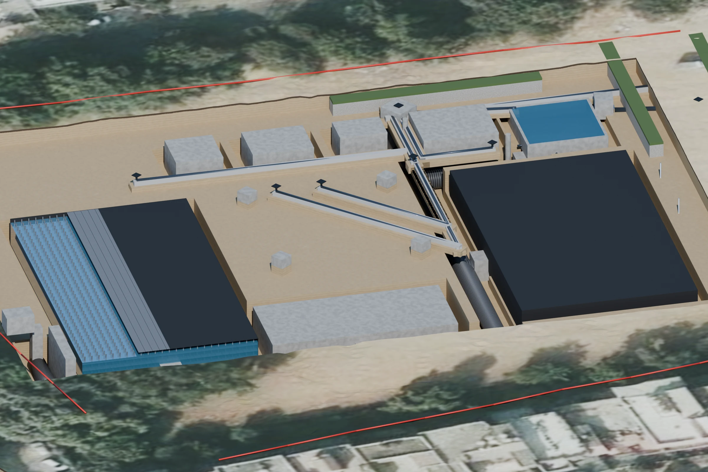
Buried storage, treatment and deep wells beneath an open public ground.
Below the surface
Two 4,000 m³ storage fields buffer the storm. Treatment and four deep wells release treated water to the receiving aquifer.
8,000 m³main storage fields
50 L/streatment design rate
Engineering cutaway · proposed underground works
Drag to orbit · scroll to zoom · indicative pipe diameters
PROPOSED WORKS · MODELLED SCENARIO
MODELLED STORM
How the storm develops
Watch water accumulate across the local study area while the proposed system captures flows from the ground and nearby streets.
Rain has stopped107 mm over the first 3 hours
Time since rainfall began3 h 15 min
Cumulative water captured7,366 m³
Modelled depths at five-minute intervals. Brown outline: proposed site boundary; grey shapes: obstacles. Study assumptions: Technical notes.
0.05–0.15 0.15–0.30 0.30–0.60 0.60–1.00 ≥1.00 m
WITH PROPOSED WORKS · INSTANTANEOUS DEPTH
N ↑
600 × 600 m · 1 m source grid · Esri, Vantor, Earthstar Geographics and GIS User Community
THE SAME STORM, WITH AND WITHOUT WORKS
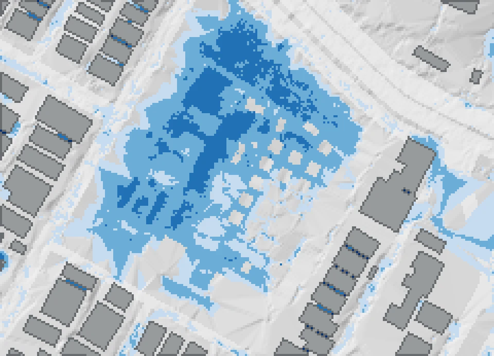
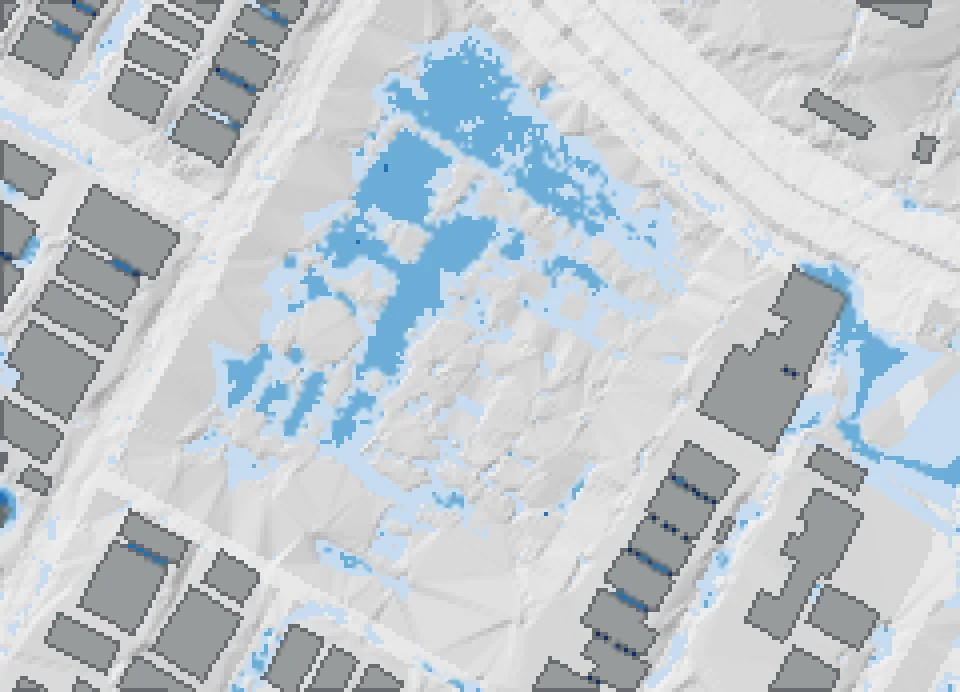
Flooding with and without the works
107 mm in 3 hours 600 × 600 m study area
Without works Peak up to 3 h 14 min
Peak depth · pale blue 0.15–0.30 m · blue 0.30–0.60 m · dark blue 0.60–1.00 m · navy ≥1.00 m
With works Peak up to 3 h 15 min
Same depth colours · depths below 0.15 m hidden · peak-depth maps, not end-time snapshots
STORAGE HANDLES THE BURST. WELLS WORK MORE SLOWLY.
Where the captured water goes
Modelled results · first 3 h 15 min Proposed system
01
Capture
7,366 m³
From 7 pond grates and 7 street pits
→02
Store
7,022 m³
Held in the plant at the selected time
→03
Treat
364 m³
Passed through the filter
→04
Feed the aquifer
330 m³
Entered the modelled aquifer screens
These are different stages of the same water. Storage is an inventory at the selected time; capture, treatment and screen transfer are cumulative flows. They must not be added together.
76% of plant storage
Captured water through the storm
3 h 15 min · 7,366 m³
Rain beginsRain ends at 3 h3 h 15 min
THE COMPLETED SURFACE
Proposed surface use
Buried units preserve space above. Inspection covers, servicing routes and load limits remain part of the design.
Proposed layout. Access zones must remain clear; areas above structures have load limits. See Technical notes.
Proposed surface · site imagery, flush inspection covers and edge facilities
70%of the ground classed as fully usable open space



 Engineering cutaway · proposed underground works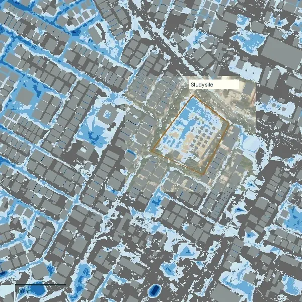
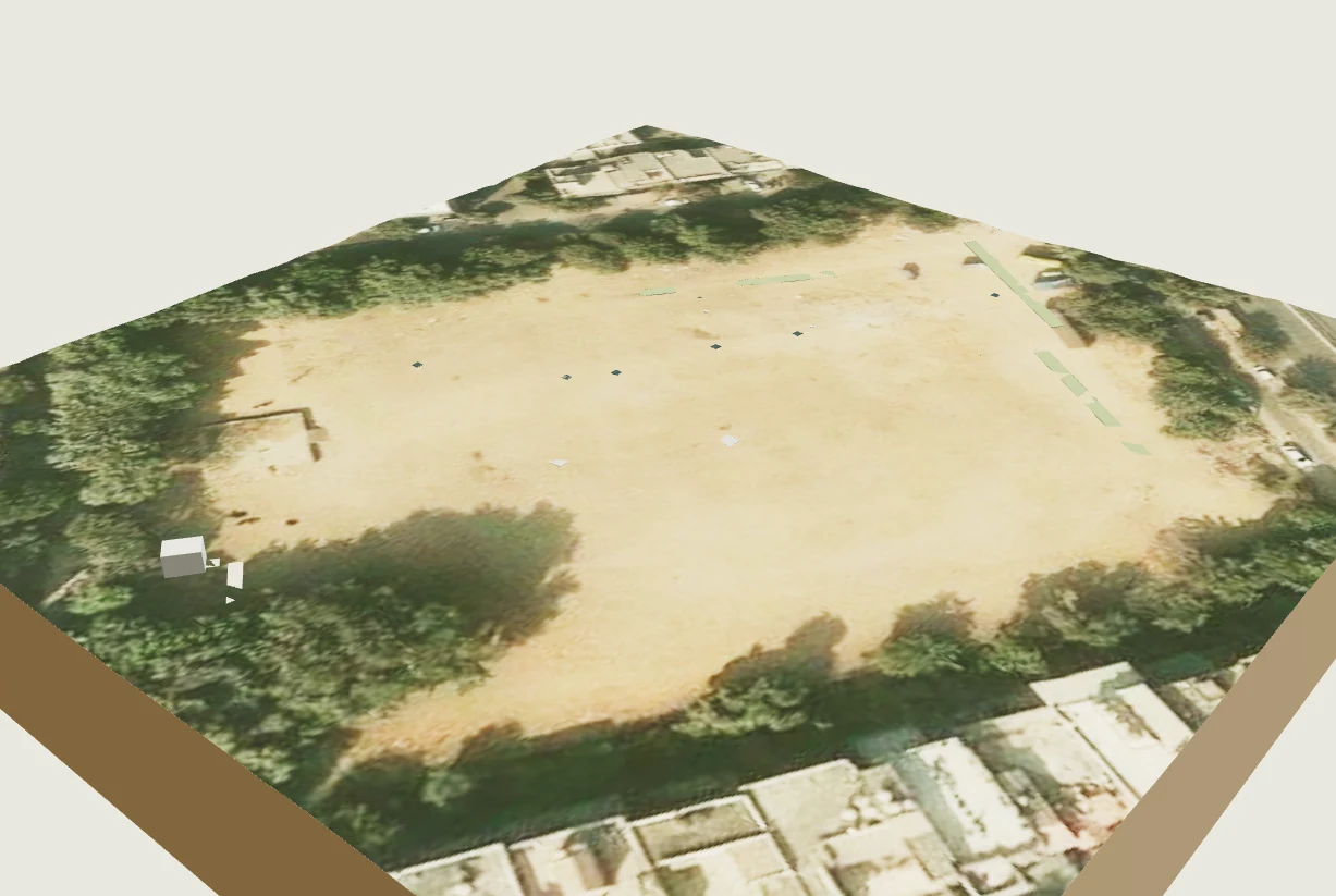 Proposed surface · site imagery, flush inspection covers and edge facilities